Bamingui
| Bamingui | |
|---|---|
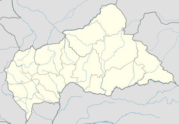 Bamingui Location in the Central African Republic | |
| Coordinates: 7°34′N 20°11′E / 7.567°N 20.183°ECoordinates: 7°34′N 20°11′E / 7.567°N 20.183°E | |
| Country |
|
| Prefecture | Bamingui-Bangoran |
| Sub-prefecture | Bamingui |
| Population (2003) | |
| • Total | 6,230 |
| Time zone | UTC + 1 |
Bamingui is a town and sub-prefecture in the Bamingui-Bangoran Prefecture in the northern Central African Republic.[1] It lies on the south bank of the Chari River (Bamingui River) along National Route 8, 529 kilometres (329 mi) by road northeast of the capital of Bangui.[2] As of 2003 it had a population of 6230 people. When the fighting resumed in December 2012 between the FACA loyalists and the rebel coalition of Séléka, the city fell to rebel forces.[3][4]
References
- ↑ Maplandia world gazetteer
- ↑ Google (30 March 2013). "Bamingui" (Map). Google Maps. Google. Retrieved 30 March 2013.
- ↑ "Centrafrique: Bangui sous la menace des rebelles" (in French). Le Figaro. 26 December 2012. Retrieved 30 March 2013.
- ↑ "La France n'est pas en Centrafrique pour y protéger «un régime" (in French). Libération. 27 December 2012. Retrieved 30 March 2013.
This article is issued from
Wikipedia.
The text is licensed under Creative Commons - Attribution - Sharealike.
Additional terms may apply for the media files.