Berbérati
| Berbérati | |
|---|---|
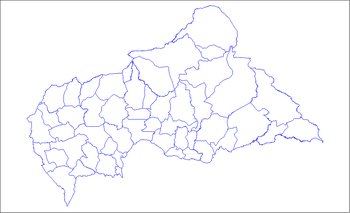
 Berbérati Location in Central African Republic | |
| Coordinates: 4°15′41″N 15°47′22″E / 4.26139°N 15.78944°E | |
| Country | Central African Republic |
| Prefecture | Mambéré-Kadéï |
| Sub-prefecture | Berbérati |
| Area | |
| • Total | 67 km2 (26 sq mi) |
| Elevation | 589 m (1,932 ft) |
| Population (2012)[1] | |
| • Total | 105,155 |
| • Density | 1,600/km2 (4,100/sq mi) |
| Time zone | UTC+1 (WAT) |
| • Summer (DST) | UTC+1 (Not observed) |
Berbérati is the third-largest city in the Central African Republic, with a population of 76,918 (2003 census). Located in the south-west of the country near the border with Cameroon, it serves as capital of the Mambéré-Kadéï Prefecture and gives its name (as capital) to the main Sub-prefecture.
Its cathedral is the episcopal see of the Roman Catholic Diocese of Berbérati. The city also has the diocese's former cathedral Sainte Anne, devoted to Saint Anna.
History
In the early 20th century Berbérati was part of Oubangui-Chari, one of the four territories comprising French Equatorial Africa which later became Central African Republic. In 1911 it was ceded to German Empire under the terms of the Morocco–Congo Treaty and Treaty of Fez, becoming part of the German colony of Neukamerun, until it was reconquered by the French in 1916 following the defeat of German forces in western Africa during World War I.
_arrive_at_Compagnie_Miniere_de_l'_Oubanghi_headquarters_in..._-_NARA_-_541651.tif.jpg)
Facilities
The state-owned university hospital of Berbérati is an unfenced complex of several bungalows near the town center. The hospital was constructed in the 1950s and operated by French military doctors until the 1980s. The French hospital administrators were succeed by an expatriate Italian Catholic nun, although the hospital also receives Protestant support.[2]
Berbérati is served by the Berbérati Airport and is often visited by tourists on their way to the Dzanga-Sangha Special Reserve. It is also home of the Roman Catholic Diocese of Berbérati.
Climate
Köppen-Geiger climate classification system classifies its climate as tropical wet and dry (Aw).[3]
| Climate data for Berbérati | |||||||||||||
|---|---|---|---|---|---|---|---|---|---|---|---|---|---|
| Month | Jan | Feb | Mar | Apr | May | Jun | Jul | Aug | Sep | Oct | Nov | Dec | Year |
| Average high °C (°F) | 31 (88) |
32.5 (90.5) |
32.5 (90.5) |
30.7 (87.3) |
30.1 (86.2) |
29 (84) |
28.3 (82.9) |
27.9 (82.2) |
28.7 (83.7) |
29.4 (84.9) |
30.2 (86.4) |
30.5 (86.9) |
30.1 (86.1) |
| Daily mean °C (°F) | 24.2 (75.6) |
25.6 (78.1) |
26.1 (79) |
25.2 (77.4) |
24.8 (76.6) |
24 (75) |
23.6 (74.5) |
23.3 (73.9) |
23.7 (74.7) |
24 (75) |
24.4 (75.9) |
23.6 (74.5) |
24.4 (75.9) |
| Average low °C (°F) | 17.5 (63.5) |
18.7 (65.7) |
19.7 (67.5) |
19.8 (67.6) |
19.6 (67.3) |
19.1 (66.4) |
18.9 (66) |
18.8 (65.8) |
18.7 (65.7) |
18.7 (65.7) |
18.6 (65.5) |
16.7 (62.1) |
18.7 (65.7) |
| Average precipitation mm (inches) | 21 (0.83) |
36 (1.42) |
95 (3.74) |
129 (5.08) |
146 (5.75) |
158 (6.22) |
143 (5.63) |
186 (7.32) |
216 (8.5) |
221 (8.7) |
84 (3.31) |
26 (1.02) |
1,461 (57.52) |
| Source: Climate-Data.org, altitude: 580m[3] | |||||||||||||
See also
References
- ↑ "World Gazetteer". Archived from the original on 2013-01-11.
- ↑ Beesley, Mark. "The Bottom of the Sack: Health Service Provision in the Central African Republic" (PDF). University of Queensland. Archived from the original (PDF) on 4 February 2014. Retrieved 6 December 2013.
- 1 2 "Climate: Berbérati - Climate graph, Temperature graph, Climate table". Climate-Data.org. Retrieved 21 October 2013.
Coordinates: 4°15′41″N 15°47′22″E / 4.26139°N 15.78944°E