Namataba
| Namataba | |
|---|---|
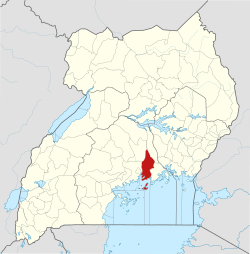
 Namataba Location in Uganda | |
| Coordinates: 00°22′30″N 32°50′24″E / 0.37500°N 32.84000°E | |
| Country |
|
| Region | Central Uganda |
| District | Mukono District |
| Elevation | 3,600 ft (1,100 m) |
Namataba is a town in Mukono District, Central Uganda. The town is an urban center under Mukono District Administration.[1]
Location
Namataba is located approximately 16 kilometres (9.9 mi), by road, northeast of Mukono, the location of the district headquarters.[2] This location lies along the Kampala-Jinja Highway, approximately 42 kilometres (26 mi), by road, east of Kampala, the capital of Uganda and the largest city in that country.[3] The coordinates of Namataba are:0° 22' 30.00"N, 32° 50' 24.00"E (Latitude:0.3750; Longitude:32.8400).
Overview
Namataba is an urban center in Mukono District. The town is administered by Namataba Town Council, an urban local government within Mukono District Administration. Other urban centers in the district include: Mukono, Kalagi, Nakifuma, Kasawo and Katosi.
Population
As of December 2013 the human population of Namataba is not publicly known.
Points of interest
The following points of interest lie within or near Namataba:
- The offices of Namataba Town Council
- Namataba Central Market
- The Kampala-Jinja Highway - The highway passes through the center of town in an east to west direction.
- Namataba Technical and Vocational Institute - Slated to open in December 2014.[4]
External links
See also
References
- ↑ "Namataba Is An Urban Center In Mukono District" (PDF). Npa.ug. Retrieved 30 December 2013.
- ↑ "Map Showing Mukono And Namataba With Distance Marker". Globefeed.com. Retrieved 30 December 2013.
- ↑ "Travel Distance Between Kampala And Namataba With Map". Globefeed.com. Retrieved 30 December 2013.
- ↑ Ssejjoba, Eddie (3 July 2014). "Mukono District Reaps From Mushrooming Industries". New Vision. Retrieved 3 July 2014.
Capital: Mukono | ||
| Counties and sub-counties |
|  |
| Towns and villages | ||
| Economy |
| |
| Banking | ||
| Notable landmarks | ||
| Transport | ||
| Education | ||
| Energy | ||
| Health | ||
| Notable people | ||