Bukeerere
| Bukeerere | |
|---|---|
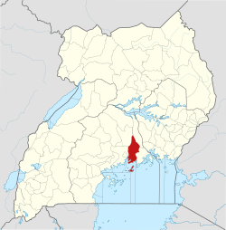
 Bukeerere Map of Uganda showing the location of Bukeerere. | |
| Coordinates: 00°24′27″N 32°42′07″E / 0.40750°N 32.70194°E | |
| Country |
|
| District | Mukono District |
| Elevation | 1,121 m (3,678 ft) |
| Time zone | UTC+3 (EAT) |
Bukeerere, sometimes wrongly spelled as Bukerere, is a township in the Central Region of Uganda. The correct phonetic spelling is with two 'e's after the 'k'.[1]
Location
Bukeerere is in Mukono District, 11 kilometres (6.8 mi), by road, northwest of Mukono, the headquarters of the district.[2] This is approximately 19 kilometres (12 mi), by road, northeast of Kampala, Uganda's capital and largest city.[3] The coordinates of Bukeerere are 0°24'27.0"N, 32°42'07.0"E (Latitude:0.407498; Longitude:32.701953).[4]
Overview
The town of Bukeerere is the headquarters of Bukeerere parish, in Goma sub-county, Kyaggwe county.[5] The Bukerere Road leads from Seeta on the Kampala–Jinja Highway through Bukeerere to join the Mukono-Kalagi Road at Kasaayi.[6] The average elevation of Bukeerere is approximately 1,121 metres (3,678 ft) above sea level.[7]
References
- ↑ "Oluguudo lwe'Bukeerere lukolebwa ddi? (When will Bukerere Road be improved?)". Bukedde Newspaper Online (in Ganda). Kampala. 8 July 2011. Retrieved 10 January 2016.
- ↑ GFC (10 January 2016). "Distance between Bukerere Health Center II, Mukono, Central Region, Uganda and Mukono, Central Region, Uganda". Globefeed.com (GFC). Retrieved 10 January 2016.
- ↑ GFC (10 January 2016). "Distance between Kampala, Central Region, Uganda and Bukerere Health Center II, Mukono, Central Region, Uganda". Globefeed.com (GFC). Retrieved 10 January 2016.
- ↑ Google (10 January 2015). "Location of Bukeerere, Uganda" (Map). Google Maps. Google. Retrieved 10 January 2016.
- ↑ Lcmt (10 January 2016). "Villages in Bukerere Parish". Lcmt.org. Retrieved 10 January 2016.
- ↑ Okedi, Joseph (23 July 2011). "Alarm Bells: Ministry should tamarck Bukerere Road". Daily Monitor. Kampala. Retrieved 10 January 2016.
- ↑ GVI (10 January 2016). "Bukerere: The estimate terrain elevation above seal level". Geoview.info (GVI). Retrieved 10 January 2016.
External links
Capital: Mukono | ||
| Counties and sub-counties |
|  |
| Towns and villages | ||
| Economy |
| |
| Banking | ||
| Notable landmarks | ||
| Transport | ||
| Education | ||
| Energy | ||
| Health | ||
| Notable people | ||