Katosi
| Katosi | |
|---|---|
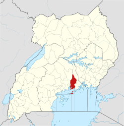
 Katosi Location in Uganda | |
| Coordinates: 00°09′10″N 32°48′05″E / 0.15278°N 32.80139°E | |
| Country |
|
| Region | Central Region |
| District | Mukono District |
| Elevation | 3,717 ft (1,133 m) |
| Population (2015 Estimate) | |
| • Total | 16,442 |
Katosi is a town in the Mukono District of the Central Region of Uganda. The town is an urban center under Mukono District Administration.
Location
Katosi is located approximately 27 kilometres (17 mi), by road, south-east of Mukono, the location of the district headquarters.[1] This location is along the northern shore of Lake Victoria, approximately 50 kilometres (31 mi), by road, east of Kampala, the capital and largest city of Uganda.[2] The coordinates of Katosi are 0°09'10.0"N, 32°48'05.0"E (Latitude:0.152778; Longitude:32.801389).[3] The town's average elevation is approximately 1,133 metres (3,717 ft) above sea level.[4]
Overview
Traditionally, Katosi was a fishing village and a landing site for water craft transporting people and merchandise between Koome Island in Mukono District and the Buvuma Islands in neighboring Buvuma District and the mainland. During the last decade of the 20th century and in the first decade of the 21st century, Katosi became a major fishing center, with the majority of the catch exported to Europe and the Middle East. As the fishing village has increased in economic importance, the human population has increased as well.
Katosi has a high population of AIDS orphans and widows.[5]
Recent developments
In 2011, the National Water and Sewerage Corporation (NWSC), the government parastatal responsible for water supply and sanitation, announced plans to build a water treatment plant in Katosi, capable of supplying 120,000 cubic meters (120,000,000 L) of purified water daily. The new water plant will cost approximately US$306 million and will supply mainly the rapidly growing towns of Mukono and Kira Town.[6][7]
Population
As of January 2015, the estimated population of Katosi was 16,442.[4]
Points of interest
The following points of interest lie within or near Katosi:
- Offices of Katosi Intercomunity Development Alliance (KIDA), an NGO
- Offices of Katosi Town Council
- Offices of Katosi Women Development Trust (KWDT), an NGO
- Offices of Katosi Women Fishing & Development Association (KWFDA), another NGO
- The site where National Water and Sewerage Corporation plans to build the Katosi Water Treatment Plant
- Katosi Landing Site
- Katosi Fish Market
- Katosi Central Market
See also
References
- ↑ "Map Showing Mukono And Katosi With Route Marker". Globefeed.com. Retrieved 23 January 2015.
- ↑ "Distance Between Kampala And Katosi With Interactive Map". Globefeed.com. Retrieved 23 January 2015.
- ↑ Google. "Location of Katosi At Google Maps". Google Maps. Retrieved 23 January 2015.
- 1 2 GAMN, . "Estimated Human Population of Katosi In 2015". GetAMap.Net (GAMN). Retrieved 23 January 2015.
- ↑ Mugalu, Moses (7 June 2012). "Feature: Religions United Against HIV In Katosi". The Observer (Uganda). Retrieved 23 January 2015.
- ↑ Industry News (18 April 2011). "Uganda To Build US$306 Million Water Treatment Plant in Katosi". Water-technology.net. Retrieved 23 January 2015.
- ↑ Athumani, Halima (17 March 2011). "New Water Purification System For Kampala City". Uganda Radio Network (URN). Retrieved 23 January 2015.
External links
Capital: Mukono | ||
| Counties and sub-counties |
|  |
| Towns and villages | ||
| Economy |
| |
| Banking | ||
| Notable landmarks | ||
| Transport | ||
| Education | ||
| Energy | ||
| Health | ||
| Notable people | ||