Naguilian, La Union
| Naguilian | ||
|---|---|---|
| Municipality | ||
| Municipality of Naguilian | ||
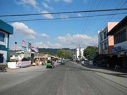 Naguilian town center along the Naguilian Road | ||
| ||
| Nickname(s): The True Heart of La Union | ||
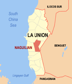 Map of La Union with Naguilian highlighted | ||
.svg.png) Naguilian Location within the Philippines | ||
| Coordinates: 16°32′N 120°24′E / 16.53°N 120.4°ECoordinates: 16°32′N 120°24′E / 16.53°N 120.4°E | ||
| Country |
| |
| Region | Ilocos Region (Region I) | |
| Province | La Union | |
| District | 2nd District | |
| Founded | February 18, 1839 | |
| Barangays | 37 (see Barangays) | |
| Government [1] | ||
| • Type | Sangguniang Bayan | |
| • Mayor | Reynaldo Jacildo Flores | |
| • Electorate | 29,839 voters (2016) | |
| Area [2] | ||
| • Total | 104.60 km2 (40.39 sq mi) | |
| Population (2015 census)[3] | ||
| • Total | 54,221 | |
| • Density | 520/km2 (1,300/sq mi) | |
| Time zone | UTC+8 (PST) | |
| ZIP code | 2511 | |
| PSGC | 013311000 | |
| IDD : area code | +63 (0)72 | |
| Climate type | Tropical monsoon climate | |
| Income class | 1st municipal income class | |
| Revenue (₱) | 205,140,052.99 (2016) | |
| Native languages |
Ilocano Tagalog | |
| Website |
www | |

Naguilian, officially the Municipality of Naguilian, is a 1st class municipality in the province of La Union, Philippines. According to the 2015 census, it has a population of 54,221 people.[3]
Naguilian is 40 kilometres (25 mi) from Baguio City via the Naguilian Road and 17 kilometres (11 mi) from the provincial capital, San Fernando.
Geography
Naguilian is characterized by hills and mountains that are gently rolling, bordered by the Cordillera Mountains in the east. The alienable lands are rolling plains in narrow strips, framed by the mountains slopes and the banks of rivers, crisscrossed by streams and springs from the side of the mountains. Its soil varies from clay loam to sandy loam and golds.
There are two major rivers in Naguilian. The Naguilian River is located in the western portion of the town. It flows westward beginning from the province of Benguet towards La Union and empties into the South China Sea, draining the valleys of Barangays Bimmotobot, Mamat-ing Sur, Mamat-ing Norte, Tuddingan, Gusing Sur, Gusing Norte, Baraoas Norte, Daramuangan, Dal-lipaoen, Cabaritan Sur, Ortiz, Natividad, Suguidan Norte and Suguidan Sur. It has a length of approximately 67 kilometres (42 mi) and has a basin area of 658 square kilometres (254 sq mi). As classified by the Environmental Management Bureau, the upper reaches of the river falls under Class A which means that it is suitable as water supply source for drinking. The lower reaches has lower water quality, categorized under Class C.
The other major stream springs from the Municipality of Burgos and drains the valleys of Barangays Aguioas, Sili, Al-alinao Norte, Nagsidorisan, Angin, Suguidan Norte and Natividad. These two rivers meet at the poblacion where it forms a delta, then meander through the center of the municipality and empty at the mouth of the river in Bauang.
Climate
The municipality’s climate falls under the first type of climate in the Philippines, characterized by two (2) distinct seasons, wet and dry. The wet season usually comes in May and ends in the early part of October. The rest of the year is dry season.
Land use
Built-up areas of the town are generally spread along the barangay roads. Of the total land area, 50 hectares (120 acres), equivalent to 0.50% of the total land area, are classified as built-up areas. Urban built-up area, totaling 18.90 hectares (46.7 acres), constitute 11.22% of the total urban land area. Rural built-up areas total 31.10 hectares (76.8 acres), or 0.31% of the total rural area.
Through Proclamation No. 52, a portion of Barangay Casilagan, with an area of 897.26 hectares (2,217.2 acres), was proclaimed as a watershed area by the Bureau of Forestry.[4] This is equivalent to .10% of the total land area of the town.
Barangays
| Rank | Barangay | Population | Rank | Barangay | Population |
|---|---|---|---|---|---|
| 1 | Baraoas Sur | 3,153 | 20 | Sili | 1,154 |
| 2 | Ortiz (Poblacion) | 2,665 | 21 | Bimmotobot | 1,031 |
| 3 | Natividad (Poblacion) | 2,656 | 22 | Daramuangan | 1,015 |
| 4 | Cabaritan Sur | 1,947 | 23 | Ribsuan | 972 |
| 5 | Casilagan | 1,896 | 24 | Nagsidorisan | 939 |
| 6 | Bariquir | 1,761 | 25 | Aguioas | 934 |
| 7 | Dal-lipaoen | 1,746 | 26 | Suguidan Sur | 907 |
| 8 | Tuddingan | 1,570 | 27 | San Isidro | 903 |
| 9 | Gusing Sur | 1,542 | 28 | San Antonio | 897 |
| 10 | Ambaracao Norte | 1,533 | 29 | Baraoas Norte | 866 |
| 11 | Bato | 1,530 | 30 | Magungunay | 858 |
| 12 | Gusing Norte | 1,525 | 31 | Al-alinao Sur | 843 |
| 13 | Lioac Norte | 1,465 | 32 | Balecbec | 824 |
| 14 | Imelda | 1,415 | 33 | Suguidan Norte | 793 |
| 15 | Al-alinao Norte | 1,293 | 34 | Ambaracao Sur | 772 |
| 16 | Mamat-ing Sur | 1,290 | 35 | Angin | 731 |
| 17 | Guesset | 1,265 | 36 | Mamat-ing Norte | 719 |
| 18 | Bancagan | 1,231 | 37 | Cabaritan Norte | 540 |
| 19 | Lioac Sur | 1,226 | Naguilian Total | 48,407 | |
Demographics
| Population census of Naguilian | ||
|---|---|---|
| Year | Pop. | ±% p.a. |
| 1903 | 11,885 | — |
| 1918 | 14,828 | +1.49% |
| 1939 | 15,933 | +0.34% |
| 1948 | 15,227 | −0.50% |
| 1960 | 19,528 | +2.09% |
| 1970 | 25,177 | +2.57% |
| 1975 | 27,114 | +1.50% |
| 1980 | 29,304 | +1.57% |
| 1990 | 36,328 | +2.17% |
| 1995 | 39,989 | +1.82% |
| 2000 | 43,501 | +1.82% |
| 2007 | 45,232 | +0.54% |
| 2010 | 48,407 | +2.50% |
| 2015 | 54,221 | +2.18% |
| Source: Philippine Statistics Authority[3][6][7][8] | ||
In the 2015 census, the population of Naguilian was 54,221 people,[3] with a density of 520 inhabitants per square kilometre or 1,300 inhabitants per square mile.
Economy
Agriculture
Generally, the agricultural lands are narrow strips in the valleys, running from the sides of the mountains to the bank of the rivers, brooks and streams. The rolling areas from the top of the mountains and hills are also utilized for the planting of rice and other crops. The area devoted for agricultural purposes, which totals 9,859.71 hectares (24,363.9 acres) constituting 97% of the total land area.
Industries
Industries in the different parts of the municipality include woodcraft, metal craft, bamboo craft, ceramics or brick making, concrete hollow block making, basi (sugarcane wine)[9] making and furniture making and upholstery, .28% of the total land area of the town is devoted for industrial purposes.
Commerce
The center of commercial activities is the public market located in Barangay Ortiz. There are, however, other commercial establishments found in the different barangays, the most common of which are sari-sari stores. The area devoted for commerce constitutes .03% of the total land area of the town.
Fishery
Fishing is done in almost all barangays traversed by the rivers, namely, Barangays Bimmotobot, Mamat-ing Sur, Mamat-ing Norte, Gusing Norte, Gusing Sur, Baraoas Norte, Baraoas Sur, Ortiz, Cabaritan Norte, Cabaritan Sur, Dal-lipaoen, Nagsidorisan, Suguidan Norte, Suguidan Sur, Guesset, Sili, Al-alinao Norte, Al-alinao Sur, Aguioas and Ribsuan.
Sister cities
- Suisun City, California, United States of America[10]
Gallery
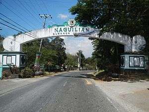 Welcome arch
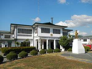 Municipal hall
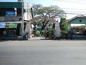 Town plaza entrance
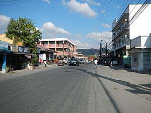 Town center
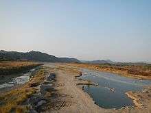
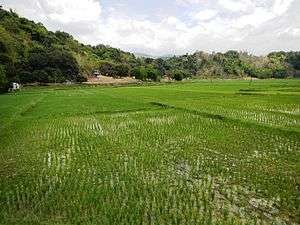 Naguilian rural landscape
References
- ↑ "Municipality". Quezon City, Philippines: Department of the Interior and Local Government. Retrieved 31 May 2013.
- ↑ "Province: La Union". PSGC Interactive. Quezon City, Philippines: Philippine Statistics Authority. Retrieved 12 November 2016.
- 1 2 3 4 Census of Population (2015). "Region I (Ilocos Region)". Total Population by Province, City, Municipality and Barangay. PSA. Retrieved 20 June 2016.
- ↑ "Proclamation No. 52; Reserving and Designating As Naguilian Watershed Reservation For Watershed Protection and Timber Production the Parcel of the Public Domain Situated in the Municipality of Naguilian, Province of La Union, Island of Luzon". Official Gazette of the Republic of the Philippines. 11 April 1936. Retrieved 3 October 2016.
- ↑ "2010 Census of Population and Housing: Population Counts - Cordillera Administrative Region" (PDF). Philippine Statistics Authority, April 4, 2012. Archived from the original (PDF) on 26 June 2015. Retrieved 16 November 2014.
- ↑ Census of Population and Housing (2010). "Region I (Ilocos Region)". Total Population by Province, City, Municipality and Barangay. NSO. Retrieved 29 June 2016.
- ↑ Censuses of Population (1903–2007). "Region I (Ilocos Region)". Table 1. Population Enumerated in Various Censuses by Province/Highly Urbanized City: 1903 to 2007. NSO.
- ↑ "Province of La Union". Municipality Population Data. Local Water Utilities Administration Research Division. Retrieved 17 December 2016.
- ↑ Keith, Charles (20 September 2011). "Naguilian struggles to save native brew". Philippine Daily Inquirer. Inquirer Northern Luzon. Archived from the original on 27 February 2015. Retrieved 3 October 2016.
- ↑ "Memorandum of Agreement Establishing the Sister City Relationship Between The Municipality of Naguilian, La Union, Philippines and The City of Suisun City, California, United States of America" (PDF). Sistercities.org. 16 May 2006. Retrieved 15 September 2018.
External links
| Wikimedia Commons has media related to Naguilian, La Union. |
- Official Website of the Provincial Government of La Union
- Local Government Unit: Naguilian La Union
- Pasyalan La Union
- Philippine Standard Geographic Code
- Philippine Census Information
- Local Governance Performance Management System
Places adjacent to Naguilian, La Union | ||||||||||
|---|---|---|---|---|---|---|---|---|---|---|
| ||||||||||