San Gabriel, La Union
| San Gabriel | |||
|---|---|---|---|
| Municipality | |||
| Municipality of San Gabriel | |||
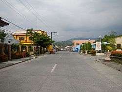 San Gabriel town center | |||
| |||
| Nickname(s): The Softbroom Capital of the North; Highland Vegetable and Tourism Adventure Paradise of La Union | |||
| Motto(s): Siglat, San Gabriel | |||
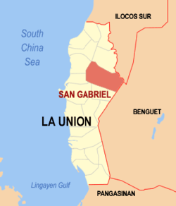 Map of La Union with San Gabriel highlighted | |||
.svg.png) San Gabriel Location within the Philippines | |||
| Coordinates: 16°40′N 120°24′E / 16.67°N 120.4°ECoordinates: 16°40′N 120°24′E / 16.67°N 120.4°E | |||
| Country |
| ||
| Region | Ilocos Region (Region I) | ||
| Province | La Union | ||
| District | 1st District | ||
| Founded | 1947 | ||
| Barangays | 15 (see Barangays) | ||
| Government [1] | |||
| • Type | Sangguniang Bayan | ||
| • Mayor | Herminigildo M. Velasco | ||
| • Electorate | 10,562 voters (2016) | ||
| Area [2] | |||
| • Total | 129.87 km2 (50.14 sq mi) | ||
| Population (2015 census)[3] | |||
| • Total | 18,172 | ||
| • Density | 140/km2 (360/sq mi) | ||
| Time zone | UTC+8 (PST) | ||
| ZIP code | 2513 | ||
| PSGC | 013315000 | ||
| IDD : area code | +63 (0)72 | ||
| Climate type | Tropical monsoon climate | ||
| Income class | 4th municipal income class | ||
| Revenue (₱) | 86,065,245.70 (2016) | ||
| Native languages |
Ilocano Tagalog | ||
| Website |
www | ||


San Gabriel (Ilokano: Ili ti San Gabriel), officially the Municipality of San Gabriel, is a 4th class municipality in the province of La Union, Philippines. According to the 2015 census, it has a population of 18,172 people.[3]
It is the largest municipality by land area in the province of La Union in the Philippines. One of the landlocked towns of the province, San Gabriel is bounded on the north by Santol with an imaginary line from a point in Ticor following the Malanas River; on the east by the Province of Benguet with an imaginary line from the Bacawayan River Junction going south following a creek to Cabassitan River up to Barangay Duplas of San Juan, southwest by San Juan with an imaginary line from Duplas following the Cabassitan River westward to a point on a concrete monument near the place known as Alangigan and from this monument going north-west making an imaginary line to Sitio Bato crossing the Dayacos River, and on the west by Bacnotan from Sitio Bato to a point in Lacong, from this point going straight with an imaginary line to Ticor, North of Sitio Matagectec, Barangay Lacong.
Barangays
San Gabriel is politically subdivided into 15 barangays. [2]
- Amontoc - Named after the rich old man, Ama Ontoc who was believed owned most of the land in the said barangay. When Ama Ontoc died he donated the whole place to the people, thus as a tribute to his generosity, the people named the said Barangay as Amontoc.
- Apayao
- Balbalayang
- Bayabas
- Bucao
- Bumbuneg
- Daking
- Lacong
- Lipay Este
- Lipay Norte
- Lipay Proper
- Lipay Sur
- Lon-oy
- Poblacion
- Polipol
History
San Gabriel was formerly known as sitio “Baka-Burnotan”, derived from “binnornutan” (English: "tug-of-war"). The sitio was the meeting place of both Christians and pagan Kankanaey settlers from nearby sitios to graze their cattle while playing the game. The name was later shortened to "burnotan". The wide plain and fertile soil attracted Christian and pagan settlers, who later intermarried which led to the increase in population.[4]
On April 19, 1897, a Roman Catholic priest Father Redondo established a church in the area and introduced the patron saint to be Saint Gabriel, from which the town was later named.[4]
In 1906, San Gabriel was made into a township under the sub-province of Amburayan in Mountain Province, with the first Presidente being Don Pablo Waggay. The township was converted into a municipal district of Amburayan in 1920, and into a municipality in 1922, following the settlement of a boundary dispute between La Union and Mountain Province. In 1947, San Gabriel was converted into a regular municipality by virtue of Executive Order No. 72 issued by President Manuel Roxas through the sponsorship of former House Speaker Pro-Tempore Francisco Ortega.[4]
Demographics
| Population census of San Gabriel | ||
|---|---|---|
| Year | Pop. | ±% p.a. |
| 1918 | 3,485 | — |
| 1939 | 5,293 | +2.01% |
| 1948 | 5,805 | +1.03% |
| 1960 | 7,546 | +2.21% |
| 1970 | 8,527 | +1.23% |
| 1975 | 9,808 | +2.85% |
| 1980 | 10,248 | +0.88% |
| 1990 | 12,532 | +2.03% |
| 1995 | 13,489 | +1.39% |
| 2000 | 14,909 | +2.17% |
| 2007 | 15,803 | +0.81% |
| 2010 | 16,628 | +1.87% |
| 2015 | 18,172 | +1.71% |
| Source: Philippine Statistics Authority[3][5][6][7] | ||
In the 2015 census, the population of San Gabriel, La Union, was 18,172 people,[3] with a density of 140 inhabitants per square kilometre or 360 inhabitants per square mile.
Economy
San Gabriel is an agricultural town. In its early days, the people of San Gabriel were engaged mainly in highland farming as their means of livelihood. They produced rice, corn, sweet potatoes and other root crops. As years passed, crop production decreased due to massive soil erosion in the uplands. Nevertheless, the inhabitants decided to improve their farming techniques and started making terraces. The perseverance of the people in constructing rice terraces and irrigation system along the hills and mountains of San Gabriel caused agricultural productivity to rebound.
Bananas and tiger grass ("Thysanolaena maxina") are also abundant in San Gabriel, which harvests materials for soft broom production on a weekly basis.
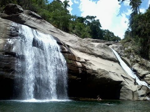
Tourist attractions
- Gumayenggeng Falls at Brgy. Lipay
- Katebbegan Fall at Brgy. Lipay Proper
- Bakes Falls and Lon-oy Spring at Brgy. Lon-oy
- Lineng Pool at Poblacion
- Tinnag-Americano Falls at Brgy. Polipol
- Tangadan Falls located at Brgy. Amontoc[8]
Education
High schools
The town has 4 Public High Schools and 1 Private School.
- Saint Gabriel the Archangel High School, former (San Gabriel Academy) is the only private school secondary in the municipality, a Christian School that demands love and discipline from all who join the SGA High School Family.
- Balbalayang National High School
- Lipay Integrated School
- San Gabriel Senior High School
- San Gabriel Vocational High School
Gallery
 Municipal hall
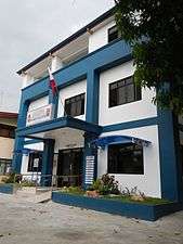 Police station
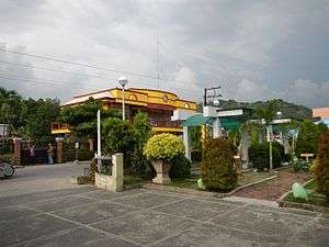 Town center
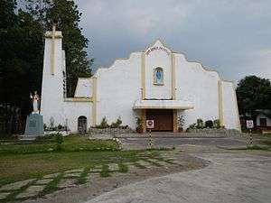 Saint Gabriel the Archangel Church
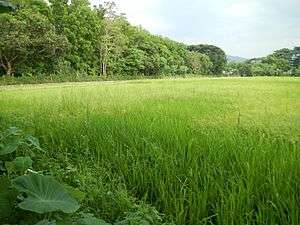 Rural landscape
References
- ↑ "Municipality". Quezon City, Philippines: Department of the Interior and Local Government. Retrieved 31 May 2013.
- 1 2 "Province: La Union". PSGC Interactive. Quezon City, Philippines: Philippine Statistics Authority. Retrieved 12 November 2016.
- 1 2 3 4 Census of Population (2015). "Region I (Ilocos Region)". Total Population by Province, City, Municipality and Barangay. PSA. Retrieved 20 June 2016.
- 1 2 3 "Municipality of San Gabriel". Provincial Government of La Union: Official Website. Retrieved 5 January 2015.
- ↑ Census of Population and Housing (2010). "Region I (Ilocos Region)". Total Population by Province, City, Municipality and Barangay. NSO. Retrieved 29 June 2016.
- ↑ Censuses of Population (1903–2007). "Region I (Ilocos Region)". Table 1. Population Enumerated in Various Censuses by Province/Highly Urbanized City: 1903 to 2007. NSO.
- ↑ "Province of La Union". Municipality Population Data. Local Water Utilities Administration Research Division. Retrieved 17 December 2016.
- ↑ https://i.ytimg.com/vi/XnP0ty3voFQ/hqdefault.jpg. Missing or empty
|title=(help)
External links
| Wikimedia Commons has media related to San Gabriel, La Union. |
- Philippine Standard Geographic Code
- Philippine Census Information
- Local Governance Performance Management System
Places adjacent to San Gabriel, La Union | |
|---|---|