Muqeible
| Muqeible מֻקֵיבִּלָה مقيبلة | |
|---|---|
 Muqeible | |
| Coordinates: 32°30′51″N 35°17′41″E / 32.51417°N 35.29472°ECoordinates: 32°30′51″N 35°17′41″E / 32.51417°N 35.29472°E | |
| Grid position | 177/213 PAL |
| District | Northern |
| Council | Gilboa |
| Population (2017)[1] | 3,915 |
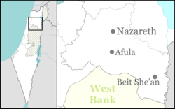
Muqeible or Muqeibla (Arabic: مقيبلة, Hebrew: מֻקֵיבִּלָה), meaning "The front place",[2] is an Arab town in Israel's Northern District, situated in the Jezreel Valley between Jenin in the West Bank and the Ta'anakh area. It is a part of the Gilboa Regional Council.In 2017 its population was 3,915. The inhabitants are Muslims and Christians.
History
During the Roman-era, a town called "Muqeibleh" stood at the site. Byzantine-era settlement is attested to archaeologically by a well and pottery workshops from that period near the present village.[3][4]
Ottoman era
According to a local inhabitant, the villagers moved here from the al-Haram-Sidna Ali-area in the latter part of the Ottoman period.[3] In 1838 Edward Robinson noted Mukeibileh as a “village in the plain, on the direct route from Jenin to Nazareth.”[5] He placed Mukeibileh as being in the District of Jenin, also called "Haritheh esh-Shemaliyeh".[6]
Victor Guérin, who visited in 1870, noted that the village contained 400 inhabitants and had a number of cisterns.[7] In 1882, the Palestine Exploration Fund's Survey of Western Palestine described Muqeible as "a mud village in the plain, supplied by cisterns."[8]
British Mandate era
In the 1922 census of Palestine conducted by the British Mandate authorities, Muquibleh had a population of 201; 181 Muslims and 20 Christians,[9] where all the Christians were Orthodox.[10] In the 1931 census the population had increased to 270; 244 Muslims and 26 Christians, in a total of 67 houses.[11]
By the 1945 statistics Muqeible had 460 inhabitants, all classified as Muslims.[12] They owned a total of 2,687 dunams of land, while 4,441 dunams were public, a total of 7,128.[13] Of this, 174 dunams were used for plantations or irrigable land, 6,421 for cereals,[14] while 22 dunams were built-up land.[15]
State of Israel
After the 1948 Arab–Israeli War, Muqeible became been part of the State of Israel.
In 1994, Andrew Petersen, an archaeologist specializing in Islamic architecture, examined the "Hawsh"; a large, square courtyard building, resembling a khan, in the center of the village. The central courtyard of the "Hawsh" measures approximately 30m per side. On the east side there is a small gateway, leading into a tall iwan. Petersen noted that the masonry suggested that it was built either in late Ottoman or early Mandate Period.[3]
See also
References
- ↑ "List of localities, in Alphabetical order" (PDF). Israel Central Bureau of Statistics. Retrieved August 26, 2018.
- ↑ Palmer, 1881, p.151
- 1 2 3 Petersen, 2001, p. 223
- ↑ Dauphin, 1998, p. 743
- ↑ Robinson and Smith, 1841, vol 3, p. 161
- ↑ Robinson and Smith, 1841, vol 3, 2nd app, p. 130, no 8
- ↑ Guérin, 1874, p. 327. Also cited in Petersen, 2001, p. 223
- ↑ Conder and Kitchener, 1882, SWP II, p. 45, also cited in Petersen, 2001, p. 223
- ↑ Barron, 1923, Table IX, Sub-district of Jenin, p. 29
- ↑ Barron, 1923, Table XV, p. 47
- ↑ Mills, 1932, p. 69
- ↑ Department of Statistics, 1945, p. 16
- ↑ Government of Palestine, Department of Statistics. Village Statistics, April, 1945. Quoted in Hadawi, 1970, p. 55
- ↑ Government of Palestine, Department of Statistics. Village Statistics, April, 1945. Quoted in Hadawi, 1970, p. 99
- ↑ Government of Palestine, Department of Statistics. Village Statistics, April, 1945. Quoted in Hadawi, 1970, p. 149
Bibliography
- Barron, J.B., ed. (1923). Palestine: Report and General Abstracts of the Census of 1922. Government of Palestine.
- Conder, C.R.; Kitchener, H.H. (1882). The Survey of Western Palestine: Memoirs of the Topography, Orography, Hydrography, and Archaeology. 2. London: Committee of the Palestine Exploration Fund.
- Department of Statistics (1945). Village Statistics, April, 1945. Government of Palestine.
- Dauphin, Claudine (1998). La Palestine byzantine, Peuplement et Populations. BAR International Series 726 (in French). III : Catalogue. Oxford: Archeopress. ISBN 0-860549-05-4.
- Guérin, V. (1874). Description Géographique Historique et Archéologique de la Palestine (in French). 2: Samarie, pt. 1. Paris: L'Imprimerie Nationale.
- Hadawi, S. (1970). Village Statistics of 1945: A Classification of Land and Area ownership in Palestine. Palestine Liberation Organization Research Center.
- Mills, E., ed. (1932). Census of Palestine 1931. Population of Villages, Towns and Administrative Areas. Jerusalem: Government of Palestine.
- Palmer, E.H. (1881). The Survey of Western Palestine: Arabic and English Name Lists Collected During the Survey by Lieutenants Conder and Kitchener, R. E. Transliterated and Explained by E.H. Palmer. Committee of the Palestine Exploration Fund.
- Petersen, Andrew (2001). A Gazetteer of Buildings in Muslim Palestine (British Academy Monographs in Archaeology). 1. Oxford University Press. ISBN 978-0-19-727011-0.
- Robinson, E.; Smith, E. (1841). Biblical Researches in Palestine, Mount Sinai and Arabia Petraea: A Journal of Travels in the year 1838. 3. Boston: Crocker & Brewster.
External links
- Welcome To Muqeibila
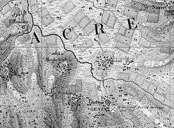
- Survey of Western Palestine, Map 8: IAA, Wikimedia commons
- Map, 1946