Mulloon
| Mulloon New South Wales | |||||||||||||||
|---|---|---|---|---|---|---|---|---|---|---|---|---|---|---|---|
 Mulloon | |||||||||||||||
|
Mulloon Location in New South Wales | |||||||||||||||
| Coordinates | 35°15′57″S 149°36′02″E / 35.26583°S 149.60056°ECoordinates: 35°15′57″S 149°36′02″E / 35.26583°S 149.60056°E | ||||||||||||||
| Population | 144 (2016 census)[1] | ||||||||||||||
| Postcode(s) | 2622 | ||||||||||||||
| Location | |||||||||||||||
| LGA(s) | Queanbeyan-Palerang Regional Council | ||||||||||||||
| Region | Southern Tablelands | ||||||||||||||
| County | Murray | ||||||||||||||
| Parish | Fairy Meadow, Mulloon | ||||||||||||||
| State electorate(s) | Monaro | ||||||||||||||
| Federal Division(s) | Eden-Monaro | ||||||||||||||
| |||||||||||||||
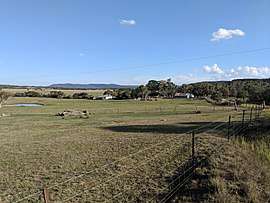
Mulloon is a locality in the Queanbeyan-Palerang Region, Southern Tablelands, New South Wales, Australia.[2][3]
Mulloon lies generally to the south of the Kings Highway between Bungendore and Braidwood on both sides of Mulloon Creek, a tributary of Reedy Creek, which flows into the Shoalhaven River.
At the 2016 census, it had a population of 144.[1]
Mullooon had a public school from 1872 to 1886, which operated "half-time". It was called Ingledow School until 1886.[4]
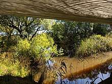
Mulloon Creek under Mulloon Bridge on the Kings Highway
References
- 1 2 Australian Bureau of Statistics (27 June 2017). "Mulloon". 2016 Census QuickStats. Retrieved 29 December 2017.

- ↑ "Mulloon". Geographical Names Register (GNR) of NSW. Geographical Names Board of New South Wales. Retrieved 29 December 2017.
- ↑ "Mulloon". OpenStreetMap. Retrieved 29 December 2017.
- ↑ "Mulloon Public School in the School history database search". New South Wales Department of Education. Retrieved 29 December 2017.
This article is issued from
Wikipedia.
The text is licensed under Creative Commons - Attribution - Sharealike.
Additional terms may apply for the media files.