Mount Tahat
| Mount Tahat | |
|---|---|
 | |
| Highest point | |
| Elevation | 3,003 m (9,852 ft) [1] |
| Prominence | 2,328 m (7,638 ft) [2][3] |
| Listing |
Country high point List of mountains in Algeria Ultra |
| Coordinates | 23°17′20″N 5°32′01″E / 23.28889°N 5.53361°ECoordinates: 23°17′20″N 5°32′01″E / 23.28889°N 5.53361°E [3] |
| Geography | |
 Mount Tahat Location in Algeria | |
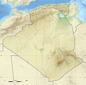
| Location | Algeria |
| Parent range | Hoggar Mountains |
| Climbing | |
| First ascent | 1931 |
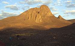
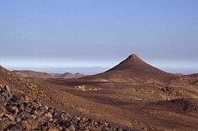
Mount Tahat (Arabic: جبل تاهات) is the highest mountain peak in Algeria. It sits at an elevation of 3,003 metres (9,852 ft).[2][3] Tahat is also the highest peak in the Hoggar Mountains. Its nearest city is Tamanrasset which is located 56 km to the south.
Mount Tahat is of volcanic origin. It is located in an arid, rocky high plateau area of the central Sahara Desert. The Tuareg inhabit this region. To the north lie the Tassili n'Ajjer mountains, which contain cave paintings dating from a period between 8000 and 2000 BC. The rock art is pastoral, showing cattle breeding and hunting of animals that are today exclusively found in the southern Sahara's climate.
Mount Tahat, Algeria
See also
References
- ↑ "Mount Tahat - Seven Natural Wonders" Sevennaturalwonders.org. Retrieved 2018-06-20.
- 1 2 "Africa Ultra-Prominences" Peaklist.org. Retrieved 2012-01-14.
- 1 2 3 "Tahat, Algeria". Peakbagger.com. Retrieved 2014-05-15.
External links
| Tell Atlas |
|
|---|---|
| Saharan Atlas |
|
| Saharan massifs | |
| Peaks |
|
This article is issued from
Wikipedia.
The text is licensed under Creative Commons - Attribution - Sharealike.
Additional terms may apply for the media files.