Montijo, Spain
| Montijo | ||
|---|---|---|
| City | ||
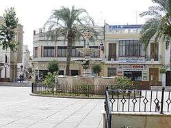 Spain Square | ||
| ||
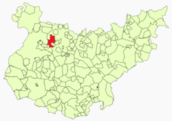 Location in Badajoz | ||
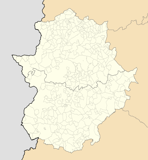 Montijo Location of Montijo within Extremadura | ||
| Coordinates: 38°54′36″N 6°37′3″W / 38.91000°N 6.61750°WCoordinates: 38°54′36″N 6°37′3″W / 38.91000°N 6.61750°W | ||
| Country |
| |
| Autonomous Community |
| |
| Province | Badajoz | |
| Comarca | Tierra de Mérida | |
| Founded | Prerromanic | |
| Government | ||
| • Mayor | Manuel Gómez Rodríguez (PSOE) | |
| Area | ||
| • Total | 119.7 km2 (46.2 sq mi) | |
| Elevation(AMSL) | 201 m (659 ft) | |
| Population (2016) | ||
| • Total | 15,674 | |
| • Density | 130/km2 (340/sq mi) | |
| Time zone | UTC+1 (CET) | |
| • Summer (DST) | UTC+2 (CEST (GMT +2)) | |
| Postal code | 06480 | |
| Area code(s) | +34 (Spain) + 924 (Badajoz) | |
| Website | Official website | |
Montijo is a town and municipality in the province of Badajoz, in Extremadura, Spain. It has a population of 16,236 inhabitants (in 2010). It is located between Badajoz and Mérida, near Guadiana river banks. The extension of the municipality covers 3 different centers of population: Lácara, Barbaño and Montijo, being the last one the capital.
The Battle of Montijo was fought near the town in 1644.
The town is also related to Eugenie de Montijo.
This article is issued from
Wikipedia.
The text is licensed under Creative Commons - Attribution - Sharealike.
Additional terms may apply for the media files.