La Garrovilla
| La Garrovilla | |||
|---|---|---|---|
| Municipality | |||
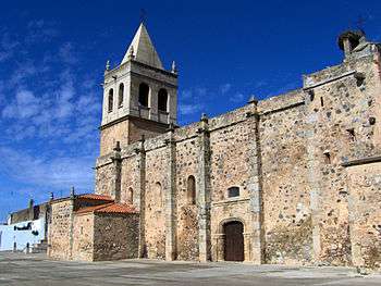 Nuestra Señora de la Asunción Church | |||
| |||
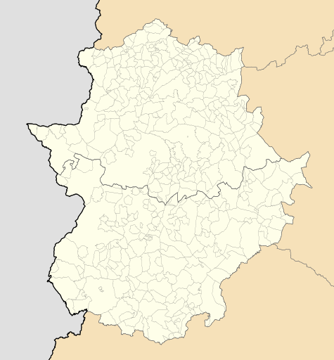 La Garrovilla Location of La Garrovilla within Extremadura | |||
| Coordinates: 38°55′16″N 6°28′33″W / 38.92111°N 6.47583°W | |||
| Country |
| ||
| Autonomous Community |
| ||
| Province | Badajoz | ||
| Comarca | Tierra de Mérida - Vegas Bajas | ||
| Government | |||
| • Mayor | Isabel Calle Jiménez (PP) | ||
| Area | |||
| • Total | 33.5 km2 (12.9 sq mi) | ||
| Elevation(AMSL) | 215 m (705 ft) | ||
| Population (2016) | |||
| • Total | 2,410 | ||
| • Density | 72/km2 (190/sq mi) | ||
| Time zone | UTC+1 (CET) | ||
| • Summer (DST) | UTC+2 (CEST (GMT +2)) | ||
| Postal code | 06870 | ||
| Area code(s) | +34 (Spain) + 924 (Badajoz) | ||
| Website | www.dip-badajoz.es | ||

La Garrovilla is a municipality located in the province of Badajoz, Extremadura, Spain. According to the 2010 census (INE), the municipality has a population of 2490 inhabitants.
Coordinates: 38°55′N 6°28′W / 38.917°N 6.467°W
This article is issued from
Wikipedia.
The text is licensed under Creative Commons - Attribution - Sharealike.
Additional terms may apply for the media files.