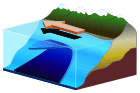
Meteotsunami
| Area | Country | Wave height (m) | Fatalities |
|---|---|---|---|
| Vela Luka (21 June 1978)[1][2]:1046 | Croatia | 5.9 | 0 |
| Nagasaki Bay (31 March 1979)[3] | Japan | 5 | 3 |
| Pohang Harbour | Korea | 0.8 | |
| Kent and Sussex coasts (20 July 1929)[4] | UK | 3.5-6 | 2 |
| Longkou Harbour (1 September 1980)[2]:1044 | China | 3 | |
| Ciutadella Harbour (15 June 2006)[3] | Spain | 4 | |
| Gulf of Trieste | Italy | 1.5 | |
| West Sicily | Italy | 1.5 | |
| Malta | Malta | 1 | |
| Chicago, IL (26 June 1954)[3] | US | 3 | 7 |
| Daytona Beach, FL (3-4 July 1992)[3][5] | US | 3.5 | 0 |
| Ciutadella Habour & Alcudia | Spain | 1,8 | 0 |
A meteotsunami or meteorological tsunami[6] is a tsunami-like wave of meteorological origin. Meteotsunamis are generated when rapid changes in barometric pressure cause the displacement of a body of water. In contrast to "ordinary" impulse-type tsunami sources, a traveling atmospheric disturbance normally interacts with the ocean over a limited period of time (from several minutes to several hours).[2] Tsunamis and meteotsunamis are otherwise similar enough that it can be difficult to distinguish one from the other, as in cases where there is a tsunami wave but there are no seismic records of an earthquake.[2]:1036
Only about 3% of historical tsunami events (from 2000 BC through 2014) are known to have meteorological origins, although their true prevalence may be considerably higher than this because 10% of historical tsunamis have unknown origins, tsunami events in the past are often difficult to validate, and meteotsunamis may have previously been misclassified as seiche waves.[3]
Meteotsunamis are restricted to local effects because they lack the energy available to significant seismic tsunami. However, when they are amplified by resonance they can be hazardous.[2] A meteotsunami that struck Nagasaki Bay on 31 March 1979 achieved a maximum wave height of 5 meters; there were three fatalities.[3] A three-meter wave that hit the Chicago waterfront in 1954 swept people off of piers, drowning seven.[3]:10
In some parts of the world, they are common enough to have local names: rissaga (Catalan), ressaca (Portuguese), milgħuba (Maltese), marrobbio (Italian), abiki (Japanese), šćiga (Croatian).[2] Some bodies of water are more susceptible than others, including anywhere that the natural resonance frequency matches that of the waves, such as in long and narrow bays, particularly where the inlet is aligned with the oncoming wave.[3]:4 Examples of particularly susceptible areas include Nagasaki Bay,[2]:1038–1040[3]:8 the eastern Adriatic Sea,[2]:1046[3]:8 and the Western Mediterranean.[2]:1044
See also
References
- ↑ National Tsunami Hazard Mitigation Program. "Meteotsunami Fact Sheet". Weather.Gov. National Weather Service. Retrieved 29 April 2016.
- 1 2 3 4 5 6 7 8 9 Monserrat, S.; Vilibić I.; Rabinovich A.B (2006). "Meteotsunamis: atmospherically induced destructive ocean waves in the tsunami frequency band" (PDF). Natural Hazards and Earth System Sciences. 6 (6): 1035–1051. doi:10.5194/nhess-6-1035-2006. Retrieved 23 November 2011.
- 1 2 3 4 5 6 7 8 9 10 Bailey, Kathleen; DiVeglio, Christopher; Welty, Ashley. "An Examination of the June 2013 East Coast Meteotsunami Captured By NOAA Observing Systems (NOAA Technical Report NOS CO-OPS 079)" (PDF). NOAA.Gov. National Oceanic and Atmospheric Administration. Retrieved 29 April 2016.
- ↑ "Tsunami or meteotsunami?". British Geological Survey. British Geological Survey. Retrieved 17 May 2016.
- ↑ Becky Oskin (12 December 2012). "Freak 'Meteotsunamis' Can Strike On A Sunny Day". Huffington Post. Retrieved 6 August 2013.
- ↑ Tsunami Glossary 2008 Archived 16 July 2011 at the Wayback Machine., UNESCO
External links
- "Presentation on meteotsunamis by the Croatian Institute for Oceanography" (PDF). Archived from the original (PDF) on 21 July 2006.
- Photos of the Rissaga in Spain (Ciutadella) 06-15-2006