Megino-Kangalassky District
| Megino-Kangalassky District Мегино-Кангаласский улус (Russian) Мэҥэ-Хаҥалас улууһа (Yakut) | |
|---|---|
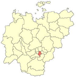 Location of Megino-Kangalassky District in the Sakha Republic | |
| Coordinates: 61°58′N 129°55′E / 61.967°N 129.917°ECoordinates: 61°58′N 129°55′E / 61.967°N 129.917°E | |
 Grazing livestock near the selo of Mayya in Megino-Kangalassky District | |
.png) |
.png) |
|
| |
| Location | |
| Country | Russia |
| Federal subject | Sakha Republic[1] |
| Administrative structure (as of June 2009) | |
| Administrative center | selo of Mayya[2] |
| Administrative divisions:[2] | |
| Settlements | 1 |
| Rural okrugs | 29 |
| Inhabited localities:[2] | |
| Urban-type settlements[3] | 1 |
| Rural localities | 35 |
| Municipal structure (as of April 2012) | |
| Municipally incorporated as | Megino-Kangalassky Municipal District[4] |
| Municipal divisions:[5] | |
| Urban settlements | 1 |
| Rural settlements | 30 |
| Statistics | |
| Area (June 2009) | 11,700 km2 (4,500 sq mi)[2] |
| Population (2010 Census) | 31,278 inhabitants[6] |
| • Urban | 11.2% |
| • Rural | 88.8% |
| Density | 2.67/km2 (6.9/sq mi)[7] |
| Time zone | YAKT (UTC+09:00)[8] |
| Established | February 10, 1930[2] |
| Official website | |
| Megino-Kangalassky District on WikiCommons | |
Megino-Kangalassky District (Russian: Ме́гино-Кангала́сский улу́с; Sakha: Мэҥэ-Хаҥалас улууһа, Meñe Xañalas uluuha, IPA: [meŋe xaŋalas uluːha]) is an administrative[1] and municipal[4] district (raion, or ulus), one of the thirty-four in the Sakha Republic, Russia. It is located in the central part of the republic, on the Lena River opposite Yakutsk, the capital of the republic. It borders Ust-Aldansky District in the north, Churapchinsky District in the east, Amginsky District in the southeast, Khangalassky District in the southwest, and is bounded by the Lena River in the west. The area of the district is 11,700 square kilometers (4,500 sq mi).[2] Its administrative center is the rural locality (a selo) of Mayya.[2] As of the 2010 Census, the total population of the district was 31,278, with the population of Mayya accounting for 23,.3% of that number.[6]
History
The district was established on February 10, 1930[2] through the merger of Meginsky and Vostochno-Kangalassky Districts.
Administrative and municipal status
Within the framework of administrative divisions, Megino-Kangalassky District is one of the thirty-four in the republic.[1] It is divided into one settlement (an administrative division with the administrative center in the urban-type settlement (inhabited locality) of Nizhny Bestyakh) and twenty-nine rural okrugs (naslegs), all of which comprise thirty-five rural localities.[2] The selo of Mayya serves as its administrative center.[2]
As a municipal division, the district is incorporated as Megino-Kangalassky Municipal District.[4] The Settlement of Nizhny Bestyakh is incorporated into an urban settlement, and the twenty-nine rural okrugs are incorporated into thirty rural settlements within the municipal district.[5] The urban-type settlement of Nizhny Bestyakh serves as the administrative center of the municipal district.[4]
Inhabited localities
| Settlements/Urban settlements | Population[6] | Inhabited localities in jurisdiction |
|---|---|---|
| Nizhny Bestyakh (Нижний Бестях) |
3,518 |
|
| Rural okrugs/Rural settlements | Population[6] | Rural localities in administrative jurisdiction* |
| Altansky (Алтанский) |
502 | |
| Arangassky (Арангасский) |
353 |
|
| Batarinsky (Батаринский) |
502 |
|
| Bedeminsky (Бедеминский) |
541 |
|
| Byuteydyakhsky (Бютейдяхский) |
703 |
|
| Dogdoginsky (Догдогинский) |
364 | |
| Doydunsky (Дойдунский) |
132 |
|
| Dollunsky (Доллунский) |
578 |
|
| Zhabylsky (Жабыльский) |
718 |
|
| Zhankhadinsky (Жанхадинский) |
1,185 | |
| Meginsky (Мегинский) |
883 |
|
| Megyuryonsky (Мегюрёнский) |
497 | |
| Meldekhsinsky (Мелдехсинский) |
505 |
|
| Moruksky (Морукский) |
426 |
|
| Nakharinsky 1-y (Нахаринский 1-й) |
534 |
|
| Nakharinsky 2-y (Нахаринский 2-й) |
622 |
|
| Neryuktyayinsky (Нерюктяйинский) |
2,022 |
|
| Rassolodinsky (Рассолодинский) |
472 |
|
| Taragaysky (Тарагайский) |
892 |
|
| Tomtorsky (Томторский) |
430 |
|
| Tyllyminsky 1-y (Тыллыминский 1-й) |
701 |
|
| Tyllyminsky 2-y (Тыллыминский 2-й) |
118 |
|
| Tyungyulyunsky (Тюнгюлюнский) |
2,308 |
|
| Khaptagaysky (Хаптагайский) |
1,004 |
|
| Kharansky (Харанский) |
1,139 |
|
| Khodorinsky (Ходоринский) |
611 |
|
| Kholguminsky (Холгуминский) |
295 |
|
| Khorobutsky (Хоробутский) |
1,002 |
|
| Chyamayykinsky (Чыамайыкинский) |
434 |
|
| Rural localities which are not a part of a settlement or a rural okrug | Population | Rural localities |
| 7,288 |
| |
*Administrative centers are shown in bold
Demographics
| 2010 Census | 31,278[6] |
|---|---|
| 2002 Census | 32,288[9] |
| 1989 Census | 31,623[10] |
| 1979 Census | 27,636[11] |
The population of the district is predominantly made up of ethnic Yakuts, who represented 91% of the inhabitants in the 2002 Census. Russians accounted for a further 6.4% of the population, with smaller numbers of Ukrainians and Evenks.
References
Notes
- 1 2 3 Constitution of the Sakha Republic, Article 45
- 1 2 3 4 5 6 7 8 9 10 11 Registry of the Administrative-Territorial Divisions of the Sakha Republic
- ↑ The count of urban-type settlements may include the work settlements, the resort settlements, the suburban (dacha) settlements, as well as urban-type settlements proper.
- 1 2 3 4 Law #172-Z #351-III
- 1 2 3 Law #173-Z #354-III
- 1 2 3 4 5 Russian Federal State Statistics Service (2011). "Всероссийская перепись населения 2010 года. Том 1" [2010 All-Russian Population Census, vol. 1]. Всероссийская перепись населения 2010 года (2010 All-Russia Population Census) (in Russian). Federal State Statistics Service. Retrieved June 29, 2012.
- ↑ The value of density was calculated automatically by dividing the 2010 Census population by the area specified in the infobox. Please note that this value is only approximate as the area specified in the infobox does not necessarily correspond to the area of the entity proper or is reported for the same year as the population.
- ↑ Правительство Российской Федерации. Федеральный закон №107-ФЗ от 3 июня 2011 г. «Об исчислении времени», в ред. Федерального закона №271-ФЗ от 03 июля 2016 г. «О внесении изменений в Федеральный закон "Об исчислении времени"». Вступил в силу по истечении шестидесяти дней после дня официального опубликования (6 августа 2011 г.). Опубликован: "Российская газета", №120, 6 июня 2011 г. (Government of the Russian Federation. Federal Law #107-FZ of June 31, 2011 On Calculating Time, as amended by the Federal Law #271-FZ of July 03, 2016 On Amending Federal Law "On Calculating Time". Effective as of after sixty days following the day of the official publication.).
- ↑ Russian Federal State Statistics Service (May 21, 2004). "Численность населения России, субъектов Российской Федерации в составе федеральных округов, районов, городских поселений, сельских населённых пунктов – районных центров и сельских населённых пунктов с населением 3 тысячи и более человек" [Population of Russia, Its Federal Districts, Federal Subjects, Districts, Urban Localities, Rural Localities—Administrative Centers, and Rural Localities with Population of Over 3,000] (XLS). Всероссийская перепись населения 2002 года [All-Russia Population Census of 2002] (in Russian). Retrieved August 9, 2014.
- ↑ Demoscope Weekly (1989). "Всесоюзная перепись населения 1989 г. Численность наличного населения союзных и автономных республик, автономных областей и округов, краёв, областей, районов, городских поселений и сёл-райцентров" [All Union Population Census of 1989: Present Population of Union and Autonomous Republics, Autonomous Oblasts and Okrugs, Krais, Oblasts, Districts, Urban Settlements, and Villages Serving as District Administrative Centers]. Всесоюзная перепись населения 1989 года [All-Union Population Census of 1989] (in Russian). Институт демографии Национального исследовательского университета: Высшая школа экономики [Institute of Demography at the National Research University: Higher School of Economics]. Retrieved August 9, 2014.
- ↑ "Всесоюзная перепись населения 1979 г. Национальный состав населения по регионам России. (All Union Population Census of 1979. Ethnic composition of the population by regions of Russia.)". Всесоюзная перепись населения 1979 года (All-Union Population Census of 1979) (in Russian). Demoscope Weekly (website of the Institute of Demographics of the State University—Higher School of Economics. 1979. Retrieved 2008-11-25.
Sources
- Official website of the Sakha Republic. Registry of the Administrative-Territorial Divisions of the Sakha Republic. Megino-Kangalassky District. (in Russian)
- Верховный Совет Республики Саха (Якутия). 4 апреля 1992 г. «Конституция (основной закон) Республики Саха (Якутия)», в ред. Конституционного закона №1077-З №1035-IV от 8 июня 2012 г. «О внесении изменений и дополнений в Конституцию (основной закон) Республики Саха (Якутия)». Опубликован: "Якутские ведомости", №7, 26 апреля 1992 г. (Supreme Council of the Sakha (Yakutia) Republic. April 4, 1992 Constitution (Basic Law) of the Sakha (Yakutia) Republic, as amended by the Constitutional Law #1077-Z No. 1035-IV of June 8, 2012 On Amending and Supplementing the Constitution (Basic Law) of the Sakha (Yakutia) Republic. ).
- Государственное Собрание (Ил Тумэн) Республики Саха (Якутия). Закон №172-З №351-III от 30 ноября 2004 г. «Об установлении границ и о наделении статусом муниципального района муниципальных образований Республики Саха (Якутия)», в ред. Закона №1535-З №597-V от 27 ноября 2015 г. «О внесении изменений в статьи 1 и 2 Закона Республики Саха (Якутия) "Об установлении границ и о наделении статусом муниципального района муниципальных образований Республики Саха (Якутия)"». Вступил в силу со дня официального опубликования. Опубликован: "Якутия", №245, 31 декабря 2004 г. (State Assembly (Il Tumen) of the Sakha (Yakutia) Republic. Law #172-Z No. 351-III of November 30, 2004 On Establishing the Borders and on Granting the Municipal District Status to the Municipal Formations of the Sakha (Yakutia) Republic, as amended by the Law #1535-Z No. 597-V of November 27, 2015 On Amending Articles 1 and 2 of the Law of the Sakha (Yakutia) Republic "On Establishing the Borders and on Granting the Municipal District Status to the Municipal Formations of the Sakha (Yakutia) Republic". Effective as of the day of the official publication.).
- Государственное Собрание (Ил Тумэн) Республики Саха (Якутия). Закон №173-З №353-III от 30 ноября 2004 г. «Об установлении границ и о наделении статусом городского и сельского поселений муниципальных образований Республики Саха (Якутия)», в ред. Закона №1058-З №1007-IV от 25 апреля 2012 г. «О внесении изменений в Закон Республики Саха (Якутия) "Об установлении границ и о наделении статусом городского и сельского поселений муниципальных образований Республики Саха (Якутия)"». Вступил в силу со дня официального опубликования. Опубликован: "Якутия", №245, 31 декабря 2004 г. (State Assembly (Il Tumen) of the Sakha (Yakutia) Republic. Law #173-Z No. 353-III of November 30, 2004 On Establishing the Borders and on Granting the Urban and Rural Settlement Status to the Municipal Formations of the Sakha (Yakutia) Republic, as amended by the Law #1058-Z No. 1007-IV of April 25, 2012 On Amending the Law of the Sakha (Yakutia) Republic "On Establishing the Borders and on Granting the Urban and Rural Settlement Status to the Municipal Formations of the Sakha (Yakutia) Republic". Effective as of the day of the official publication.).