Bezymyanny, Sakha Republic
| Bezymyanny Безымянный (Russian) Безымяннай (Yakut) | |
|---|---|
| - Urban-type settlement[1] - | |
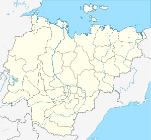
_Republic_(2008-03).svg.png) Location of the Sakha (Yakutia) Republic in Russia | |
 Bezymyanny | |
| Administrative status (as of June 2009) | |
| Country | Russia |
| Federal subject | Sakha Republic[2] |
| Administrative district | Aldansky District[2] |
| Settlement | Settlement of Bezymyanny[2] |
| Administrative center of | Settlement of Bezymyanny[2] |
| Municipal status (as of April 2012) | |
| Municipal district | Aldansky Municipal District[3] |
| Urban settlement | Tommot Urban Settlement[3] |
| Statistics | |
| Population (2010 Census) | 0 inhabitants[4] |
| Population (January 2016 est.) | 0 inhabitants[5] |
| Time zone | YAKT (UTC+09:00)[6] |
| Urban-type settlement status since | 1981[2] |
| 2010 Census | 0[4] |
|---|---|
| 2002 Census | 111[7] |
| 1989 Census | 537[8] |
Bezymyanny (Russian: Безымя́нный, lit. nameless; Sakha: Безымяннай) is an urban locality (an urban-type settlement) in Aldansky District of the Sakha Republic, Russia, located 112 kilometers (70 mi) from Aldan, the administrative center of the district.[2] As of the 2010 Census, it had no recorded population.[4]
History
Urban-type settlement status was granted to it in 1981.[2]
Administrative and municipal status
Within the framework of administrative divisions, the urban-type settlement of Bezymyanny[1] is incorporated within Aldansky District as the Settlement of Bezymyanny.[2] As a municipal division, the territories of the Settlement of Bezymyanny and the Town of Tommot are incorporated within Aldansky Municipal District as Tommot Urban Settlement.[3]
References
Notes
- 1 2 According to Article 7 of the Law #77-I, lower-level administrative divisions with the status of a settlement have their administrative centers in an inhabited locality with the status of an urban-type settlement. According to the Registry of the Administrative-Territorial Divisions of the Sakha Republic, Bezymyanny is the administrative center of the Settlement of Bezymyanny.
- 1 2 3 4 5 6 7 8 Registry of the Administrative-Territorial Divisions of the Sakha Republic
- 1 2 3 Law #173-Z 353-III
- 1 2 3 Russian Federal State Statistics Service (2011). "Всероссийская перепись населения 2010 года. Том 1" [2010 All-Russian Population Census, vol. 1]. Всероссийская перепись населения 2010 года (2010 All-Russia Population Census) (in Russian). Federal State Statistics Service. Retrieved June 29, 2012.
- ↑ Sakha Republic (Yakutia) Territorial Branch of the Federal State Statistics Service. Численность населения по районам республики на 1 января 2016 года (in Russian)
- ↑ Правительство Российской Федерации. Федеральный закон №107-ФЗ от 3 июня 2011 г. «Об исчислении времени», в ред. Федерального закона №271-ФЗ от 03 июля 2016 г. «О внесении изменений в Федеральный закон "Об исчислении времени"». Вступил в силу по истечении шестидесяти дней после дня официального опубликования (6 августа 2011 г.). Опубликован: "Российская газета", №120, 6 июня 2011 г. (Government of the Russian Federation. Federal Law #107-FZ of June 31, 2011 On Calculating Time, as amended by the Federal Law #271-FZ of July 03, 2016 On Amending Federal Law "On Calculating Time". Effective as of after sixty days following the day of the official publication.).
- ↑ Russian Federal State Statistics Service (May 21, 2004). "Численность населения России, субъектов Российской Федерации в составе федеральных округов, районов, городских поселений, сельских населённых пунктов – районных центров и сельских населённых пунктов с населением 3 тысячи и более человек" [Population of Russia, Its Federal Districts, Federal Subjects, Districts, Urban Localities, Rural Localities—Administrative Centers, and Rural Localities with Population of Over 3,000] (XLS). Всероссийская перепись населения 2002 года [All-Russia Population Census of 2002] (in Russian). Retrieved August 9, 2014.
- ↑ Demoscope Weekly (1989). "Всесоюзная перепись населения 1989 г. Численность наличного населения союзных и автономных республик, автономных областей и округов, краёв, областей, районов, городских поселений и сёл-райцентров" [All Union Population Census of 1989: Present Population of Union and Autonomous Republics, Autonomous Oblasts and Okrugs, Krais, Oblasts, Districts, Urban Settlements, and Villages Serving as District Administrative Centers]. Всесоюзная перепись населения 1989 года [All-Union Population Census of 1989] (in Russian). Институт демографии Национального исследовательского университета: Высшая школа экономики [Institute of Demography at the National Research University: Higher School of Economics]. Retrieved August 9, 2014.
Sources
- Official website of the Sakha Republic. Registry of the Administrative-Territorial Divisions of the Sakha Republic. Aldansky District. (in Russian)
- Государственное Собрание (Ил Тумэн) Республики Саха (Якутия). Закон №173-З №353-III от 30 ноября 2004 г. «Об установлении границ и о наделении статусом городского и сельского поселений муниципальных образований Республики Саха (Якутия)», в ред. Закона №1058-З №1007-IV от 25 апреля 2012 г. «О внесении изменений в Закон Республики Саха (Якутия) "Об установлении границ и о наделении статусом городского и сельского поселений муниципальных образований Республики Саха (Якутия)"». Вступил в силу со дня официального опубликования. Опубликован: "Якутия", №245, 31 декабря 2004 г. (State Assembly (Il Tumen) of the Sakha (Yakutia) Republic. Law #173-Z No. 353-III of November 30, 2004 On Establishing the Borders and on Granting the Urban and Rural Settlement Status to the Municipal Formations of the Sakha (Yakutia) Republic, as amended by the Law #1058-Z No. 1007-IV of April 25, 2012 On Amending the Law of the Sakha (Yakutia) Republic "On Establishing the Borders and on Granting the Urban and Rural Settlement Status to the Municipal Formations of the Sakha (Yakutia) Republic". Effective as of the day of the official publication.).
This article is issued from
Wikipedia.
The text is licensed under Creative Commons - Attribution - Sharealike.
Additional terms may apply for the media files.