Kobyaysky District
| Kobyaysky District Кобяйский улус (Russian) Кэбээйи улууһа (Yakut) | |
|---|---|
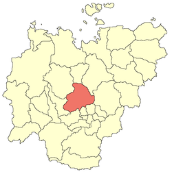 Location of Kobyaysky District in the Sakha Republic | |
| Coordinates: 63°55′N 127°28′E / 63.917°N 127.467°ECoordinates: 63°55′N 127°28′E / 63.917°N 127.467°E | |
.jpg) View of Kobyasky District near the urban-type settlement of Sangar | |
.png) | |
|
| |
| Location | |
| Country | Russia |
| Federal subject | Sakha Republic[1] |
| Administrative structure (as of June 2009) | |
| Administrative center | urban-type settlement of Sangar[2] |
| Administrative divisions:[2] | |
| Settlements | 1 |
| Rural okrugs | 11 |
| Inhabited localities:[2] | |
| Urban-type settlements[3] | 1 |
| Rural localities | 22 |
| Municipal structure (as of April 2012) | |
| Municipally incorporated as | Kobyaysky Municipal District[4] |
| Municipal divisions:[5] | |
| Urban settlements | 1 |
| Rural settlements | 11 |
| Statistics | |
| Area (June 2009) | 107,800 km2 (41,600 sq mi)[2] |
| Population (2010 Census) | 13,680 inhabitants[6] |
| • Urban | 32.0% |
| • Rural | 68.0% |
| Density | 0.13/km2 (0.34/sq mi)[7] |
| Time zone | YAKT (UTC+09:00)[8] |
| Established | April 20, 1937[2] |
| Kobyaysky District on WikiCommons | |
Kobyaysky District (Russian: Кобяйский улу́с; Sakha: Кэбээйи улууһа, Kebeeyi uluuha, IPA: [kebeːji uluːha]) is an administrative[1] and municipal[4] district (raion, or ulus), one of the thirty-four in the Sakha Republic, Russia. It is located in the center of the republic on the Vilyuy River, 334 kilometers (208 mi) by road north of the republic's capital of Yakutsk.[9] The area of the district is 107,800 square kilometers (41,600 sq mi).[2] Its administrative center is the urban-type settlement of Sangar.[2] As of the 2010 Census, the total population of the district was 13,680, with the population of Sangar accounting for 32.0% of that number.[6]
Geography
Mountain plains are located in the north and northeast of the district, notably the Verkhoyansk Range, while the rest of the district is lowland.
Several rivers flow through the district. These include the Lena River, which flows between the mouths of tributaries of the Aldan and the Linde, and its tributary the Vilyuy in the lower reaches.[9] The largest of the district's lowland lakes is Lake Nidzhili. A part of the Ust-Vilyuysky National Park is also located on the district's territory.[10]
Climate
Due to the sub-polar location, it is bitterly cold in the winter months, with an average January temperature of −36 °C (−33 °F) in the mountains and −40 °C (−40 °F) in the valley, and in July over +10 °C (50 °F) in the mountains and over +18 °C (64 °F) in the valley.[9] Annual precipitation ranges from 200–250 millimeters (7.9–9.8 in) in the east to 500–600 millimeters (20–24 in) in the mountains.[9]
History
The territory of what is now Kobyaysky District has long been settled by the Even, Evenk, and Yakut peoples. Silver-lead deposits were found in Yendybalskoye as early as 1765. In 1913, the coal potential of the area was noted and coal mining began at Tsugaru in the late 1920s. The first elementary school opened in Kobyay in 1926. In 1928, as the coal mining operations got underway, the miners established the new village of Sangar. In 1931, the first collective farms began to appear, and the first medical dispensary in the area was opened at Tsugaru mine, with the first pharmacy opening a year later. In 1936, a fishing organization was established in the area to unite the small fishing enterprises that had begun to develop.
Kobyaysky District was formed on April 20, 1937[2] from the remote territories of Namsky, Gorny, and Vilyuysky Districts, with the district's administrative center located in Kobyay. In 1959, however, the administrative center was moved to Sangar.[2] In 1938, thermal power stations operating on coal were built in Sangar, and the first library opened in Kobyay.[2] By 1939, the two main villages were connected by radio and in 1946 with a telephone station.[2] In September 1942, 2,482 were recorded as moving into the district.[2] In 1944, the district newspaper Sana oloh (renamed Leninets in 1962 and Dabaan in 1993) was established, and in 1945 an airport was commissioned, 5 kilometers (3.1 mi) from Sangar.[2] The first savings bank opened in 1946 and on April 16, 1947, Sangar commissioned a new steam turbine power plant.[2]
In 1952, the oil and gas reserves of the area began to be exploited, and over the next few years there was extensive planning and drilling to find these reserves.[2]In 1957, mass carp fishing began on Lake Nidzhili.[2] In 1963, the construction of a 400-kilometer (250 mi) gas pipeline Taas–Tumus–Berge–Yakutsk–Mokhsogollokh began—the first in the world on permafrost and in a sub-polar climate.[2] Several schools were established in the district in the 1960s and 1970s, with the folk theater opened in 1973 and Kobyay children's music school in 1974.[2] The oil and gas industry developed extensively during the 1980s and 1990s.[2]
On February 1, 2006, at a frequency of 102 FM, radio NEC "Sakha" started broadcasting.[2]
Administrative and municipal status
Within the framework of administrative divisions, Kobyaysky District is one of the thirty-four in the republic.[1] It is divided into one settlement (an administrative division with the administrative center in the urban-type settlement (inhabited locality) of Sangar) and eleven rural okrugs (naslegs), all of which comprise twenty-two rural localities.[2] As a municipal division, the district is incorporated as Kobyaysky Municipal District.[4] The Settlement of Sangar is incorporated into an urban settlement, and the eleven rural okrugs are incorporated into eleven rural settlements within the municipal district.[5] The urban-type settlement of Sangar serves as the administrative center of both the administrative[2] and municipal[4] district.
Inhabited localities
| Settlements/Urban settlements | Population[6] | Inhabited localities in jurisdiction |
|---|---|---|
| Sangar (Сангар) |
4657 |
|
| Rural okrugs/Rural settlements | Population[6] | Rural localities in jurisdiction* |
| Aryktakhsky (Арыктахский) |
509 |
|
| Kirovsky (Кировский) |
628 |
|
| Kobyaysky (Кобяйский) |
2605 |
|
| Kuokuysky (Куокуйский) |
828 | |
| Lamynkhinsky (Ламынхинский) |
796 |
|
| Lyuchcheginsky 1-y (Люччегинский 1-й) |
256 | |
| Lyuchcheginsky 2-y (Люччегинский 2-й) |
658 |
|
| Mukuchunsky (Мукучунский) |
1221 |
|
| Nizhilinsky (Нижилинский) |
542 |
|
| Sittinsky (Ситтинский) |
503 |
|
| Tyayinsky (Тыайинский) |
477 |
|
*Administrative centers are shown in bold
Economy
The leading industry is agriculture, with cattle, pig, horse breeding, reindeer husbandry, poultry farming, cellular farming, fisheries, mining, and furs forming much of the main economic activity in the district.[9] There are 59,200 hectares (146,000 acres) of arable land, with some 66.3% of it being hayfields.[9] The district has notable deposits of gold, silver, lead, zinc, gas, coal, and building materials.[11] In 1998, upon the decision of the Russian Ministry of Energy, the Tsugaru coal mine was closed. In 2000, a fire broke out. In 2008, the Mastakhskoye gas-condensate field was in the final stages of development.
The district has a number of facilities such as printing houses, clubs, a theater in Kobyay, and vocational, educational, sports, and children's art schools.[9]
The Sangar Airport is the main airport in the district.
Demographics
| 2010 Census | 13,680[6] |
|---|---|
| 2002 Census | 14,178[12] |
| 1989 Census | 20,352[13] |
| 1979 Census | 18,914[14] |
As of the 2002 Census, the ethnic composition of the district is as follows:
- Yakuts: 9,209 people (65.0%)
- Russians: 3,425 people (24.2%)
- Evens: 809 people (5.7%)
- Ukrainians: 235 people (1.7%)
- Evenks: 64 people (0.4%)
- other ethnicities: 436 people (3.1%)
References
Notes
- 1 2 3 Constitution of the Sakha Republic, Article 45
- 1 2 3 4 5 6 7 8 9 10 11 12 13 14 15 16 17 18 19 20 21 22 23 Registry of the Administrative-Territorial Divisions of the Sakha Republic
- ↑ The count of urban-type settlements may include the work settlements, the resort settlements, the suburban (dacha) settlements, as well as urban-type settlements proper.
- 1 2 3 4 Law #172-Z #351-III
- 1 2 3 Law #173-Z #354-III
- 1 2 3 4 5 Russian Federal State Statistics Service (2011). "Всероссийская перепись населения 2010 года. Том 1" [2010 All-Russian Population Census, vol. 1]. Всероссийская перепись населения 2010 года (2010 All-Russia Population Census) (in Russian). Federal State Statistics Service. Retrieved June 29, 2012.
- ↑ The value of density was calculated automatically by dividing the 2010 Census population by the area specified in the infobox. Please note that this value is only approximate as the area specified in the infobox does not necessarily correspond to the area of the entity proper or is reported for the same year as the population.
- ↑ Правительство Российской Федерации. Федеральный закон №107-ФЗ от 3 июня 2011 г. «Об исчислении времени», в ред. Федерального закона №271-ФЗ от 03 июля 2016 г. «О внесении изменений в Федеральный закон "Об исчислении времени"». Вступил в силу по истечении шестидесяти дней после дня официального опубликования (6 августа 2011 г.). Опубликован: "Российская газета", №120, 6 июня 2011 г. (Government of the Russian Federation. Federal Law #107-FZ of June 31, 2011 On Calculating Time, as amended by the Federal Law #271-FZ of July 03, 2016 On Amending Federal Law "On Calculating Time". Effective as of after sixty days following the day of the official publication.).
- 1 2 3 4 5 6 7 Кобяйский улус (in Russian). Npeople. Retrieved November 14, 2016.
- ↑ "Protected areas" (in Russian). Ministry of Nature Protection of the Sakha Republic. Retrieved November 14, 2016.
- ↑ Минерально-сырьевая база Кобяйского улуса (по данным Госкомгеологии РС(Я)) (in Russian). Ulus of Kobyaysky. Retrieved 2010-03-05.
- ↑ Russian Federal State Statistics Service (May 21, 2004). "Численность населения России, субъектов Российской Федерации в составе федеральных округов, районов, городских поселений, сельских населённых пунктов – районных центров и сельских населённых пунктов с населением 3 тысячи и более человек" [Population of Russia, Its Federal Districts, Federal Subjects, Districts, Urban Localities, Rural Localities—Administrative Centers, and Rural Localities with Population of Over 3,000] (XLS). Всероссийская перепись населения 2002 года [All-Russia Population Census of 2002] (in Russian). Retrieved August 9, 2014.
- ↑ Demoscope Weekly (1989). "Всесоюзная перепись населения 1989 г. Численность наличного населения союзных и автономных республик, автономных областей и округов, краёв, областей, районов, городских поселений и сёл-райцентров" [All Union Population Census of 1989: Present Population of Union and Autonomous Republics, Autonomous Oblasts and Okrugs, Krais, Oblasts, Districts, Urban Settlements, and Villages Serving as District Administrative Centers]. Всесоюзная перепись населения 1989 года [All-Union Population Census of 1989] (in Russian). Институт демографии Национального исследовательского университета: Высшая школа экономики [Institute of Demography at the National Research University: Higher School of Economics]. Retrieved August 9, 2014.
- ↑ "Всесоюзная перепись населения 1979 г. Национальный состав населения по регионам России. (All Union Population Census of 1979. Ethnic composition of the population by regions of Russia.)". Всесоюзная перепись населения 1979 года (All-Union Population Census of 1979) (in Russian). Demoscope Weekly (website of the Institute of Demographics of the State University—Higher School of Economics. 1979. Retrieved 2008-11-25.
Sources
- Official website of the Sakha Republic. Registry of the Administrative-Territorial Divisions of the Sakha Republic. Kobyaysky District. (in Russian)
- Верховный Совет Республики Саха (Якутия). 4 апреля 1992 г. «Конституция (основной закон) Республики Саха (Якутия)», в ред. Конституционного закона №1077-З №1035-IV от 8 июня 2012 г. «О внесении изменений и дополнений в Конституцию (основной закон) Республики Саха (Якутия)». Опубликован: "Якутские ведомости", №7, 26 апреля 1992 г. (Supreme Council of the Sakha (Yakutia) Republic. April 4, 1992 Constitution (Basic Law) of the Sakha (Yakutia) Republic, as amended by the Constitutional Law #1077-Z No. 1035-IV of June 8, 2012 On Amending and Supplementing the Constitution (Basic Law) of the Sakha (Yakutia) Republic. ).
- Государственное Собрание (Ил Тумэн) Республики Саха (Якутия). Закон №172-З №351-III от 30 ноября 2004 г. «Об установлении границ и о наделении статусом муниципального района муниципальных образований Республики Саха (Якутия)», в ред. Закона №1535-З №597-V от 27 ноября 2015 г. «О внесении изменений в статьи 1 и 2 Закона Республики Саха (Якутия) "Об установлении границ и о наделении статусом муниципального района муниципальных образований Республики Саха (Якутия)"». Вступил в силу со дня официального опубликования. Опубликован: "Якутия", №245, 31 декабря 2004 г. (State Assembly (Il Tumen) of the Sakha (Yakutia) Republic. Law #172-Z No. 351-III of November 30, 2004 On Establishing the Borders and on Granting the Municipal District Status to the Municipal Formations of the Sakha (Yakutia) Republic, as amended by the Law #1535-Z No. 597-V of November 27, 2015 On Amending Articles 1 and 2 of the Law of the Sakha (Yakutia) Republic "On Establishing the Borders and on Granting the Municipal District Status to the Municipal Formations of the Sakha (Yakutia) Republic". Effective as of the day of the official publication.).
- Государственное Собрание (Ил Тумэн) Республики Саха (Якутия). Закон №173-З №353-III от 30 ноября 2004 г. «Об установлении границ и о наделении статусом городского и сельского поселений муниципальных образований Республики Саха (Якутия)», в ред. Закона №1058-З №1007-IV от 25 апреля 2012 г. «О внесении изменений в Закон Республики Саха (Якутия) "Об установлении границ и о наделении статусом городского и сельского поселений муниципальных образований Республики Саха (Якутия)"». Вступил в силу со дня официального опубликования. Опубликован: "Якутия", №245, 31 декабря 2004 г. (State Assembly (Il Tumen) of the Sakha (Yakutia) Republic. Law #173-Z No. 353-III of November 30, 2004 On Establishing the Borders and on Granting the Urban and Rural Settlement Status to the Municipal Formations of the Sakha (Yakutia) Republic, as amended by the Law #1058-Z No. 1007-IV of April 25, 2012 On Amending the Law of the Sakha (Yakutia) Republic "On Establishing the Borders and on Granting the Urban and Rural Settlement Status to the Municipal Formations of the Sakha (Yakutia) Republic". Effective as of the day of the official publication.).