Mead, West Virginia
| Mead, West Virginia | |
|---|---|
| Unincorporated community | |
 Mead, West Virginia  Mead, West Virginia | |
| Coordinates: 37°37′28″N 81°15′38″W / 37.62444°N 81.26056°WCoordinates: 37°37′28″N 81°15′38″W / 37.62444°N 81.26056°W | |
| Country | United States |
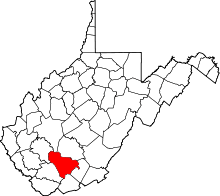
| State | West Virginia |
| County | Raleigh |
| Elevation | 1,768 ft (539 m) |
| Time zone | UTC-5 (Eastern (EST)) |
| • Summer (DST) | UTC-4 (EDT) |
| ZIP codes | 25877 |
| Area code(s) | 304 & 681 |
| GNIS feature ID | 1543037[1] |
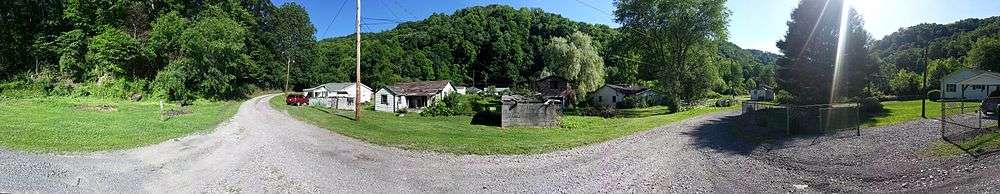
Mead is an unincorporated community in Raleigh County, West Virginia, United States. Mead is located on County Route 33 and Stonecoal Creek 2.7 miles (4.3 km) east-northeast of Rhodell.[2] Mead had a post office, which closed on June 10, 1989.[3] It was also known as Vanwood.
The community was named after C. H. Mead, the proprietor of a local mine.[4]
Gallery
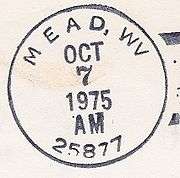
Mead postmark
See also
![]()
References
- ↑ "Mead". Geographic Names Information System. United States Geological Survey.
- ↑ Raleigh County, West Virginia General Highway Map (PDF) (Map). West Virginia Department of Transportation. 2011. p. 3. Archived from the original (PDF) on April 25, 2012. Retrieved November 11, 2011.
- ↑ "Postmaster Finder - Post Offices by ZIP Code". United States Postal Service. Retrieved November 11, 2011.
- ↑ Kenny, Hamill (1945). West Virginia Place Names: Their Origin and Meaning, Including the Nomenclature of the Streams and Mountains. Piedmont, WV: The Place Name Press. p. 408.
External links
![]()
This article is issued from
Wikipedia.
The text is licensed under Creative Commons - Attribution - Sharealike.
Additional terms may apply for the media files.