Matapeake State Park
| Matapeake State Park | |
| Matapeake Beach & Clubhouse[1] Matapeake Marine Terminal[2] | |
| Maryland State Park | |
 Matapeake State Park | |
| Country | United States |
|---|---|
| State | Maryland |
| County | Queen Anne's |
| Elevation | 23 ft (7 m) [3] |
| Coordinates | 38°57′13″N 76°21′09″W / 38.95361°N 76.35250°WCoordinates: 38°57′13″N 76°21′09″W / 38.95361°N 76.35250°W [3] |
| Area | 29 acres (12 ha) [2] |
| Opened | 2009 |
| Management | Queen Anne's County |
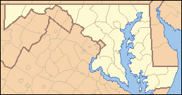 Location in Maryland | |
| Website: Matapeake Beach & Clubhouse | |
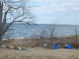
Matapeake State Park is a public recreation area on Chesapeake Bay occupying the site of a former ferry landing in Matapeake, Kent Island, Maryland. The landing served the state-owned Chesapeake Bay Ferry System before the Chesapeake Bay Bridge opened. The park is leased and managed by Queen Anne's County.[1]
History
The park land was first acquired by the state in 1941 with the purchase of the Claiborne-Annapolis Ferry Company, which became the Chesapeake Bay Ferry System. The Sandy Point-Matapeake Ferry, which had used the land as a landing, was discontinued in 1952. Afterwards, uses for the land by the state included a shooting range and a building housing a scale model of the Chesapeake Bay. The bay model was made obsolete by computer simulations, and the building was left vacant. Following the 2003 collapse of the building during that year's Presidents' Day snowstorm, the county resumed renovation of the ferry terminal building and renamed it Matapeake Clubhouse.[4] The Matapeake Clubhouse and adjoining public beach opened to the public in May 2009.[5]
Activities and amenities
Park grounds include the restored ferry house and former ferry landing, which is used as a fishing pier. The park offers a swimming beach, amphitheater, trails, picnicking area, dog beach, and views of the Bay Bridge.[1] It is the northern terminus of the paved Kent Island South Trail, which extends 6 miles (9.7 km) from the park to Romancoke Pier.[6]
See also
References
- 1 2 3 "Matapeake Beach & Clubhouse". Queen Anne's County Government. Retrieved November 9, 2016.
- 1 2 "Fiscal Year 2016 DNR Owned Lands Acreage" (PDF). Maryland Department of Natural Resources. July 29, 2016. Retrieved November 5, 2017.
- 1 2 "Matapeake State Park". Geographic Names Information System. United States Geological Survey.
- ↑ "Chronology of the Matapeake property". My Eastern Shore MD. Easton, Md. October 13, 2010. Retrieved November 9, 2016.
- ↑ "History of Matapeake". Queen Anne's County Government. Retrieved November 9, 2016.
- ↑ "Hiker-Biker Trails". Queen Anne's County Recreation. Retrieved November 5, 2017.
External links
- Matapeake Beach & Clubhouse Queen Anne's County