Gambrill State Park
| Gambrill State Park | |
| Maryland State Park | |
 | |
| Country | United States |
|---|---|
| State | Maryland |
| County | Frederick |
| Elevation | 1,549 ft (472 m) [1] |
| Coordinates | 39°28′43″N 77°29′29″W / 39.47861°N 77.49139°WCoordinates: 39°28′43″N 77°29′29″W / 39.47861°N 77.49139°W [1] |
| Area | 1,191 acres (482 ha) [2] |
| Established | 1934 |
| Management | Maryland Department of Natural Resources |
| Nearest city | Frederick, Maryland |
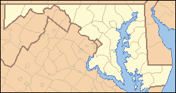 Location in Maryland | |
| Website: Gambrill State Park | |
Gambrill State Park is a public recreation area located on Catoctin Mountain near the city of Frederick in Frederick County, Maryland. The state park is known for the dramatic views of the surrounding area that can be seen from stone overlooks built in the 1930s by the Civilian Conservation Corps. The park is operated by the Maryland Department of Natural Resources.[3]
Location
The park is approximately 51 miles (82 km) northwest of Washington, D.C. and 53 miles (85 km) west of Baltimore on Catoctin Mountain. Gambrill Park Road is located approximately six miles (10 km) away from Frederick on Route 40 West. The park road traverses Catoctin Mountain, and accesses the campground, the trailhead, and the High Knob areas of this park.
History
The park is named after James H. Gambrill, Jr. (1866-1951), a participant in the grain industry and in Frederick city politics, who was a conservationist and frequent visitor to Catoctin Mountain. In an effort to establish a park, Gambrill convinced his fellow businessmen to purchase the land that now makes up the park and donate it to the city of Frederick. The city then donated the land one year later to the state of Maryland. The state park was dedicated on September 7, 1934.[4] A majority of the park's buildings and structures including its roads, stone overlooks, wooden picnic shelters, Tea Room, and ranger’s residence were constructed in the 1930s by the Civilian Conservation Corps.[5]
Activities and amenities
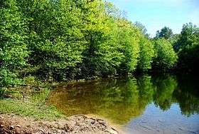
The park offers trails for hikers and mountain bikers as well as a picnic area with a playground and a small fishing pond.
- Trails
Each park trail is blazed with its own color scheme; each is maintained by a different volunteer group. The descriptions below are adapted from the official trail guide offered by the State of Maryland.[6]
| Trail Name | Blaze | Length | Notes |
|---|---|---|---|
| White Oak | White | 1 mile (1.6 km) | Open only to hikers |
| Red Maple | Red | 1 mile (1.6 km) | Connects campground with the rest of the park; one short steep section; maintained by The Trail House store |
| Green Ash | Green | 2 miles (3.2 km) | Several steep slopes and very little level ground; maintained by the Wheel Base bike shop |
| Black Locust | Black-on-white | 3.3 miles (5.3 km) | Several steep slopes mixed with level areas; wooded slopes and views of Frederick Valley to the east and Middletown Valley to the west; maintained by the Potomac Appalachian Trail Club, West Virginia Chapter |
| Yellow Poplar | Yellow | 7.1 miles (11.4 km) | Longest Gambrill trail; passes stone overlooks built by the CCC as it ascends the mountain and goes into the far reaches of the park; maintained by Mid-Atlantic Off Road Enthusiasts |
| Catoctin Trail | Blue | 26.5 miles (42.6 km) | Traverses the state park for approximately 3.0 miles (4.8 km), and continues north through the Frederick City Watershed, Cunningham Falls State Park, and Catoctin Mountain Park, where it ends at Mt. Zion Road, 1.3 miles (2.1 km) north of Owens Creek Campground |
- Overlooks
Three native stone overlooks located on the 1600-foot (490 m) summit of High Knob, midway between the Mason–Dixon line and the Potomac River, offer views of the surrounding area: north – the rugged tree-covered mountains of the Frederick City Municipal Forest; south – Crampton's Gap, a Civil War landmark and the location of Gathland State Park, as well as the Middletown and Monocacy valleys; west – South Mountain, the site of numerous Civil War engagements.
References
- 1 2 "Gambrill State Park". Geographic Names Information System. United States Geological Survey.
- ↑ "Fiscal Year 2016 DNR Owned Lands Acreage" (PDF). Maryland Department of Natural Resources. July 29, 2016. Retrieved November 3, 2017.
- ↑ "Gambrill State Park". Maryland Department of Natural Resources. Retrieved December 16, 2013.
- ↑ "The man behind the founding of Gambrill State Park". The Frederick News-Post. Frederick, Md. June 23, 2013. Retrieved January 29, 2016.
- ↑ "Gambrill State Park: Civilian Conservation Corps". Maryland Department of Natural Resources. Retrieved October 18, 2016.
- ↑ "Gambrill State Park Trail Guide". Maryland Department of Natural Resources. Archived from the original on February 7, 2012. Retrieved December 16, 2013.
External links
| Wikimedia Commons has media related to Gambrill State Park. |
- Gambrill State Park Maryland Department of Natural Resources