Fort Tonoloway State Park
| Fort Tonoloway State Park | |
| Maryland State Park | |
| Country | United States |
|---|---|
| State | Maryland |
| County | Washington |
| Coordinates | 39°41′54″N 78°12′7″W / 39.69833°N 78.20194°WCoordinates: 39°41′54″N 78°12′7″W / 39.69833°N 78.20194°W |
| Area | 26 acres (11 ha) [1] |
| Established | Unspecified |
| Management | Maryland Department of Natural Resources |
| IUCN category | III[2] |
| Status | Closed |
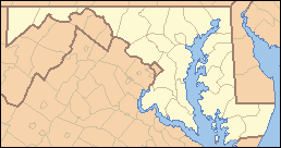 Location in Maryland | |
Fort Tonoloway State Park is an undeveloped Maryland state park located near present day Hancock. Fort Tonoloway was a frontier fort built in 1755 by Lt. Thomas Stoddert and men from the Maryland State Militia.[3] The fort was also known as Stoddert's Fort. It was abandoned in 1756 when Fort Frederick was constructed.[4][5]
The state park was at one time leased to the Boy Scouts. It is awaiting archaeological investigation before its use as a recreational facility can be assessed.[6]
References
- ↑ "Fiscal Year 2016 DNR Owned Lands Acreage" (PDF). Maryland Department of Natural Resources. July 29, 2016. Retrieved November 3, 2017.
- ↑ "Fort Tonoloway State Park". Protected Planet. IUCN. Retrieved 1 May 2018.
- ↑ "Fort Stoddert on the Tonoloways". C&O Canal Trust. Retrieved November 3, 2017.
- ↑ "Tonoloway Fort". Maryland's Roadside Historical Markers. Maryland Historical Trust. Retrieved December 6, 2013.
- ↑ Rubin, Mary H. (2003). The Chesapeake and Ohio Canal. Images of America. Arcadia Publishing. p. 96. ISBN 9780738515984.
- ↑ "Maryland Land Preservation, Parks & Recreation Plan 2009" (PDF). Maryland Department of Natural Resources. p. 59. Retrieved December 6, 2013.
Further reading
- Tonoloway Fort: Outpost on the Maryland Frontier, Gerald Sword, Friends of Fort Frederick, 1994, ASIN: B002X49ZMA.
External links
- State Parks Maryland Manual On-Line
This article is issued from
Wikipedia.
The text is licensed under Creative Commons - Attribution - Sharealike.
Additional terms may apply for the media files.