Mantua Township, Portage County, Ohio
| Mantua Township, Portage County, Ohio | |
|---|---|
| Township | |
 Historic Snow Home, built in 1815 | |
 Location within Portage County | |
| Coordinates: 41°17′50″N 81°14′36″W / 41.29722°N 81.24333°WCoordinates: 41°17′50″N 81°14′36″W / 41.29722°N 81.24333°W | |
| Country | United States |
| State | Ohio |
| County | Portage |
| Area | |
| • Total | 26.6 sq mi (68.8 km2) |
| • Land | 26.5 sq mi (68.5 km2) |
| • Water | 0.1 sq mi (0.2 km2) |
| Elevation[1] | 1,175 ft (358 m) |
| Population (2010) | |
| • Total | 4,811 |
| • Density | 176.1/sq mi (68.0/km2) |
| Time zone | UTC-5 (Eastern (EST)) |
| • Summer (DST) | UTC-4 (EDT) |
| ZIP code | 44255 |
| Area code(s) | 330, 234 |
| FIPS code | 39-47194[2] |
| GNIS feature ID | 1086831[1] |
Mantua Township /ˈmænəweɪ/ is one of the eighteen townships of Portage County, Ohio, United States. The 2000 census found 4,661 people in the township.[3]
Name and history
Mantua Township was named in commemoration of Mantua, Italy, which in 1796 was besieged by Napoleon, during the Napoleonic Wars.[4]
It is the only Mantua Township statewide.[5]
Government
The township is governed by a three-member board of trustees, who are elected in November of odd-numbered years to a four-year term beginning on the following January 1. Two are elected in the year after the presidential election and one is elected in the year before it. There is also an elected township fiscal officer,[6] who serves a four-year term beginning on April 1 of the year after the election, which is held in November of the year before the presidential election. Vacancies in the fiscal officership or on the board of trustees are filled by the remaining trustees.
Geography
Formed from the Connecticut Western Reserve, Mantua Township covers an area of 26 sq mi (67 km2). It is located in the northern part of Portage county and borders the following townships and cities:
- Auburn Township, Geauga County - north
- Troy Township, Geauga County - northeast corner
- Hiram Township - east
- Freedom Township - southeast corner
- Shalersville Township - south
- Streetsboro - southwest corner
- Aurora - west
- Bainbridge Township, Geauga County - northwest corner
The village of Mantua, which became independent of the township in 1993,[7] is located in what was previously southern Mantua Township and borders the township on three sides.
Mantua Bog State Nature Preserve and Marsh Wetlands State Nature Preserve, are located east of Mantua. Both are part of the Mantua Swamp region which was designated as a National Natural Landmark in 1976.[8][9]
Notable people
- Eliza Roxcy Snow Smith, an early Latter Day Saint leader, and a plural wife of both Joseph Smith and Brigham Young
- Lorenzo Snow, a former president of The Church of Jesus Christ of Latter-day Saints. The community of Mantua, Utah, in Utah's Box Elder County, was named in honor of Snow and his hometown.[10]
References
- 1 2 "US Board on Geographic Names". United States Geological Survey. 2007-10-25. Retrieved 2008-01-31.
- ↑ "American FactFinder". United States Census Bureau. Retrieved 2008-01-31.
- ↑ Portage County, Ohio — Population by Places Estimates Ohio State University, 2007. Accessed 15 May 2007.
- ↑ History of Portage County, Ohio: Containing a History of the County, Its Townships, Towns, Villages, Schools, Churches, Industries, Etc. Warner, Beers & Company. 1885. p. 480.
- ↑ "Detailed map of Ohio" (PDF). United States Census Bureau. 2000. Retrieved 2007-02-16.
- ↑ §503.24, §505.01, and §507.01 of the Ohio Revised Code. Accessed 4/30/2009.
- ↑ "Census Bureau data". Archived from the original on 2011-06-29. Retrieved 2017-12-05.
- ↑ "National Natural Landmarks - Mantua Swamp". www.NPS.gov. Retrieved September 22, 2017.
- ↑ "Wetland areas designated as landmarks". Chillicothe Gazette. Chillicothe, Ohio. March 24, 1976. p. 20. Retrieved September 21, 2017 – via Newspapers.com.

- ↑ Jenson, Andrew (1920). "Origin of Western Geographic Names". The Utah genealogical and historical magazine. 11 (2): 83.
But in 1864 the settlement was named Mantua, after Mantua, Portage County, Ohio, the birthplace of President Lorenzo Snow.
External links
| Wikimedia Commons has media related to Mantua Township, Ohio. |
Municipalities and communities of Portage County, Ohio, United States | ||
|---|---|---|
| Cities | 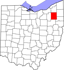 | |
| Villages | ||
| Townships | ||
| CDPs | ||
| Unincorporated communities | ||
| Historical places | ||
| Footnotes | ‡This populated place also has portions in an adjacent county or counties | |