New Milford, Ohio
| New Milford, Ohio | |
|---|---|
| Unincorporated area | |
 New Milford, Ohio Location in Ohio and the United States  New Milford, Ohio New Milford, Ohio (the US) | |
| Coordinates: 41°06′17″N 81°12′52″W / 41.10472°N 81.21444°WCoordinates: 41°06′17″N 81°12′52″W / 41.10472°N 81.21444°W | |
| Country | United States |
| State | Ohio |
| County | Portage |
| Township | Rootstown |
| Elevation | 1,125 ft (343 m) |
| Time zone | UTC−5 (EST) |
| • Summer (DST) | UTC−4 (EDT) |
| ZIP code | 44272 |
| Area code(s) | 330, 234 |
| GNIS feature ID | 1049145[1] |
New Milford, also called Rootstown Station, is an unincorporated area in Portage County, Ohio, United States. It is located in eastern Rootstown Township, immediately south of Interstate 76.[1]
History
A post office called New Milford was established in 1857, and remained in operation until 1967.[2] Besides the post office, New Milford had a railroad station and a gristmill.[3]
References
- 1 2 "New Milford". Geographic Names Information System. United States Geological Survey. July 12, 1979. Retrieved January 9, 2018.
- ↑ "Portage County". Jim Forte Postal History. Retrieved 13 January 2016.
- ↑ Brown, Robert C.; Norris, J. E. (1885). History of Portage County, Ohio: Containing a History of the County, Its Townships, Towns, Villages, Schools, Churches, Industries, Etc. Warner, Beers & Company. p. 551.
Municipalities and communities of Portage County, Ohio, United States | ||
|---|---|---|
| Cities | 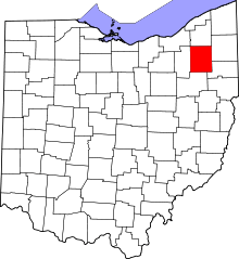 | |
| Villages | ||
| Townships | ||
| CDPs | ||
| Unincorporated communities | ||
| Historical places | ||
| Footnotes | ‡This populated place also has portions in an adjacent county or counties | |
This article is issued from
Wikipedia.
The text is licensed under Creative Commons - Attribution - Sharealike.
Additional terms may apply for the media files.