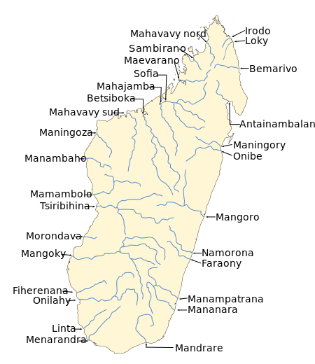
Maningory River
| Maningory River | |
| River | |
 | |
| Country | |
|---|---|
| Region | Analanjirofo |
| Tributaries | |
| - left | Sandratsio River |
| City | Ampasina Maningory |
| Source | |
| - location | Lake Alaotra |
| - elevation | 750 m (2,461 ft) |
| Mouth | Indian Ocean |
| - location | Antakobola, Analanjirofo |
| - elevation | 0 m (0 ft) |
| - coordinates | 17°12′21″S 49°27′45″E / 17.20583°S 49.46250°ECoordinates: 17°12′21″S 49°27′45″E / 17.20583°S 49.46250°E |
| Length | 260 km (162 mi) |
| Basin | 12,646 km2 (4,883 sq mi) |
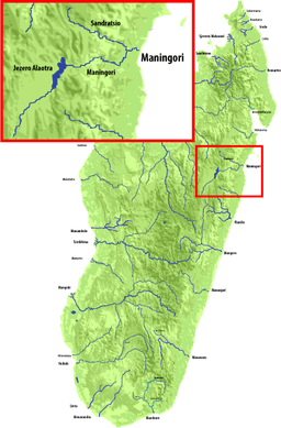
Maningory is a river in the region of Analanjirofo in north-eastern Madagascar. It takes it source in Lake Alaotra[1] and flows into the Indian Ocean near Antakobola.[2]
Rivers of Madagascar
The Maningory Falls of 90 meters are situated 20 km from Imerimandroso.[3]
References
- ↑ "Madagascar-GEOGRAPHY". countrystudies.us. U. S. Library of Congress. Retrieved 27 September 2017.
- ↑ M. Aldegheri,1972.Rivers and streams on Madagascar. Dr. W. Junk B.V. Publishers
- ↑ "En construction". Madagascar-guide.com. Retrieved 11 August 2017.
This article is issued from
Wikipedia.
The text is licensed under Creative Commons - Attribution - Sharealike.
Additional terms may apply for the media files.