Mahajilo River
| Mahajilo River | |
| River | |
| Country | |
|---|---|
| City | Miandrivazo |
| Mouth | |
| - location | Tsiribihina River, Menabe |
| - coordinates | 19°41′00″S 45°22′23″E / 19.68333°S 45.37306°ECoordinates: 19°41′00″S 45°22′23″E / 19.68333°S 45.37306°E |
| Length | 260 km (162 mi) |
| Basin | 14,375 km2 (5,550 sq mi) |
| Discharge | for Tsiribihina River |
| - average | 517 m3/s (18,258 cu ft/s) at Miandrivazo[1] |
| - max | 1,530 m3/s (54,031 cu ft/s) January |
| - min | 53.2 m3/s (1,879 cu ft/s) |
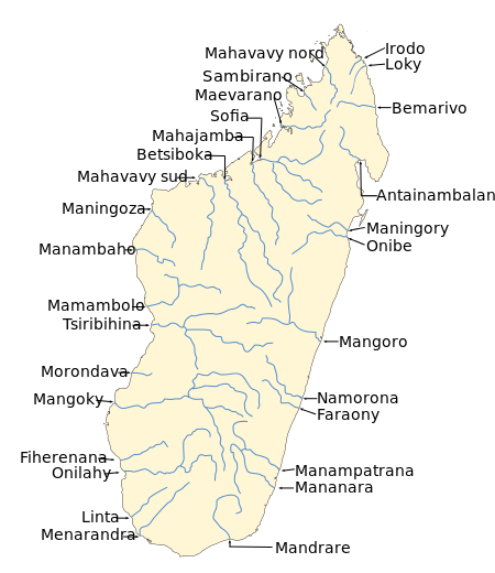 Map of Malagasy rivers (Mahajilo flows from the central highlands to the Tsiribihina River). | |
Mahajilo is a river in Menabe, western Madagascar. It flows down from the central highlands, to flow into the Tsiribihina River.
Rafting trips are purposed by several operators on this river from Miandrivazo.
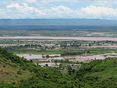
Mahajilo River at Miandrivazo
References
This article is issued from
Wikipedia.
The text is licensed under Creative Commons - Attribution - Sharealike.
Additional terms may apply for the media files.