Mangalpur, Nepal
| Mangalpur मंगलपुर | |
|---|---|
| Village Development Committee | |
 Mangalpur Location in Nepal | |
| Coordinates: 27°40′N 84°21′E / 27.67°N 84.35°ECoordinates: 27°40′N 84°21′E / 27.67°N 84.35°E | |
| Country |
|
| Zone | Narayani Zone |
| District | Chitwan District |
| Population (1991) | |
| • Total | 12,969 |
| Time zone | UTC+5:45 (Nepal Time) |
Mangalpur is a Village Development Committee in Chitwan District in the Narayani Zone of southern Nepal. At the time of the 1991 Nepal census it had a population of 12,969 people residing in 2580 individual households.[1]
Location
It lies 7 km west from the headquarters of the district. Narayani River flows on its northern part.
References
- ↑ "Nepal Census 2001". Nepal's Village Development Committees. Digital Himalaya. Archived from the original on October 12, 2008. Retrieved December 14, 2008.
Headquarters: Bharatpur | ||
| Metropolitan city | 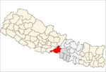 | |
| Municipalities | ||
| Rural municipality |
| |
| Former VDCs | ||
This article is issued from
Wikipedia.
The text is licensed under Creative Commons - Attribution - Sharealike.
Additional terms may apply for the media files.