Bharatpur, Nepal
| Bharatpur भरतपुर महानगरपालिका | |
|---|---|
| Metropolitan City | |
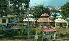
 Bharatpur city view from Maula Kalika temple Gaindakot | |
 Bharatpur Location in Nepal | |
| Coordinates: 27°41′N 84°26′E / 27.683°N 84.433°E | |
| Country |
|
| Province | Province No. 3 |
| District | Chitwan District |
| Government | |
| • Mayor | Renu Dahal (NCP) |
| • Deputy Mayor | Parbati Shah (NC) |
| • Chief Administrative Officer | Netra Prasad Subedi |
| Area | |
| • Total | 433 km2 (167 sq mi) |
| Elevation | 208 m (682 ft) |
| Population (2015)census | |
| • Total | 280,502 |
| • Density | 650/km2 (1,700/sq mi) |
| Time zone | UTC+5:45 (NST) |
| Postal code | 44200, 44207 (Narayangarh) |
| Area code(s) | 056 |
| Climate | Cwa |
| Website |
www |
Bharatpur (Nepali: भरतपुर) is a city in central-southern Nepal and, with a population of 280,502, it's the fourth largest city in Nepal. Bharatpur is the district headquarters of the Chitwan District[1], as well as a separate metropolitan authority.
Bharatpur is one of the fastest-growing cities in Nepal. It lies on the left bank of the Narayani River and serves as a commercial center of the Chitwan district and the central region of Nepal. Most of the shopping area lies in the city of Narayangadh, while government offices, big hospitals and colleges are situated in other parts of the city, including Nepal's premier cancer hospital, B.P Koirala Memorial Cancer Hospital.
Bharatpur has been declared a sub-metropolitan city on December 2, 2014, by the Government with the inclusion of the Village development committees Phulbari, Gitanagar, Shivanagar, Mangalpur and Patihani.[2]
In 2016, Bharatpur was declared a metropolitan city, after Narayani Municipality, Chitraban Municipality and Kabilas Village were merged into Bharatpur.[3]
Economy
The economy of Bharatpur is traditionally based on agriculture. Agricultural land is gradually converted into residential and industrial areas. The main industries of Bharatpur are small-scale processing industries. A large number of poultry industries have developed in the municipality. It is believed that it produces more than 60% of poultry for the whole country. Moreover, this metropolitan city has a substantial volume of poultry products for export trade. Other products of the city include honey, mushrooms, and floriculture, and a significant part of the economic base derives from the service industry (education and health). Chitwan is regarded as a food surplus district, which is processed in Bharatpur and sold to major cities of Nepal including Kathmandu and Pokhara. Bharatpur has also a large Poultry industry, a survey found that almost 50 percent of people in Chitwan District are involved in the poultry business.[4]
Tourist attractions
Bishazari Tal
Bishazari Tal (20 Thousand Lakes) is in the southern corner of Bharatpur. The lake serves as an important bird watching centre and houses lots of crocodiles. The lake lies near Chitwan National Park. Bishazari Tal lies just 5 km (3.1 mi) south of the city centre (Chaubiskothi) of Bharatpur. Pandeyghumti is the nearest chok (square) from the lake, being only 1 km (0.62 mi).
Chitwan National Park
Nearby Chitwan National Park is home to one-horned rhinos, elephants, royal Bengal tigers, crocodiles, deers, and many other wild animals. It is the third largest tourist destination in Nepal after Kathmandu and Pokhara.Hotels of Bharatpur, Nepal and around Bharatpur. It has also been listed in the UNESCO World Heritage List since 1983.
Hotels
There are many large and medium-sized hotels and lodges near and inside the Chitwan National Park. Some of them are Jagatpur Lodge - Chitwan National Park 5-star, Meghauli Serai, A Taj Safari Lodge, Meghauli, 5-star, Barahi Jungle Lodge, Meghauli 5-star, Bharatpur Garden Resort, Bharatpur 3.5-star, Central Palms Hotel 3.5-star, Hotel Royal Century, Bharatpur 3-star, Jungle Villa Resort 3-star, Naryani Safari, Chitwan Key Men, Jungle Resort, Jungle Safari and Tiger Top Tesort, Wild Life Camp, etc. Chitwan National Park is also listed as a World Heritage Site.[5]
Narayani River
The Narayani River flows north to south in the west of Bharatpur. It is the deepest and also one of the biggest rivers of Nepal. The Narayani Bridge over the river connects Chitwan District with Nawalpur District of Nepal. Small islands, like Nagarban in Narayani river, are popular picnic spots.
Rapti River
Rapti River flows east to south-west in the south of Bharatpur and makes the northern border of the Chitwan National Park.
Religious and cultural landmarks
- Devghat: Devghat is one of the holiest places for Hindus and is located in ward no. 1, on the banks of Narayani and Kali River Junction. Various caves and temples of Hindu gods and goddesses are located here. Devghat also holds a significant natural attraction because of the two main holy rivers. It is just 7 km (4.3 mi) from the city centre of Bharatpur.
- Tinkhole Monastery is an antique piece of art which makes Bharatpur a land of diverse tribes. This Lamasery was made by Buddhists as a symbol of piece and the interior design of this monastery reminds their meaning of life.
- Ganeshthan Temple (Baseni) is the most famous Hindu temple in Bharatpur and has a very long history. This temple is believed to be constructed by Muni Makunda Sen, King of Palpa in the 15th century, but the modern temple was constructed in 1952 in the period of King Mahendra. This temple is located in Baseni, ward no. 11. Every Tuesday people from different parts of the city visit this temple to worship Ganesha.
- Bageshwari Temple: Another ancient temple, located in ward no. 2, is believed to be built before Muni Makunda Sen and was renovated by yogi Narahari Nath. It is located in the Devghat area development district, but the area of Bageshwari temple is also being used by Bharatpur Medical College.
- Harihar Temple (Narayangadh): Harihar is another name of the Hindu deity Vishnu. This temple is on the banks of Narayani river.
- Mahakaleshwar Shiva Mandir (Bharatpur -10): This temple is the only temple of Shiva around this locality. This temple is made with many antiques. Along with the building itself, the temple altogether has 108 lingam, Havan Kunda, Hanuman statues, Satsang halls, Ganesha temples. Gauri Kund can also be seen in the temple periphery.
- Kalika Temple: Kalika is one of the most important Hindu goddess, this temple being in Bharatpur heights. This temple is relatively more recent than the others, being built around 1992.
- Jakhadi Mai Temple (Baseni): This temple is on the eastern corner of the Jungle in ward no. 11 and was constructed in 1982 by the locals.
 Durga Temple situated in Bharatpur 11 Baseni of Chitwan district
 - Durga Temple (Baseni): Durga Temple was built by the police force within the compound of Police Academy, Bharatpur in 1992.
- Pashupatinath Temple (Mahendra Buspark) Bharatpur: This new temple is on the banks of the Narayani river with scenic views of Narayani and the northern Jungle of Devghat Region. This temple has all the facilities for wedding ceremonies and other religious purposes.
- Rameshwar Temple (Kchetrapur): This Mahadev temple was built in 1994, is the busiest temple in the city and also serves people through a health post and
- Children Fun Park: Located on the Torikhet village, there is a swimming pool in this pokhari it is called children fun park kamalpokhari, 1 km (0.62 mi) away from Madi highway.
Forts and palaces
- Upardanghari Fort: Located in the old headquarters of Chitwan district, it is believed to be made by Satrubhanjan Shah, son of Prince Bahadur Shah to defend newly founded Kingdom in the 17th century. It is located on the top of a hill and overlooks natural scenery.
- Kasrra Durbar (Palace) is an old palace made by Rana Regime inside the Chitwan National Park. Now, it is being used as an office of the National Park and also hosts a museum.
- Diyalo Bangala Palace (Aptari Bharatpur): This was the spring season palace used by the Shaha Dynasty of Nepal. This palace was built by late King Mahendra to rest during the winter season. It is located on the banks of Narayani river in ward no. 2.
- DAO Building Bharatpur: This long and attractive old building was built in the period of shifting the headquarters from Upardanghadhi. Now used as an office of chief district officer.
- Bharatpur Covered hall: Hall in the guesthouse of Bharatpur for indoor games.
Education
Bharatpur's Chitwan Higher Secondary School is the oldest government school in Chitwan District[6] There are furthermore several colleges in Bharatpur, including the College of Medical Sciences, Bharatpur and Chitwan Medical College. The city's most famous institution is the Agriculture and Forestry University, which was established in 2010 and is the first technical university in Nepal.[7]
Healthcare
Compared to other parts of the country, Bharatpur has a highly developed healthcare systems with several famous hospitals including the second largest Government Hospital in Nepal (after Bir Hospital in Kathmandu) that was established by American aid during the malaria controlling program operated by the US government on the request of late King Mahendra of Nepal. B.P. Koirala Memorial Cancer Hospital was established with the help of the Government of China in 1994. With all cancer treatment facilities, this is the meager cancer treatment institution in the country.[8] Two Medical Colleges, College of Medical Sciences and Chitwan Medical College also maintain own teaching hospitals[9][10] Other important hospitals and nursing homes are Niko Children's Hospital, Narayani Community Hospital and Bharatpur Eye Hospital.
Transportation
_2.jpg)
Bharatpur is located at the crossing of Mahendra Highway and Madan Ashrit Highway. The closest bigger cities are Gorkha Municipality at 67 km, 42 mi and Hetauda at 78 km, 48 mi. Kathmandu is located 146 km, 91 mi away.
Bharatpur is the only city in Nepal that has two operating airports. Bharatpur Airport in the central part of the city offeres daily to Kathmandu and to Pokhara. Meghauli Airport is a smaller airstrip in the south west of the city but is located closer to Chitwan National Park.
Public transportation consists of privately run bus or microbus services. There are also frequent bus services to Kathmandu and Birgunj.
Media
Eight major local FM radio stations broadcast from Bharatpur. They are Amrit FM, Synergy FM, Hamro FM, Radio Triveni, Radio Chitwan,Chitwan Online FM. Kalika music FM, and Kalika FM. The television stations Beso Channel, Avass TV, and Crystal TV also broadcast from Bharatpur.
Narayangadh
| Narayangadh नारायणगढ | |
|---|---|
| subdivision of Bharatpur | |
|
Narayangadh Location in Nepal | |
| Coordinates: 27°44′N 84°23′E / 27.73°N 84.39°E | |
| Country |
|
| Zone | Narayani Zone |
| District | Chitwan District |
| Area | |
| • Total | 554.0 km2 (213.9 sq mi) |
| Population (1991) | |
| • Total | 202,874 |
| • Density | 370/km2 (950/sq mi) |
| Time zone | UTC+5:45 (Nepal Time) |
Narayangadh (Nepali: नारायणगढ) or Narayanghat (Nepali: नारायणघाट)) is an important trading centre in the centre of the city. The major neighborhoods of Narayangadh are Shahid Chok, Pulchok, Kshetrapur, Belchok and Milanchok. Narayangadh is very famous for "Taas", a spicy fried goat-meat lunch dish served with Bhuja or Cheura. Narayangadh has extremely hot summers but very mild winters.
References
- ↑ "Welcome to Bharatpur Metropolitan City | Bharatpur Metropolitan City". bharatpurmun.gov.np. Retrieved 2018-07-20.
- ↑ Municipal Association of Nepal (MuAN)
- ↑ "Mayoral candidates vow to make Bharatpur prosperous". The Himalayan Times. 9 May 2017. Retrieved 1 September 2018.
- ↑ "Healthy Profits in the Poultry Hub – CHITWAN REPORT". Business 360. Retrieved 1 September 2018.
- ↑ https://www.hotels.com/de10404073/hotels-chitwan-district-nepal/?locale=en_MY&rffrid=sem.hcom.AS.google.003.00.04.s.kwrd=c.256929194776.52289992696.1057901913.1t1.dsa-318789544306.1011034..0.CjwKCAjw4PHZBRA-EiwAAas4ZluRDwmxIb4Xoj3VkicgB4TQnEJxV9kCKgav2LjovOUVABOKCte0hRoCV08QAvD_BwE.aw.ds&PSRC=AFF05&gclid=CjwKCAjw4PHZBRA-EiwAAas4ZluRDwmxIb4Xoj3VkicgB4TQnEJxV9kCKgav2LjovOUVABOKCte0hRoCV08QAvD_BwE&gclsrc=aw.ds
- ↑ "Beni- A Souvenir of Chitwan Higher Secondary School".
- ↑ "About Us". Agriculture and Forestry University. Retrieved 1 September 2018.
- ↑ Koirala Memorial Cancer Hospital website
- ↑ http://www.cmsnepal.edu.np/pages/aboutinst.htm
- ↑ Chitwan Medical College website
| Authority control |
|---|