Jutpani
| Jutpani जुटपानी | |
|---|---|
| Village development committee | |
 Jutpani Location in Nepal | |
| Coordinates: 27°42′N 84°31′E / 27.70°N 84.52°ECoordinates: 27°42′N 84°31′E / 27.70°N 84.52°E | |
| Country |
|
| Zone | Narayani Zone |
| District | Chitwan District |
| Population (1991) | |
| • Total | 8,762 |
| Time zone | UTC+5:45 (Nepal Time) |
Jutpani is a village development committee in Chitwan District in the Narayani Zone of southern Nepal. At the time of the 1991 Nepal census it had a population of 8762 people living in 1714 individual households.[1]
Geography
- East: Pithuwa VDC and Shaktikhor VDC
- West: Bharatpur Municipality
- North: Padampur VDC
- South: Ratnanagar Municipality
Education
- PRIVATE SCHOOLs
- New Sagarmatha Secondary School, Jutpani-3 (Jutpani Bazzar)
- Moon Light Boarding School, Jutpani-1(Shanti Chowk)
- Siddhi Vinayak Boarding School Jutpani-1 (Kholesimal Bazzar)
- Janapriya Lower Secondary School, Jutpani-4
- PUBLIC SCHOOLs
- Prithivi Higher Secondary School Jutpani-4
- Jamunapur Ka Lower Secondary School, Jutpani-5
- Sivalaya Primary School, Jutpani-4
- Redcross Primary School, Jutpani-4
- Rastriya Primary School, Jutpani-3 (Jutpani Bazzar)
Major places
- Gaidakhola Tole
- Jutpani Bazzar
- Kholesimal Bazzar
- Kalika Temple
- Shanti Nikunja
- Sivalaya Temple, Gurauchour
- Jamunapur
- Bhateni/Prithivi Chowk
References
- ↑ "Nepal Census 2001". Nepal's Village Development Committees. Digital Himalaya. Archived from the original on October 12, 2008. Retrieved 12 December 2008.
Headquarters: Bharatpur | ||
| Metropolitan city | 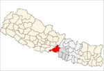 | |
| Municipalities | ||
| Rural municipality |
| |
| Former VDCs | ||
This article is issued from
Wikipedia.
The text is licensed under Creative Commons - Attribution - Sharealike.
Additional terms may apply for the media files.