Malapatan, Sarangani
| Malapatan | |
|---|---|
| Municipality | |
| Municipality of Malapatan | |
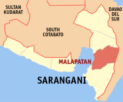 Map of Sarangani with Malapatan highlighted | |
.svg.png) Malapatan Location within the Philippines | |
| Coordinates: 5°58′N 125°17′E / 5.97°N 125.28°ECoordinates: 5°58′N 125°17′E / 5.97°N 125.28°E | |
| Country |
|
| Region | Soccsksargen (Region XII) |
| Province | Sarangani |
| District | Lone district |
| Barangays | 12 (see Barangays) |
| Government [1] | |
| • Type | Sangguniang Bayan |
| • Mayor | Alfonso M. Singcoy Sr. |
| • Electorate | 35,286 voters (2016) |
| Area [2] | |
| • Total | 609.28 km2 (235.24 sq mi) |
| Population (2015 census)[3] | |
| • Total | 76,914 |
| • Density | 130/km2 (330/sq mi) |
| Time zone | UTC+8 (PST) |
| ZIP code | 9516 |
| PSGC | 128006000 |
| IDD : area code | +63 (0)83 |
| Climate type | Tropical rainforest climate |
| Income class | 1st municipal income class |
| Revenue (₱) | 204,110,936.22 (2016) |
| Native languages |
Cebuano Tboli Maguindanao language Blaan language Tagalog |
| Website |
www |
Malapatan, officially the Municipality of Malapatan, is a 1st class municipality in the province of Sarangani, Philippines. According to the 2015 census, it has a population of 76,914 people.[3]
Malapatan is bounded on the west by Sarangani Bay, on the east by Davao Occidental, on the north by Alabel, and on the south by Glan.
Barangays
Malapatan is politically subdivided into 12 barangays.
- Daan Suyan
- Kihan
- Kinam
- Libi
- Lun Masla
- Lun Padidu
- Patag
- Poblacion (Malapatan)
- Sapu Masla
- Sapu Padidu
- Tuyan
- Upper Suyan
Demographics
| Population census of Malapatan | ||
|---|---|---|
| Year | Pop. | ±% p.a. |
| 1990 | 36,255 | — |
| 1995 | 47,911 | +5.36% |
| 2000 | 53,876 | +2.55% |
| 2007 | 65,605 | +2.75% |
| 2010 | 72,386 | +3.64% |
| 2015 | 76,914 | +1.16% |
| Source: Philippine Statistics Authority[3][4][5][6] | ||
Inhabited by Christians, Muslims as well the indigenous people of Sarangani. Malapatan is a great illustration of how different religious beliefs can harmoniously co-exist. It is also the home of the famous Blaan "dreamweavers" who craft sleeping mats using the designs they have dreamt about.
Economy
The economy of Malapatan is largely based on agriculture with a high level production of copra (dried coconut meat). Animal husbandry is the second biggest income earner, notably cattle farming. Other agricultural products are coconuts, maize, sugarcane, bananas, pineapples, mangoes, eggs, beef, fish.
The economy has accelerated in the past decade driven by advances in global communication technology and the finishing of a modern highway that tremendously improved trade and transport.
References
- ↑ "Municipality". Quezon City, Philippines: Department of the Interior and Local Government. Retrieved 31 May 2013.
- ↑ "Province: Sarangani". PSGC Interactive. Quezon City, Philippines: Philippine Statistics Authority. Retrieved 12 November 2016.
- 1 2 3 Census of Population (2015). "Region XII (Soccsksargen)". Total Population by Province, City, Municipality and Barangay. PSA. Retrieved 20 June 2016.
- ↑ Census of Population and Housing (2010). "Region XII (Soccsksargen)". Total Population by Province, City, Municipality and Barangay. NSO. Retrieved 29 June 2016.
- ↑ Censuses of Population (1903–2007). "Region XII (Soccsksargen)". Table 1. Population Enumerated in Various Censuses by Province/Highly Urbanized City: 1903 to 2007. NSO.
- ↑ "Province of Sarangani". Municipality Population Data. Local Water Utilities Administration Research Division. Retrieved 17 December 2016.
External links
- Malapatan Municipal Profile at the Province of Sarangani Official Website
- Philippine Standard Geographic Code
- Philippine Census Information
- Local Governance Performance Management System
Places adjacent to Malapatan, Sarangani | |
|---|---|