Möckernbrücke (Berlin U-Bahn)
Möckernbrücke | |||||||||||||||||||||
|---|---|---|---|---|---|---|---|---|---|---|---|---|---|---|---|---|---|---|---|---|---|
.jpg) | |||||||||||||||||||||
| Location |
Möckernbrücke Kreuzberg | ||||||||||||||||||||
| Owned by | Berliner Verkehrsbetriebe | ||||||||||||||||||||
| Operated by | Berliner Verkehrsbetriebe | ||||||||||||||||||||
| Platforms |
1 island platform (U7) 2 side platforms (U1/3) | ||||||||||||||||||||
| Tracks | 4 | ||||||||||||||||||||
| Train operators | Berliner Verkehrsbetriebe | ||||||||||||||||||||
| Connections |
| ||||||||||||||||||||
| Other information | |||||||||||||||||||||
| Fare zone | Berlin A | ||||||||||||||||||||
| History | |||||||||||||||||||||
| Opened | 18 February 1902 | ||||||||||||||||||||
| Services | |||||||||||||||||||||
| |||||||||||||||||||||
| Location | |||||||||||||||||||||
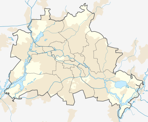 Möckernbrücke Location within Berlin | |||||||||||||||||||||
Möckernbrücke is a station of the Berlin U-Bahn network in the western Kreuzberg district, named after a nearby bridge crossing the Landwehrkanal. It is on the U 1/U 3 and on U 7 lines, in the vicinity of Potsdamer Platz.
Overview

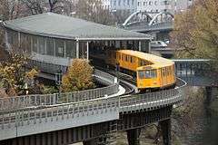
The station located on a viaduct at the northern shore of the Landwehrkanal is part of the first Stammstrecke route of the Berlin U-Bahn opened on 15 February 1902. As the station also served the nearby Anhalter Bahnhof the original building was soon getting too small to cope with the rising number of passengers. It therefore was demolished and replaced by the current station opened on 25 March 1937. Severely damaged by air raids it was closed on 30 January 1944 and not reopened until 16 June 1947.
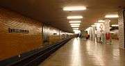
In the course of the extension of the U7 line from Mehringdamm to the west a twin underground station was built at the southern shore of the Landwehrkanal. The U7 platform opened on 28 February 1966 (architect Rümmler) [1] Möckernbrücke became the line's western terminus until the second continuation to Fehrbelliner Platz on 29 January 1971. The U1/U3 and U7 platforms are connected by a glazed bridge over the Landwehr Canal.
U 1U 3: The next station is Hallesches Tor (change here for U6) or Gleisdreieck (change here for U2);
U 7: The next station is Yorckstraße (change here for S-Bahn) or Mehringdamm (change here for U6).

References
- ↑ J. Meyer-Kronthaler, Berlins U-Bahnhöfe, Berlin: be.bra, 1996
External links
Coordinates: 52°29′57″N 13°22′58″E / 52.49917°N 13.38278°E