Schwartzkopffstraße (Berlin U-Bahn)
Schwartzkopffstraße | |||||||||||
|---|---|---|---|---|---|---|---|---|---|---|---|
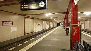 Platform view of Schwartzkopffstraße | |||||||||||
| Location | Mitte | ||||||||||
| Owned by | Berliner Verkehrsbetriebe | ||||||||||
| Operated by | Berliner Verkehrsbetriebe | ||||||||||
| Platforms | 1 island platform | ||||||||||
| Tracks | 2 | ||||||||||
| Train operators | Berliner Verkehrsbetriebe | ||||||||||
| Other information | |||||||||||
| Fare zone | Berlin A | ||||||||||
| History | |||||||||||
| Opened | 8 March 1923 | ||||||||||
| Services | |||||||||||
| |||||||||||
| Location | |||||||||||
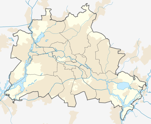 Schwartzkopffstraße Location within Berlin | |||||||||||
Schwartzkopffstraße is a Berlin U-Bahn station located on the U 6.
History
The station was built in 1923 by Grenander/Fehse/Jennen. Due to massive financial problems, the station was built in a very simple way, without any artwork: the walls are covered only in plaster, and many columns are left as exposed, painted steel. In 1951 the station was renamed "Walter-Ulbricht-Stadion" after the stadium nearby.
In 1961 the station was closed due to the building of the Berlin Wall, rendering it a so-called "ghost station"; trains then passed through the station without stopping. In 1973, despite having been closed for over 11 years, the station was renamed "Stadion der Weltjugend" to reflect the change in name of the stadium. This change was visible only to East German guards patrolling the platform, and West Berliners passing through the closed station, as ghost stations were not printed on East German city maps. It was secured with utmost care; the station entrances were walled and equipped with observation points, and a locked access door. Rolls of barbed wire were installed to prevent people from crawling onto the tracks. All these measures were removed by 30 June 1990, and the station was reopened on 1 July 1990.
As a result of the demolition of the stadium, the station's name was changed back to Schwartzkopffstraße on 3 October 1991.
In 1995 the platform was lengthened to allow trains with six cars. Currently, all the U6 trains stop at this station.[1]
References
- ↑ J. Meyer-Kronthaler: Berlins U-Bahnhöfe. be.bra Verlag (1996)