Loir
| Loir | |
|---|---|
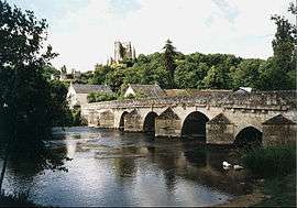 The Loir in Lavardin | |
| Native name | Le Loir |
| Country | France |
| Physical characteristics | |
| Main source |
Perche 150 m (490 ft) |
| River mouth |
Sarthe 47°33′27″N 0°31′35″W / 47.55750°N 0.52639°WCoordinates: 47°33′27″N 0°31′35″W / 47.55750°N 0.52639°W |
| Length | 317 km (197 mi) |
| Discharge |
|
| Basin features | |
| Progression | Sarthe→ Maine→ Loire→ Atlantic Ocean |
| Basin size | 8,270 km2 (3,190 sq mi) |
The Loir is a 317 km (197 mi) long river in western France.[1] It is a left tributary of the Sarthe. Its source is in the Eure-et-Loir department, north of Illiers-Combray. It joins the river Sarthe in Briollay, north of the city of Angers.
It is indirectly a tributary of the Loire, and runs roughly parallel to it and slightly north of it for much of its length, and so might be regarded as a Yazoo type river.
Departments and towns crossed include
Tributaries include
References
| Wikimedia Commons has media related to Loir. |
This article is issued from
Wikipedia.
The text is licensed under Creative Commons - Attribution - Sharealike.
Additional terms may apply for the media files.