Salt Creek Township, Pickaway County, Ohio
| Salt Creek Township, Pickaway County, Ohio | |
|---|---|
| Township | |
 A field in Salt Creek Township | |
 Location of Salt Creek Township in Pickaway County | |
| Coordinates: 39°31′15″N 82°46′52″W / 39.52083°N 82.78111°WCoordinates: 39°31′15″N 82°46′52″W / 39.52083°N 82.78111°W | |
| Country | United States |
| State | Ohio |
| County | Pickaway |
| Area | |
| • Total | 35.9 sq mi (93.0 km2) |
| • Land | 35.9 sq mi (93.0 km2) |
| • Water | 0.0 sq mi (0.0 km2) |
| Elevation[1] | 840 ft (256 m) |
| Population (2000) | |
| • Total | 2,655 |
| • Density | 73.9/sq mi (28.5/km2) |
| Time zone | UTC-5 (Eastern (EST)) |
| • Summer (DST) | UTC-4 (EDT) |
| FIPS code | 39-70184[2] |
| GNIS feature ID | 1086802[1] |
Salt Creek Township is one of the fifteen townships of Pickaway County, Ohio, United States. The 2000 census found 2,655 people in the township, 2,357 of whom lived in the unincorporated portions of the township.[3]
Geography
Located in the southeastern corner of the county, it borders the following townships:
- Clearcreek Township, Fairfield County - north
- Perry Township, Hocking County - east
- Salt Creek Township, Hocking County - southeast corner
- Colerain Township, Ross County - south
- Green Township, Ross County - southwest corner
- Pickaway Township - west
- Washington Township - northwest corner
The farthest east township in Pickaway County, it is the only county township to border Hocking County.
The village of Tarlton is located in northern Salt Creek Township.
Name and history
It is one of five Salt Creek Townships statewide.[4]
Government
The township is governed by a three-member board of trustees, who are elected in November of odd-numbered years to a four-year term beginning on the following January 1. Two are elected in the year after the presidential election and one is elected in the year before it. There is also an elected township fiscal officer,[5] who serves a four-year term beginning on April 1 of the year after the election, which is held in November of the year before the presidential election. Vacancies in the fiscal officership or on the board of trustees are filled by the remaining trustees.
References
- 1 2 "US Board on Geographic Names". United States Geological Survey. 2007-10-25. Retrieved 2008-01-31.
- ↑ "American FactFinder". United States Census Bureau. Retrieved 2008-01-31.
- ↑ Pickaway County, Ohio — Population by Places Estimates Ohio State University, 2007. Accessed 15 May 2007.
- ↑ "Detailed map of Ohio" (PDF). United States Census Bureau. 2000. Retrieved 2007-02-16.
- ↑ §503.24, §505.01, and §507.01 of the Ohio Revised Code. Accessed 4/30/2009.
External links
Municipalities and communities of Pickaway County, Ohio, United States | ||
|---|---|---|
| City | 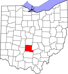 | |
| Villages | ||
| Townships | ||
| CDPs | ||
| Unincorporated communities | ||
| Ghost town | ||
| Footnotes | ‡This populated place also has portions in an adjacent county or counties | |