Little Sugar Loaf
| Little Sugar Loaf | |
|---|---|
| Giolspar | |
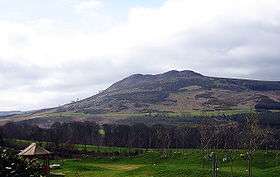 Little Sugar Loaf, from the east | |
| Highest point | |
| Elevation | 342 m (1,122 ft) [1] |
| Prominence | 247 m (810 ft) [1] |
| Listing | Marilyn |
| Coordinates | 53°10′8″N 6°7′12″W / 53.16889°N 6.12000°W |
| Geography | |
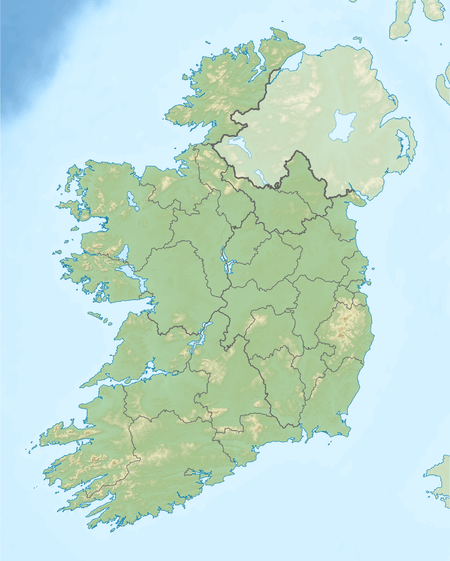 Little Sugar Loaf Ireland | |
| Location | Wicklow, Ireland |
| Parent range | Wicklow Mountains |
| OSI/OSNI grid | O260144 |
| Topo map | OSi Discovery 56 |
Little Sugar Loaf, also called Giltspur Mountain[1] (Irish: Giolspar, earlier name Beannach Bheag), is a hill in County Wicklow, Ireland.
Geography
The mountain is situated East-North-East of the Great Sugar Loaf, separated from it by the N11 dual carriageway. The northern side of Little Sugar Loaf directly overlooks the town of Bray; the eastern side (see photo) looks across the R761 between Bray and Greystones to the western slope of Bray Head.
It is readily identifiable by its distinctive rocky double summit which contrasts with the hilltops in the area which, apart from Bray Head, are very regular in appearance. It is the 913th highest summit in Ireland.
References
- 1 2 3 "Dublin/Wicklow Area - Little Sugar Loaf". MountainViews. Ordnance Survey Ireland. Retrieved July 4, 2015.
See also
![]()
This article is issued from
Wikipedia.
The text is licensed under Creative Commons - Attribution - Sharealike.
Additional terms may apply for the media files.