List of historic places in Southwestern Ontario
This is a list of historic places in Southwestern Ontario, containing heritage sites listed on the Canadian Register of Historic Places (CRHP), all of which are designated as historic places either locally, provincially, territorially, nationally, or by more than one level of government.
The following subregions have separate listings:
- County of Brant
- Essex County
- Middlesex County
- Perth County
- Regional Municipality of Waterloo
- Wellington County
List of historic places in other subregions
Bruce County


Chatham-Kent
| Name | Address | Coordinates | IDF | IDP | IDM | Image | |
|---|---|---|---|---|---|---|---|
| Buxton Settlement National Historic Site of Canada | 7th Concession, Dillon and Drake Roads, Chatham-Kent, ON | 42°16′00″N 82°11′00″W / 42.2667°N 82.1833°W | 1206 | 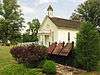 More images | |||
| Canadian National Railways/VIA Rail Station | Queen & William Streets, Chatham-Kent, ON | 42°23′54″N 82°10′44″W / 42.3982°N 82.1788°W | 4584 |  | |||
| Fairfield on the Thames National Historic Site of Canada | , Chatham-Kent, ON | 42°37′55″N 81°52′11″W / 42.632°N 81.8696°W | 15726 |  More images | |||
| Government of Canada Building | 120 Wellington Street, Chatham-Kent, ON | 42°24′16″N 82°11′07″W / 42.4044°N 82.1853°W | 13467 | | |||
| Uncle Tom's Cabin - Harris House | 29251 Uncle Tom's Road, Chatham-Kent, ON | 42°35′06″N 82°11′45″W / 42.585°N 82.1958°W | 8199 | _Grave_Site.jpg) | |||
| Uncle Tom's Cabin - Henson House | 29251 Uncle Tom's Road, Chatham-Kent, ON | 42°35′08″N 82°11′45″W / 42.5856°N 82.1958°W | 8200 | | |||
| Uncle Tom's Cabin - Pioneer Church | 29251 Uncle Tom's Road, Chatham-Kent, ON | 42°35′07″N 82°11′46″W / 42.5854°N 82.196°W | 8198 | |
Elgin County


Grey County
| Name | Address | Coordinates | IDF | IDP | IDM | Image | |
|---|---|---|---|---|---|---|---|
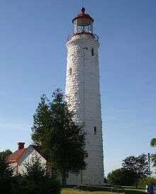
| Tower | Griffith Island, Georgian Bluffs, ON | 44°51′04″N 80°53′24″W / 44.851°N 80.89°W | 3292 |  | |||
| Billy Bishop Boyhood Home National Historic Site of Canada | 948 Third Avenue West, Owen Sound, ON | 44°33′59″N 80°56′54″W / 44.5663°N 80.9484°W | 4028 | 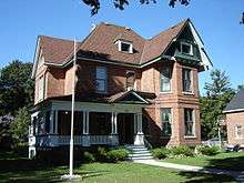 More images | |||
| Canadian Pacific Railway Station | First Avenue East (at 12th St. E.), Owen Sound, ON | 44°34′20″N 80°56′32″W / 44.5722°N 80.9422°W | 4586 | | |||
| Former Owen Sound Bus Terminal | 1023 2nd Avenue East, Owen Sound, ON | 44°34′06″N 80°56′34″W / 44.5682°N 80.9428°W | 15128 | | |||
| Former Reitman's Store | 992 2nd Avenue East, Owen Sound, ON | 44°34′03″N 80°56′36″W / 44.5675°N 80.9434°W | 15129 | |
Haldimand County


Huron County


Lambton County


Norfolk County
| Name | Address | Coordinates | IDF | IDP | IDM | Image | |
|---|---|---|---|---|---|---|---|
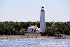
| Lighttower | Tip of Long Point, south of Port Dover, Long POint, ON | 42°32′56″N 80°02′57″W / 42.5488°N 80.0493°W | 11199 | | |||
| Backhouse Grist Mill National Historic Site of Canada | RR 3, Norfolk, ON | 42°37′00″N 80°28′00″W / 42.6167°N 80.4667°W | 7554 | 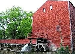 More images | |||
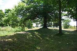
| Cliff Site National Historic Site of Canada | Brant Hill in Port Dover, Norfolk, ON | 42°47′08″N 80°11′46″W / 42.7856°N 80.1961°W | 13398 |  | |||
| Fort Norfolk National Historic Site of Canada | , Norfolk, ON | 42°41′56″N 80°19′31″W / 42.6989°N 80.3252°W | 16785 |  | |||
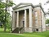
| Lynnwood/Campbell-Reid House National Historic Site of Canada | 21 Lynnwood Avenue, Norfolk, ON | 42°50′16″N 80°18′12″W / 42.8379°N 80.3034°W | 12402 | 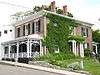 | |||
| Van Norman-Guiler House | 2318 Front Road, Norfolk (Normandale), ON | 42°42′39″N 80°18′45″W / 42.7108°N 80.3125°W | 15347 | | |||
| Lighttower | End of west pier, Port Dover, ON | 42°46′52″N 80°12′06″W / 42.7811°N 80.2017°W | 4739 20710 |
| |||
| Walpole Island Lower A32 Lighthouse | Off Walpole Island in the St. Clair River, Walpole Island, ON | 42°36′42″N 82°31′03″W / 42.6117°N 82.5176°W | 21033 | | |||
| Walpole Island Upper A34 Lighthouse | Off Walpole Island in the St. Clair River opposite Algonac Michigan, Walpole Island, ON | 42°37′20″N 82°30′41″W / 42.6223°N 82.5114°W | 21034 | |
Oxford County
| Name | Address | Coordinates | IDF | IDP | IDM | Image | |
|---|---|---|---|---|---|---|---|
| African Methodist Episcopal Cemetery | Church St (Pick Line), Otterville, Norwich, ON | 42°55′53″N 80°36′30″W / 42.931463°N 80.608332°W | 10775 | 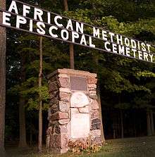 | |||
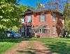
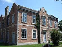
| Annandale House | 30 Tillson Avenue, Tillsonburg, Tillsonburg, ON | 42°51′44″N 80°43′18″W / 42.862284°N 80.721668°W | 4178 | 18001 | 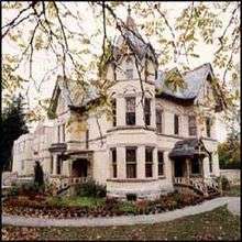 More images | ||
| Curries United Church | 465003 Curries Road, Curries, Norwich, ON | 43°04′17″N 80°43′14″W / 43.071443°N 80.720418°W | 10925 |  | |||
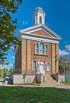
| Knox Presbyterian Church (Norwich) | 67 Main Street West, Norwich, Norwich, ON | 42°59′13″N 80°36′04″W / 42.986948°N 80.601176°W | 11678 | 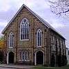 | |||
| Museum School | 656 Main Street North, Burgessville, Norwich, ON | 43°01′39″N 80°39′18″W / 43.027463°N 80.654954°W | 11828 |  | |||
| Norwich Gore United Church | 89 Stover Street North, Norwich, Norwich, ON | 42°59′44″N 80°36′01″W / 42.995429°N 80.6003244°W | 11848 |  | |||
| Norwich United Church and Manse | 80 Main Street West, Norwich, Norwich, ON | 42°59′14″N 80°36′05″W / 42.987211°N 80.601301°W | 11849 | 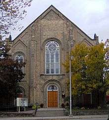 | |||
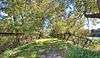
| Otter Creek Bridge | Middletown Line (just west of Otterville), Norwich, ON | 42°53′50″N 80°37′10″W / 42.897193°N 80.619385°W | 11865 |  More images | |||
| Otterville Mill | Main St W, Otterville, Norwich, ON | 42°55′30″N 80°36′22″W / 42.925061°N 80.605988°W | 11864 | 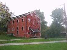 | |||
| Otterville Park | William St, Otterville, Norwich, ON | 42°55′43″N 80°36′11″W / 42.928722°N 80.603032°W | 11866 |  | |||
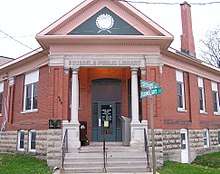
| Otterville Railway Museum | Main Street W, Otterville, Norwich, ON | 42°55′25″N 80°37′11″W / 42.923611°N 80.619742°W | 11867 |  | |||
| Quaker Meeting House (Norwich Museum) | 89 Stover Street North, Norwich, Norwich, ON | 42°59′42″N 80°36′00″W / 42.995066°N 80.600006°W | 11893 |  | |||
| Quaker Street Burying Ground | 8 Quaker Street (just north of Norwich village), Norwich, ON | 43°00′06″N 80°36′24″W / 43.001532°N 80.606562°W | 11894 |  | |||
| Woodlawn Place | Main Street West, Otterville, Norwich, ON | 42°55′25″N 80°37′09″W / 42.923682°N 80.619205°W | 9941 |  | |||
| Old St. Paul's Church (Anglican) | 723 Dundas Street, Woodstock, Woodstock, ON | 43°07′56″N 80°44′47″W / 43.132356°N 80.746321°W | 10544 |  | |||
| Woodstock Railway Station | 94 Victoria Street South, Woodstock, Woodstock, ON | 43°07′35″N 80°45′07″W / 43.12639°N 80.752077°W | 4610 |  More images | |||
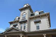
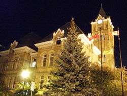
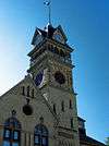
| Old Woodstock Town Hall | 500 Dundas Street, Woodstock, Woodstock, ON | 43°07′46″N 80°45′27″W / 43.1295°N 80.7575°W | 4257 | 8207 | 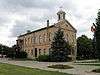 More images |
See also
| Wikimedia Commons has media related to Cultural heritage monuments in Ontario. |
References
This article is issued from
Wikipedia.
The text is licensed under Creative Commons - Attribution - Sharealike.
Additional terms may apply for the media files.