| Name |
Address |
Coordinates |
IDF |
IDP |
IDM |
 |
Image |
|---|
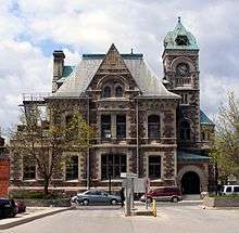
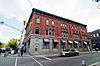
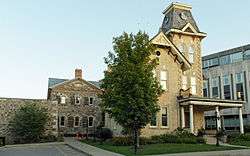
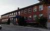
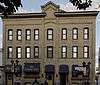
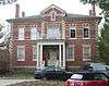
| Armoury |
Ainslie Street South, Cambridge, ON |
43°21′29″N 80°18′49″W / 43.3581°N 80.3137°W / 43.3581; -80.3137 (Armoury) |
4685 |
|
|
|
 |
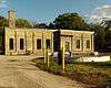
| Black Bridge |
8 Black Bridge Road, Cambridge, ON |
43°26′58″N 80°18′42″W / 43.4495°N 80.3116°W / 43.4495; -80.3116 (Black Bridge) |
|
|
10789 |
|

More images |
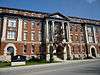
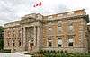
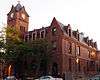
| Cambridge City Hall |
46 Dickson Street, Cambridge, ON |
43°21′36″N 80°18′46″W / 43.3601°N 80.3127°W / 43.3601; -80.3127 (Cambridge City Hall) |
|
7606 |
|
|

More images |
| Cambridge Farmer's Market |
40 Dickson Street, Cambridge, ON |
43°21′36″N 80°18′48″W / 43.3599°N 80.3134°W / 43.3599; -80.3134 (Cambridge Farmer's Market) |
|
|
9766 |
|

More images |
| Cambridge Main Street Bridge |
Main Street, Cambridge, ON |
43°21′32″N 80°19′00″W / 43.3588°N 80.3166°W / 43.3588; -80.3166 (Cambridge Main Street Bridge) |
|
|
10817 |
|
 |
| Canadian Pacific Railway Station |
10 Malcolm Street, Cambridge, ON |
43°22′05″N 80°18′56″W / 43.3680°N 80.3156°W / 43.3680; -80.3156 (Canadian Pacific Railway Station) |
4524 |
|
|
|
|
| Dickson Public School |
65 St. Andrew Street, Cambridge, ON |
43°21′19″N 80°19′15″W / 43.3554°N 80.3207°W / 43.3554; -80.3207 (Dickson Public School) |
|
|
10132 |
|

More images |
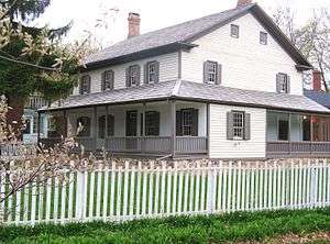
| Duncan Ferguson Homestead |
71 Cowan Boulevard, Cambridge, ON |
43°23′01″N 80°17′39″W / 43.3836°N 80.2943°W / 43.3836; -80.2943 (Duncan Ferguson Homestead) |
|
|
10135 |
|
|
| First Delta Baptist Church |
47 Water Street, Cambridge, ON |
43°21′25″N 80°18′54″W / 43.3569°N 80.315°W / 43.3569; -80.315 (First Delta Baptist Church) |
|
10487 |
11221 |
|

More images |
| Former Galt Post Office National Historic Site of Canada |
12-1/2 Water Street South, Cambridge, ON |
43°21′36″N 80°18′54″W / 43.3601°N 80.3151°W / 43.3601; -80.3151 (Former Galt Post Office National Historic Site of Canada) |
13139 |
|
|
|
More images |
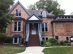
| Ferguson Cottage |
37 Grand Avenue South, Cambridge, ON |
43°21′23″N 80°19′03″W / 43.3565°N 80.3175°W / 43.3565; -80.3175 (Ferguson Cottage) |
|
|
11218 |
|

More images |
| Galt Collegiate Institute |
210 Water Street, Cambridge, ON |
43°22′09″N 80°19′02″W / 43.3691°N 80.3171°W / 43.3691; -80.3171 (Galt Collegiate Institute) |
|
|
10092 |
|
More images |
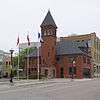
| Galt Fire Department Hall |
56 Dickson Street, Cambridge, ON |
43°21′36″N 80°18′44″W / 43.3599°N 80.3122°W / 43.3599; -80.3122 (Galt Fire Department Hall) |
|
|
10093 |
|
 |
| Galt Public Utilities Commission Building |
62 Dickson Street, Cambridge, ON |
43°21′35″N 80°18′42″W / 43.3598°N 80.3116°W / 43.3598; -80.3116 (Galt Public Utilities Commission Building) |
|
|
10095 |
|

More images |
| Hespeler Town Hall |
11 Tannery Street East, Cambridge, ON |
43°25′51″N 80°18′34″W / 43.4308°N 80.3095°W / 43.4308; -80.3095 (Hespeler Town Hall) |
|
|
11634 |
|
 |
| Landreth Cottage |
84 Water Street South, Cambridge, ON |
43°21′44″N 80°18′55″W / 43.3623°N 80.3152°W / 43.3623; -80.3152 (Landreth Cottage) |
|
|
13719 |
|
|
| Middleton Water Pumping Station |
60 Middleton Street, Cambridge, ON |
43°20′50″N 80°19′06″W / 43.3471°N 80.3183°W / 43.3471; -80.3183 (Middleton Water Pumping Station) |
|
|
13720 |
|

More images |
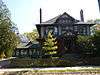
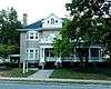
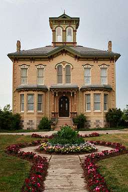
| Morris C. Lutz House |
60 Water Street North, Cambridge, ON |
43°21′41″N 80°18′55″W / 43.3614°N 80.3153°W / 43.3614; -80.3153 (Morris C. Lutz House) |
|
|
9895 |
|
|
| Pioneer Pergola |
St. Andrews Street, Cambridge, ON |
43°21′19″N 80°19′15″W / 43.3554°N 80.3207°W / 43.3554; -80.3207 (Pioneer Pergola) |
|
|
11891 |
|

More images |
| Riverside Park Gates |
King Street E., Cambridge, ON |
43°24′01″N 80°21′59″W / 43.4004°N 80.3663°W / 43.4004; -80.3663 (Riverside Park Gates) |
|
|
15304 |
|
|
| 39 Doon Valley Drive |
39 Doon Valley Drive, Kitchener, ON |
43°23′23″N 80°24′55″W / 43.3896°N 80.4154°W / 43.3896; -80.4154 (39 Doon Valley Drive) |
|
|
10685 |
|

More images |
| 41 Bloomingdale Road |
41 Bloomingdale Road, Kitchener, ON |
43°28′54″N 80°28′33″W / 43.4818°N 80.4759°W / 43.4818; -80.4759 (41 Bloomingdale Road) |
|
|
14882 |
|
|
| 45 King Street West |
45 King Street West, Kitchener, ON |
43°27′N 80°29′W / 43.45°N 80.49°W / 43.45; -80.49 (45 King Street West) |
|
|
15112 |
|
 |
| 150 Water Street South |
150 Water Street South, Kitchener, ON |
43°26′51″N 80°29′53″W / 43.4476°N 80.498°W / 43.4476; -80.498 (150 Water Street South) |
|
|
9990 |
|
More images |
| 883 Doon Village Road |
883 Doon Village Road, Kitchener, ON |
43°23′28″N 80°26′24″W / 43.3912°N 80.4399°W / 43.3912; -80.4399 (883 Doon Village Road) |
|
|
14885 |
|
 |
| 307 Queen Street South |
307 Queen Street South, Kitchener, ON |
43°26′47″N 80°29′33″W / 43.4463°N 80.4926°W / 43.4463; -80.4926 (307 Queen Street South) |
|
|
10684 |
|
 |
| 3734 King Street East |
3734 King Street East, Kitchener, ON |
43°25′15″N 80°24′35″W / 43.4208°N 80.4098°W / 43.4208; -80.4098 (3734 King Street East) |
|
|
14866 |
|
 |
| Betzner Farmstead |
437 Pioneer Tower Road, Kitchener, ON |
43°24′15″N 80°25′11″W / 43.4042°N 80.4196°W / 43.4042; -80.4196 (Betzner Farmstead) |
|
|
9069 |
|
|
| Bridgeport Free Church |
76 Bloomingdale, Kitchener, ON |
43°28′57″N 80°28′25″W / 43.4825°N 80.4735°W / 43.4825; -80.4735 (Bridgeport Free Church) |
|
|
14981 |
|
 |
| Canadian Imperial Bank of Commerce (CIBC) Building |
1 King, Kitchener, ON |
43°26′59″N 80°29′21″W / 43.4496°N 80.4891°W / 43.4496; -80.4891 (Canadian Imperial Bank of Commerce (CIBC) Building) |
|
|
14965 |
|
 |
| David Weber House |
69 Biehn, Kitchener, ON |
43°23′44″N 80°27′19″W / 43.3955°N 80.4554°W / 43.3955; -80.4554 (David Weber House) |
|
|
15109 |
|

More images |
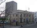
| Federal Building |
15 Duke Street, Kitchener, ON |
43°27′02″N 80°29′16″W / 43.4506°N 80.4877°W / 43.4506; -80.4877 (Federal Building) |
4804 |
|
|
|
|
| Former Canadian National Railways (VIA Rail) Station |
126 Weber Street, Kitchener, ON |
43°27′22″N 80°29′35″W / 43.456°N 80.493°W / 43.456; -80.493 (Former Canadian National Railways (VIA Rail) Station) |
4571 |
|
|
|

More images |
| Freeport Bridge |
King Street, Kitchener, ON |
43°25′23″N 80°24′40″W / 43.4231°N 80.411°W / 43.4231; -80.411 (Freeport Bridge) |
|
|
8068 |
|

More images |
| Government of Canada Building |
166 Frederick Street, Kitchener, ON |
43°27′10″N 80°29′01″W / 43.4527°N 80.4836°W / 43.4527; -80.4836 (Government of Canada Building) |
4268 |
|
|
|
|
| Haalboom Home |
1165 Doon Village Road, Kitchener, ON |
43°23′20″N 80°25′47″W / 43.3888°N 80.4298°W / 43.3888; -80.4298 (Haalboom Home) |
|
|
9217 |
|

More images |
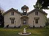
| Haas-Pemberton House |
45 Young Street West, Kitchener, ON |
43°26′51″N 80°29′53″W / 43.4476°N 80.498°W / 43.4476; -80.498 (Haas-Pemberton House) |
|
|
11023 |
|
|
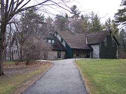
| Homer Watson House / Doon School of Fine Arts National Historic Site of Canada |
1754 Old Mill Road, Kitchener, ON |
43°23′38″N 80°25′02″W / 43.394°N 80.4171°W / 43.394; -80.4171 (Homer Watson House / Doon School of Fine Arts National Historic Site of Canada) |
1143 |
10497 |
10969 |
|
More images |
| Joseph Schneider Haus National Historic Site of Canada |
466 Queen Street South, Kitchener, ON |
43°26′41″N 80°29′41″W / 43.4446°N 80.4947°W / 43.4446; -80.4947 (Joseph Schneider Haus National Historic Site of Canada) |
1145 |
|
|
|
More images |
| Kaufman Rubber Company Ltd. |
410 King Street West, Kitchener, ON |
43°27′09″N 80°29′48″W / 43.4525°N 80.4966°W / 43.4525; -80.4966 (Kaufman Rubber Company Ltd.) |
|
|
15469 |
|
 |
| Public Utilities Commission Building |
191 King Street West, Kitchener, ON |
43°27′04″N 80°29′34″W / 43.451°N 80.4928°W / 43.451; -80.4928 (Public Utilities Commission Building) |
|
|
15474 |
|
 |
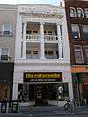
| Registry Theatre |
122 Frederick Street, Kitchener, ON |
43°27′05″N 80°29′10″W / 43.4515°N 80.4861°W / 43.4515; -80.4861 (Registry Theatre) |
|
|
12427 |
|
 |
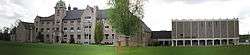
| St. Jerome's College/High School |
120 Duke Street West, Kitchener, ON |
43°27′08″N 80°29′31″W / 43.4523°N 80.492°W / 43.4523; -80.492 (St. Jerome's College/High School) |
|
|
15472 |
|
 |
| Schoerg Homestead |
381 Pioneer Tower Road, Kitchener, ON |
43°24′22″N 80°24′33″W / 43.4061°N 80.4092°W / 43.4061; -80.4092 (Schoerg Homestead) |
|
|
9898 |
|
|
| Shoemaker House |
38 Shirk, Kitchener, ON |
43°28′54″N 80°29′09″W / 43.4818°N 80.4859°W / 43.4818; -80.4859 (Shoemaker House) |
|
|
14964 |
|
|
| Simpson Block |
117 King, Kitchener, ON |
43°27′02″N 80°29′29″W / 43.4505°N 80.4914°W / 43.4505; -80.4914 (Simpson Block) |
|
|
14982 |
|
 |
| Sonneck House |
108 Queen Street North, Kitchener, ON |
43°26′55″N 80°29′25″W / 43.4487°N 80.4904°W / 43.4487; -80.4904 (Sonneck House) |
|
|
15476 |
|
 |
| Stauffer Log House |
393 Tilt, Kitchener, ON |
43°22′38″N 80°26′19″W / 43.3771°N 80.4386°W / 43.3771; -80.4386 (Stauffer Log House) |
|
|
15111 |
|
|
| Steckle Homestead |
811 Bleams Road, Kitchener, ON |
43°24′16″N 80°29′06″W / 43.4045°N 80.485°W / 43.4045; -80.485 (Steckle Homestead) |
|
|
13245 |
|
|
| Victoria Public School |
25 Joseph Street, Kitchener, ON |
43°26′55″N 80°29′31″W / 43.4486°N 80.492°W / 43.4486; -80.492 (Victoria Public School) |
|
|
15475 |
|

More images |
| The Walper Hotel |
20 Queen St South, Kitchener, ON |
43°26′59″N 80°29′21″W / 43.4497°N 80.4893°W / 43.4497; -80.4893 (The Walper Hotel) |
|
|
10659 |
|
 |
| Waterloo County Jail and Governor's House |
73 Queen Street, Kitchener, ON |
43°27′09″N 80°29′12″W / 43.4525°N 80.4868°W / 43.4525; -80.4868 (Waterloo County Jail and Governor's House) |
|
|
9216 |
|
More images |
| Waterloo Pioneer Memorial Tower |
300 Lookout Lane, Kitchener, ON |
43°24′00″N 80°24′59″W / 43.4001°N 80.4163°W / 43.4001; -80.4163 (Waterloo Pioneer Memorial Tower) |
3297 |
|
|
|

More images |
| Weber Block |
37 King, Kitchener, ON |
43°27′00″N 80°29′24″W / 43.4499°N 80.49°W / 43.4499; -80.49 (Weber Block) |
|
|
14984 |
|
 |
| Williamsburg School |
1385 Bleams, Kitchener, ON |
43°24′04″N 80°29′57″W / 43.4011°N 80.4992°W / 43.4011; -80.4992 (Williamsburg School) |
|
|
14985 |
|
|
| Woodside National Historic Site of Canada |
528 Wellington Street North, Kitchener, ON |
43°27′49″N 80°28′50″W / 43.4635°N 80.4805°W / 43.4635; -80.4805 (Woodside National Historic Site of Canada) |
12767
9951 |
|
|
|
 |
| Woolner Farmstead |
748 Zeller Drive, Kitchener, ON |
43°27′02″N 80°25′22″W / 43.4505°N 80.4229°W / 43.4505; -80.4229 (Woolner Farmstead) |
|
|
9047 |
|
|
| Bahnsen-Bierstock-Marsland House |
47 Albert, Waterloo, ON |
43°28′00″N 80°31′28″W / 43.4666°N 80.5244°W / 43.4666; -80.5244 (Bahnsen-Bierstock-Marsland House) |
|
|
14366 |
|
 |
| Bank of Montreal |
3 King, Waterloo, ON |
43°27′54″N 80°31′21″W / 43.465°N 80.5225°W / 43.465; -80.5225 (Bank of Montreal) |
|
|
14386 |
|
 |
| Bean-Wright House |
73 George Street, Waterloo, ON |
43°27′50″N 80°31′02″W / 43.4638°N 80.5171°W / 43.4638; -80.5171 (Bean-Wright House) |
|
|
10782 |
|
 |
| Burkhardt House |
7 Central Street, Waterloo, ON |
43°28′11″N 80°31′26″W / 43.4698°N 80.5238°W / 43.4698; -80.5238 (Burkhardt House) |
|
|
10802 |
|
 |
| The Button Factory |
25 Regina Street, Waterloo, ON |
43°27′50″N 80°31′15″W / 43.4639°N 80.5208°W / 43.4639; -80.5208 (The Button Factory) |
|
|
14751 |
|
 |
| Charlie Voelker House |
29 Spring Street West, Waterloo, ON |
43°28′08″N 80°31′34″W / 43.4688°N 80.526°W / 43.4688; -80.526 (Charlie Voelker House) |
|
|
10901 |
|
 |
| Elam Martin Farmstead |
Woolwich Street, Waterloo, ON |
43°31′21″N 80°29′42″W / 43.5226°N 80.4951°W / 43.5226; -80.4951 (Elam Martin Farmstead) |
|
|
8064 |
|
|
| Elizabeth Ziegler Public School |
90 Moore Avenue South, Waterloo, ON |
43°27′55″N 80°30′48″W / 43.4653°N 80.5134°W / 43.4653; -80.5134 (Elizabeth Ziegler Public School) |
|
|
9721 |
|

More images |
| Elsworthy-Elgie House |
88 Fountain Street, Waterloo, ON |
43°28′09″N 80°31′33″W / 43.4692°N 80.5258°W / 43.4692; -80.5258 (Elsworthy-Elgie House) |
|
|
11033 |
|
 |
| Erb-Kumpf House |
172 King Street South, Waterloo, ON |
43°27′39″N 80°31′12″W / 43.4609°N 80.5201°W / 43.4609; -80.5201 (Erb-Kumpf House) |
|
|
11185 |
|
 |
| Good-Shantz-Bosch House |
157 Albert Street, Waterloo, ON |
43°28′17″N 80°31′46″W / 43.4715°N 80.5294°W / 43.4715; -80.5294 (Good-Shantz-Bosch House) |
|
|
14749 |
|
 |
| Hilliard House |
88 William, Waterloo, ON |
43°27′31″N 80°31′30″W / 43.4585°N 80.5251°W / 43.4585; -80.5251 (Hilliard House) |
|
|
14446 |
|
 |
| Huether Hotel |
59 King Street, Waterloo, ON |
43°28′01″N 80°31′23″W / 43.467°N 80.5231°W / 43.467; -80.5231 (Huether Hotel) |
|
|
8281 |
|

More images |
| J.E. Seagram's Distillery Administration and Maintenance Buildings |
83 Erb Street West, Waterloo, ON |
43°27′49″N 80°31′37″W / 43.4635°N 80.527°W / 43.4635; -80.527 (J.E. Seagram's Distillery Administration and Maintenance Buildings) |
|
|
11652 |
|
 |
| John E. Brubacher House |
Columbia Street West, Waterloo, ON |
43°28′22″N 80°33′08″W / 43.4727°N 80.5523°W / 43.4727; -80.5523 (John E. Brubacher House) |
|
|
9893 |
|

More images |
| Kuntz-Eckert House |
156 King Street South, Waterloo, ON |
43°27′41″N 80°31′14″W / 43.4615°N 80.5206°W / 43.4615; -80.5206 (Kuntz-Eckert House) |
|
|
11679 |
|
 |
| Kuntz-Labatt's House |
167 King Street South, Waterloo, ON |
43°27′39″N 80°31′13″W / 43.4609°N 80.5204°W / 43.4609; -80.5204 (Kuntz-Labatt's House) |
|
|
11680 |
|
 |
| Market Hotel |
12 Dupont Street, Waterloo, ON |
43°27′58″N 80°31′25″W / 43.466°N 80.5237°W / 43.466; -80.5237 (Market Hotel) |
|
|
14750 |
|
 |
| McLaughlin House |
20 Menno Street, Waterloo, ON |
43°27′46″N 80°31′43″W / 43.4627°N 80.5286°W / 43.4627; -80.5286 (McLaughlin House) |
|
|
11824 |
|
 |
| Mutual Life Assurance Co. of Canada Building |
227 King Street South, Waterloo, ON |
43°27′31″N 80°30′58″W / 43.4585°N 80.5161°W / 43.4585; -80.5161 (Mutual Life Assurance Co. of Canada Building) |
|
|
11829 |
|
 |
| Nixon House |
81 Norman Street, Waterloo, ON |
43°27′30″N 80°31′25″W / 43.4582°N 80.5237°W / 43.4582; -80.5237 (Nixon House) |
|
|
11831 |
|
 |
| The Pumping Station |
17 William Street, Waterloo, ON |
43°27′42″N 80°30′21″W / 43.4617°N 80.5057°W / 43.4617; -80.5057 (The Pumping Station) |
|
|
13243 |
|
 |
| Reitzel House |
147 Avondale Avenue South, Waterloo, ON |
43°27′21″N 80°31′24″W / 43.4557°N 80.5232°W / 43.4557; -80.5232 (Reitzel House) |
|
|
15480 |
|
 |
| Richber House |
222 Mary Street, Waterloo, ON |
43°27′36″N 80°30′59″W / 43.46°N 80.5165°W / 43.46; -80.5165 (Richber House) |
|
|
12434 |
|
 |
| Rudy-Snyder House |
268 Southampton Place, Waterloo, ON |
43°26′39″N 80°32′55″W / 43.4441°N 80.5487°W / 43.4441; -80.5487 (Rudy-Snyder House) |
|
|
14752 |
|
 |
| Rummelhardt School |
600 Erb Street, Waterloo, ON |
43°26′54″N 80°33′56″W / 43.4483°N 80.5655°W / 43.4483; -80.5655 (Rummelhardt School) |
|
|
12846 |
|
 |
| Schiel-Patterson House |
115 William, Waterloo, ON |
43°27′27″N 80°31′35″W / 43.4576°N 80.5264°W / 43.4576; -80.5264 (Schiel-Patterson House) |
|
|
14576 |
|
 |
| Snyder-Hahn Building |
4 King Street South, Waterloo, ON |
43°26′51″N 80°29′53″W / 43.4476°N 80.498°W / 43.4476; -80.498 (Snyder-Hahn Building) |
|
|
13168 |
|
 |
| Snyder-Seagram House |
50 Albert Street, Waterloo, ON |
43°28′02″N 80°31′30″W / 43.4672°N 80.525°W / 43.4672; -80.525 (Snyder-Seagram House) |
|
|
11870 |
|
 |
| Voelker House |
36 Young Street West, Waterloo, ON |
43°28′06″N 80°31′33″W / 43.4682°N 80.5257°W / 43.4682; -80.5257 (Voelker House) |
|
|
10602 |
|
 |
| The Waterloo Hotel |
4 King Street, Waterloo, ON |
43°27′55″N 80°31′21″W / 43.4653°N 80.5224°W / 43.4653; -80.5224 (The Waterloo Hotel) |
|
|
14747 |
|
 |
| Waterloo Post Office |
35 King Street North, Waterloo, ON |
43°27′58″N 80°31′22″W / 43.4661°N 80.5229°W / 43.4661; -80.5229 (Waterloo Post Office) |
|
|
10594 |
|
 |
| Waterloo Train Station |
20 Regina Street South, Waterloo, ON |
43°27′53″N 80°31′16″W / 43.4646°N 80.521°W / 43.4646; -80.521 (Waterloo Train Station) |
|
|
10593 |
|
 |
| Wissler House |
438 Malabar Drive, Waterloo, ON |
43°30′17″N 80°30′00″W / 43.5046°N 80.5001°W / 43.5046; -80.5001 (Wissler House) |
|
|
10658 |
|
|
| The Ament-Burrell House |
70 Arthur Road, Wellesley, ON |
43°31′15″N 80°37′25″W / 43.5208°N 80.6235°W / 43.5208; -80.6235 (The Ament-Burrell House) |
|
|
15232 |
|
|
| Forrest House |
2086 Perth Line, Wellesley, ON |
43°28′44″N 80°49′21″W / 43.4789°N 80.8225°W / 43.4789; -80.8225 (Forrest House) |
|
|
11627 |
|
|
| Frenzel-Kuebart House |
3851 Weimar Line, Wellesley, ON |
43°29′16″N 80°40′24″W / 43.4878°N 80.6733°W / 43.4878; -80.6733 (Frenzel-Kuebart House) |
|
|
15227 |
|
|
| Hastings Belmont House |
4862 William Hastings Line, Wellesley, ON |
43°31′52″N 80°44′32″W / 43.5311°N 80.7423°W / 43.5311; -80.7423 (Hastings Belmont House) |
|
|
11631 |
|
|
| Old School |
1137 Henry Street, Wellesley, ON |
43°28′42″N 80°45′51″W / 43.4784°N 80.7641°W / 43.4784; -80.7641 (Old School) |
|
|
9896 |
|
|
| Queen's Tavern |
1215 Queen's Bush Road, Wellesley, ON |
43°28′40″N 80°46′02″W / 43.4778°N 80.7673°W / 43.4778; -80.7673 (Queen's Tavern) |
|
|
12078 |
|

More images |
| Reiner House |
19 Doering Street, Wellesley, ON |
43°28′26″N 80°45′50″W / 43.4738°N 80.7638°W / 43.4738; -80.7638 (Reiner House) |
|
|
15218 |
|

More images |
| St. John's Lutheran Church |
4260 Hessen Strasse, Wellesley, ON |
43°30′32″N 80°42′05″W / 43.5088°N 80.7015°W / 43.5088; -80.7015 (St. John's Lutheran Church) |
|
|
9722 |
|

More images |
| Wellesley Township Hall |
4805 William Hastings Line, Wellesley, ON |
43°31′51″N 80°44′30″W / 43.5308°N 80.7417°W / 43.5308; -80.7417 (Wellesley Township Hall) |
|
|
9720 |
|
|
| Baden Hotel |
39 Snyder's Road West, Wilmot, ON |
43°24′12″N 80°40′14″W / 43.4034°N 80.6705°W / 43.4034; -80.6705 (Baden Hotel) |
|
|
10080 |
|

More images |
| Blue Moon |
1677 Snyder's Road, Wilmot, ON |
43°24′49″N 80°36′16″W / 43.4135°N 80.6044°W / 43.4135; -80.6044 (Blue Moon) |
|
|
9989 |
|

More images |
| Castle Kilbride |
60 Snyder's Road West, Wilmot, ON |
43°24′12″N 80°40′17″W / 43.4032°N 80.6714°W / 43.4032; -80.6714 (Castle Kilbride) |
11938 |
|
10077 |
|
More images |
| Christner House |
1379 Christner Road, Wilmot, ON |
43°42′47″N 81°05′06″W / 43.7131°N 81.0849°W / 43.7131; -81.0849 (Christner House) |
|
|
10898 |
|
|
| Doctor's House |
27 Mill Street, Wilmot, ON |
43°19′07″N 80°31′50″W / 43.3187°N 80.5306°W / 43.3187; -80.5306 (Doctor's House) |
|
|
10955 |
|
|
| The Emporium |
169 Front Street, Wilmot, ON |
43°21′05″N 80°32′08″W / 43.3515°N 80.5356°W / 43.3515; -80.5356 (The Emporium) |
|
|
13223 |
|
|
| Gingerich Property |
1 Shadybrook Court, Wilmot, ON |
43°22′39″N 80°31′52″W / 43.3775°N 80.5311°W / 43.3775; -80.5311 (Gingerich Property) |
|
|
10835 |
|
|
| Hamilton Bank Building |
98 Peel Street, New Hamburg, Wilmot, ON |
43°22′42″N 80°42′34″W / 43.3782°N 80.7094°W / 43.3782; -80.7094 (Hamilton Bank Building) |
|
|
11628 |
|
|
| Henry Killer Farmstead |
2541 Nafziger Road, Wilmot, ON |
43°24′33″N 80°42′27″W / 43.4091°N 80.7076°W / 43.4091; -80.7076 (Henry Killer Farmstead) |
|
|
11633 |
|
|
| Hostetler House |
1145 Christner Road, Wilmot, ON |
43°23′48″N 80°42′19″W / 43.3966°N 80.7054°W / 43.3966; -80.7054 (Hostetler House) |
|
|
11650 |
|
|
| Martini House |
1634 Snyder's Road East, Wilmot, ON |
43°24′47″N 80°36′25″W / 43.4131°N 80.607°W / 43.4131; -80.607 (Martini House) |
|
|
11751 |
|
|
| New Hamburg Heritage Conservation District |
, Wilmot, ON |
43°22′41″N 80°42′34″W / 43.3781°N 80.7095°W / 43.3781; -80.7095 (New Hamburg Heritage Conservation District) |
|
|
11830 |
|

More images |
| Shantz Country Cupboard |
1828 Notre Dame Road, Wilmot, ON |
43°25′02″N 80°36′33″W / 43.4171°N 80.6091°W / 43.4171; -80.6091 (Shantz Country Cupboard) |
|
|
12848 |
|
|
| Wagler Property |
1138 Snyder's Road West, Wilmot, ON |
43°24′09″N 80°40′38″W / 43.4026°N 80.6773°W / 43.4026; -80.6773 (Wagler Property) |
|
|
10601 |
|
|
| Waterlot |
17 Huron Street, Wilmot, ON |
43°22′42″N 80°42′36″W / 43.3783°N 80.71°W / 43.3783; -80.71 (Waterlot) |
|
|
9049 |
|
More images |
| William J. Scott House |
3332 Bleams Road, Wilmot, ON |
43°22′42″N 80°40′39″W / 43.3782°N 80.6775°W / 43.3782; -80.6775 (William J. Scott House) |
|
|
9983 |
|
|
| Zoeller House |
2791 Bleams Road East, Wilmot, ON |
43°22′35″N 80°41′38″W / 43.3764°N 80.6938°W / 43.3764; -80.6938 (Zoeller House) |
|
|
10605 |
|
|
| Bristow's Inn |
80 Arthur, Woolwich, ON |
43°35′44″N 80°33′39″W / 43.5955°N 80.5609°W / 43.5955; -80.5609 (Bristow's Inn) |
|
|
14579 |
|
|
| Conestogo United Church |
1790 Sawmill Road, Woolwich, ON |
43°32′27″N 80°29′52″W / 43.5409°N 80.4979°W / 43.5409; -80.4979 (Conestogo United Church) |
|
|
10263 |
|

More images |
| Dunke House |
2 William Street, Woolwich, ON |
43°36′04″N 80°33′27″W / 43.6011°N 80.5575°W / 43.6011; -80.5575 (Dunke House) |
|
|
15191 |
|
|
| Gore Park Bandstand |
68 Arthur Street South, Woolwich, ON |
43°35′50″N 80°33′36″W / 43.5972°N 80.5601°W / 43.5972; -80.5601 (Gore Park Bandstand) |
|
|
10933 |
|
|
| John B. Snyder House |
24 Queensway Drive, Woolwich, ON |
43°31′59″N 80°33′21″W / 43.5331°N 80.5558°W / 43.5331; -80.5558 (John B. Snyder House) |
|
|
11651 |
|
 |
| McDonald House |
13 Katherine Street North, Woolwich, ON |
43°33′36″N 80°28′07″W / 43.56°N 80.4685°W / 43.56; -80.4685 (McDonald House) |
|
|
11823 |
|
|
| Steiner Residence |
1401 King Street, Woolwich, ON |
43°32′20″N 80°33′13″W / 43.539°N 80.5536°W / 43.539; -80.5536 (Steiner Residence) |
|
|
13190 |
|
|
| Swope House |
52 Hill Street, Woolwich, ON |
43°35′12″N 80°35′12″W / 43.5868°N 80.5868°W / 43.5868; -80.5868 (Swope House) |
|
|
10053 |
|
|
| West Montrose Covered Bridge |
Covered Bridge Drive, Woolwich, ON |
43°35′09″N 80°28′54″W / 43.5859°N 80.4818°W / 43.5859; -80.4818 (West Montrose Covered Bridge) |
|
|
8291 |
|
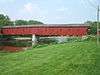
More images |