| Name |
Address |
Coordinates |
IDF |
IDP |
IDM |
 |
Image |
|---|
| 30 Moir Street |
30 Moir Street, Centre Wellington, ON |
43°41′06″N 80°25′52″W / 43.6851°N 80.4312°W / 43.6851; -80.4312 (30 Moir Street) |
|
|
10683 |
|
 |
| 40 McNab Street West |
40 McNab Street West, Centre Wellington, ON |
43°40′45″N 80°25′36″W / 43.6791°N 80.4266°W / 43.6791; -80.4266 (40 McNab Street West) |
|
|
10687 |
|
|
| 107 James Street |
107 James Street, Centre Wellington, ON |
43°40′56″N 80°25′57″W / 43.6823°N 80.4326°W / 43.6823; -80.4326 (107 James Street) |
|
|
9552 |
|
|
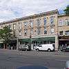
| 198 St. Andrew Street West |
198 St. Andrew Street West, Centre Wellington, ON |
43°42′18″N 80°22′43″W / 43.7049°N 80.3786°W / 43.7049; -80.3786 (198 St. Andrew Street West) |
|
|
10019 |
|
 |
| 240 Union Street West |
240 Union Street West, Centre Wellington, ON |
43°42′08″N 80°22′35″W / 43.7021°N 80.3764°W / 43.7021; -80.3764 (240 Union Street West) |
|
|
10675 |
|
|
| 292 South River Road |
292 South River Road, Centre Wellington, ON |
43°41′23″N 80°24′23″W / 43.6897°N 80.4065°W / 43.6897; -80.4065 (292 South River Road) |
|
|
10676 |
|
|
| 396 St. Andrew Street East |
396 St. Andrew Street East, Centre Wellington, ON |
43°42′34″N 80°22′24″W / 43.7095°N 80.3732°W / 43.7095; -80.3732 (396 St. Andrew Street East) |
|
|
10686 |
|
|
| 425 Provost Lane |
425 Provost Lane, Centre Wellington, ON |
43°42′22″N 80°22′56″W / 43.7061°N 80.3821°W / 43.7061; -80.3821 (425 Provost Lane) |
|
|
10677 |
|
|
| 445 Provost Lane |
445 Provost Lane, Centre Wellington, ON |
43°42′22″N 80°22′57″W / 43.7062°N 80.3825°W / 43.7062; -80.3825 (445 Provost Lane) |
|
|
10680 |
|
|
| 7003 Highway 6 |
7003 Highway 6, Centre Wellington, ON |
43°49′10″N 80°22′58″W / 43.8195°N 80.3827°W / 43.8195; -80.3827 (7003 Highway 6) |
|
|
10688 |
|
|
| 7053 First Line |
7053 First Line, Centre Wellington, ON |
43°46′23″N 80°26′07″W / 43.773°N 80.4353°W / 43.773; -80.4353 (7053 First Line) |
|
|
10689 |
|
|
| Armoury Hall |
23 High Street, Centre Wellington, ON |
43°39′38″N 80°27′37″W / 43.6605°N 80.4604°W / 43.6605; -80.4604 (Armoury Hall) |
|
|
10765 |
|
|
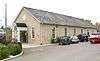
| The Beatty Pool |
190 St. David Street South, Centre Wellington, ON |
43°42′19″N 80°22′34″W / 43.7052°N 80.3762°W / 43.7052; -80.3762 (The Beatty Pool) |
|
|
9745 |
|

More images |
| Belleside |
230 Hillside Drive, Centre Wellington, ON |
43°42′28″N 80°22′18″W / 43.7078°N 80.3716°W / 43.7078; -80.3716 (Belleside) |
|
|
10787 |
|
|
| Brock Avenue Heritage Conservation District |
Brock Avenue, Centre Wellington, ON |
43°42′06″N 80°23′05″W / 43.7017°N 80.3847°W / 43.7017; -80.3847 (Brock Avenue Heritage Conservation District) |
|
|
9765 |
|
|
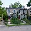
| Chalmers Manse |
14 Henderson Street, Centre Wellington, ON |
43°40′57″N 80°25′59″W / 43.6826°N 80.4331°W / 43.6826; -80.4331 (Chalmers Manse) |
|
|
9886 |
|
|
| Commercial Hotel |
23-43 West Mill Street, Centre Wellington, ON |
43°40′52″N 80°25′50″W / 43.6810°N 80.4305°W / 43.6810; -80.4305 (Commercial Hotel) |
|
|
10262 |
|
|
| Elora Junior School |
75 Melville Street, Centre Wellington, ON |
43°40′58″N 80°25′35″W / 43.6828°N 80.4265°W / 43.6828; -80.4265 (Elora Junior School) |
|
|
11031 |
|
|
| Elora Post Office |
128 Geddes Street, Centre Wellington, ON |
43°41′01″N 80°25′51″W / 43.6836°N 80.4307°W / 43.6836; -80.4307 (Elora Post Office) |
|
|
10978 |
|
 |
| Ennotville Library |
7722 Sixth Line, Centre Wellington, ON |
43°39′38″N 80°27′37″W / 43.6605°N 80.4604°W / 43.6605; -80.4604 (Ennotville Library) |
|
|
11183 |
|
|
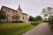
| Fergus District High School |
680 Tower Street South, Centre Wellington, ON |
43°41′58″N 80°22′20″W / 43.6994°N 80.3723°W / 43.6994; -80.3723 (Fergus District High School) |
|
|
10953 |
|

More images |
| Fergus Public Library |
190 St. Andrew Street West, Centre Wellington, ON |
43°42′18″N 80°22′43″W / 43.7049°N 80.3786°W / 43.7049; -80.3786 (Fergus Public Library) |
|
|
11194 |
|
|
| Former Elora Drill Shed National Historic Site of Canada |
40 High Street, Centre Wellington, ON |
43°40′48″N 80°25′44″W / 43.68°N 80.429°W / 43.68; -80.429 (Former Elora Drill Shed National Historic Site of Canada) |
11748 |
|
|
|
More images |
| Groves Mill |
140 St. David Street South, Centre Wellington, ON |
43°42′16″N 80°22′28″W / 43.7045°N 80.3745°W / 43.7045; -80.3745 (Groves Mill) |
|
|
15229 |
|

More images |
| Mansfield Cottage |
200 Smith Street, Centre Wellington, ON |
43°41′02″N 80°25′58″W / 43.684°N 80.4327°W / 43.684; -80.4327 (Mansfield Cottage) |
|
|
11752 |
|
|
| Market Scales Building |
150 Provost Lane, Centre Wellington, ON |
43°42′16″N 80°23′05″W / 43.7044°N 80.3847°W / 43.7044; -80.3847 (Market Scales Building) |
|
|
11753 |
|
 |
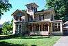
| The Old McLean House |
17 Henderson Street, Centre Wellington, ON |
43°40′58″N 80°25′58″W / 43.6828°N 80.4328°W / 43.6828; -80.4328 (The Old McLean House) |
|
|
13242 |
|
|
| Richard Moore House |
259 St. Andrew Street East, Centre Wellington, ON |
43°42′27″N 80°22′33″W / 43.7076°N 80.3757°W / 43.7076; -80.3757 (Richard Moore House) |
|
|
12433 |
|
|
| St. John's Church |
36 Henderson Street, Centre Wellington, ON |
43°41′00″N 80°25′54″W / 43.6834°N 80.4318°W / 43.6834; -80.4318 (St. John's Church) |
|
|
11871 |
|

More images |
| Wellington County House of Industry and Refuge National Historic Site of Canada |
536 County Road 18, Centre Wellingtin (Fergus), ON |
43°41′34″N 80°23′54″W / 43.6927°N 80.3984°W / 43.6927; -80.3984 (Wellington County House of Industry and Refuge National Historic Site of Canada) |
7691 |
|
|
|
More images |
| 7 Waterloo Avenue |
7 Waterloo Avenue, Guelph, ON |
43°32′28″N 80°15′01″W / 43.5411°N 80.2502°W / 43.5411; -80.2502 (7 Waterloo Avenue) |
|
|
5509 |
|
|
| 8 Glenhill Place |
8 Glenhill Place, Guelph, ON |
43°33′23″N 80°15′03″W / 43.5565°N 80.2508°W / 43.5565; -80.2508 (8 Glenhill Place) |
|
|
14545 |
|
|
| 22-26 Oxford Street, Guelph |
22 Oxford Street, Guelph, ON |
43°32′N 80°15′W / 43.54°N 80.25°W / 43.54; -80.25 (22-26 Oxford Street, Guelph) |
|
|
2979 |
|
|
| 24 Cambridge Street |
24 Cambridge Street, Guelph, ON |
43°32′36″N 80°15′18″W / 43.5432°N 80.2551°W / 43.5432; -80.2551 (24 Cambridge Street) |
|
|
10674 |
|
|
| 32 Liverpool Street |
32 Liverpool Street, Guelph, ON |
43°32′46″N 80°15′19″W / 43.5461°N 80.2554°W / 43.5461; -80.2554 (32 Liverpool Street) |
|
|
14551 |
|
|
| 49 Albert Street |
49 Albert Street, Guelph, ON |
43°32′13″N 80°14′34″W / 43.537°N 80.2429°W / 43.537; -80.2429 (49 Albert Street) |
|
|
10681 |
|
|
| 74-76 Liverpool Street |
74 Liverpool Street, Guelph, ON |
43°32′44″N 80°15′23″W / 43.5456°N 80.2564°W / 43.5456; -80.2564 (74-76 Liverpool Street) |
|
|
14553 |
|
 |
| 83 King Street |
83 King Street, Guelph, ON |
43°33′04″N 80°15′00″W / 43.551°N 80.2501°W / 43.551; -80.2501 (83 King Street) |
|
|
14546 |
|
 |
| 87 Liverpool Street |
87 Liverpool Street, Guelph, ON |
43°32′42″N 80°15′27″W / 43.5451°N 80.2574°W / 43.5451; -80.2574 (87 Liverpool Street) |
|
|
14554 |
|
|
| 93-95 Nottingham Street |
93 Nottingham Street, Guelph, ON |
43°32′20″N 80°14′57″W / 43.5388°N 80.2493°W / 43.5388; -80.2493 (93-95 Nottingham Street) |
|
|
13884 |
|
|
| 109 Surrey Street East |
109 Surrey Street East, Guelph, ON |
43°32′41″N 80°14′39″W / 43.5447°N 80.2441°W / 43.5447; -80.2441 (109 Surrey Street East) |
|
|
14550 |
|
|
| 146 Waterloo Avenue |
146 Waterloo Avenue, Guelph, ON |
43°32′14″N 80°15′15″W / 43.5373°N 80.2542°W / 43.5373; -80.2542 (146 Waterloo Avenue) |
|
|
14543 |
|
|
| 204 College Avenue West |
204 College Avenue West, Guelph, ON |
43°31′25″N 80°14′39″W / 43.5235°N 80.2442°W / 43.5235; -80.2442 (204 College Avenue West) |
|
|
14544 |
|
|
| 221 Woolwich Street |
221 Woolwich Street, Guelph, ON |
43°32′55″N 80°15′17″W / 43.5486°N 80.2547°W / 43.5486; -80.2547 (221 Woolwich Street) |
|
|
10673 |
|
|
| 268-270 Woolwich Street |
268 Woolwich Street, Guelph, ON |
43°32′58″N 80°15′23″W / 43.5494°N 80.2564°W / 43.5494; -80.2564 (268-270 Woolwich Street) |
|
|
10764 |
|
 |
| 341 Forestell Road |
341 Forestell Road, Guelph, ON |
43°28′48″N 80°13′02″W / 43.4799°N 80.2172°W / 43.4799; -80.2172 (341 Forestell Road) |
|
|
13847 |
|
|
| 1453 Gordon Street |
1453 Gordon Street, Guelph, ON |
43°30′36″N 80°11′46″W / 43.5099°N 80.196°W / 43.5099; -80.196 (1453 Gordon Street) |
|
|
14849 |
|
|
| Alumni Centre |
Arboretum Road, University of Guelph, Guelph, ON |
43°32′08″N 80°13′14″W / 43.5355°N 80.2205°W / 43.5355; -80.2205 (Alumni Centre) |
|
|
10776 |
|
|
| Armoury |
Farquahar Street, Guelph, ON |
43°32′35″N 80°14′48″W / 43.5431°N 80.2466°W / 43.5431; -80.2466 (Armoury) |
4345 |
|
|
|
|
| Bell-Carlton House |
40 Albert Street, Guelph, ON |
43°32′14″N 80°14′31″W / 43.5371°N 80.242°W / 43.5371; -80.242 (Bell-Carlton House) |
|
|
10784 |
|
|
| The Bell House |
21 Oxford Street, Guelph, ON |
43°32′45″N 80°15′14″W / 43.5459°N 80.254°W / 43.5459; -80.254 (The Bell House) |
|
|
13253 |
|
More images |
| Bell O'Donnell House |
96 Water Street, Guelph, ON |
43°32′11″N 80°14′39″W / 43.5364°N 80.2443°W / 43.5364; -80.2443 (Bell O'Donnell House) |
|
|
10786 |
|
|
| Blacksmith Fountain |
59 Carden Street, Guelph, ON |
43°32′38″N 80°14′53″W / 43.544°N 80.248°W / 43.544; -80.248 (Blacksmith Fountain) |
|
|
13845 |
|

More images |
| The Boat House |
116 Gordon Street, Guelph, ON |
43°32′23″N 80°14′35″W / 43.5397°N 80.2431°W / 43.5397; -80.2431 (The Boat House) |
|
|
13222 |
|

More images |
| County Jail and Governor's Residence |
74 Woolwich Street, Guelph, ON |
43°32′51″N 80°14′55″W / 43.5476°N 80.2486°W / 43.5476; -80.2486 (County Jail and Governor's Residence) |
|
|
10906 |
|
|
| County of Wellington Building |
131 Wyndham Street North, Guelph, ON |
43°32′48″N 80°15′00″W / 43.5468°N 80.2499°W / 43.5468; -80.2499 (County of Wellington Building) |
|
|
10907 |
|
 |
| County Solicitor's Building |
15 Douglas Street, Guelph, ON |
43°32′48″N 80°14′55″W / 43.5467°N 80.2487°W / 43.5467; -80.2487 (County Solicitor's Building) |
|
|
10908 |
|
 |
| Duncan-McPhee Store |
1 Quebec Street, Guelph, ON |
43°32′43″N 80°15′06″W / 43.5453°N 80.2518°W / 43.5453; -80.2518 (Duncan-McPhee Store) |
|
|
11749 |
|
|
| Ferndell House |
25 Mitchell Street, Guelph, ON |
43°33′03″N 80°15′04″W / 43.5508°N 80.2511°W / 43.5508; -80.2511 (Ferndell House) |
|
|
13885 |
|
 |
| Former Canadian National Railways (VIA Rail/GO Transit) Station |
79 Carden Street, Guelph, ON |
43°32′40″N 80°14′50″W / 43.5445°N 80.2471°W / 43.5445; -80.2471 (Former Canadian National Railways (VIA Rail/GO Transit) Station) |
4569 |
|
|
|
|
| Goldie Mill |
70 Norwich Street, Guelph, ON |
43°33′03″N 80°15′14″W / 43.5508°N 80.2539°W / 43.5508; -80.2539 (Goldie Mill) |
|
|
10867 |
|
 |
| Gow's Bridge |
McCrae Boulevard, Guelph, ON |
43°32′38″N 80°14′46″W / 43.5439°N 80.246°W / 43.5439; -80.246 (Gow's Bridge) |
|
|
5518 |
|

More images |
| Guelph City Hall National Historic Site of Canada |
59 Carden Street, Guelph, ON |
43°32′39″N 80°14′53″W / 43.5441°N 80.248°W / 43.5441; -80.248 (Guelph City Hall National Historic Site of Canada) |
7446 |
8171 |
10090 |
|
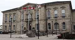
More images |
| Guelph Civic Museum |
6 Dublin Street South, Guelph, ON |
43°32′27″N 80°15′01″W / 43.5409°N 80.2504°W / 43.5409; -80.2504 (Guelph Civic Museum) |
|
|
10097 |
|
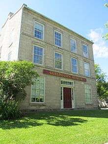
More images |
| Guelph Waterworks Engine House and Pumping Station |
29 Waterworks Place, Guelph, ON |
43°32′45″N 80°13′50″W / 43.5459°N 80.2306°W / 43.5459; -80.2306 (Guelph Waterworks Engine House and Pumping Station) |
|
|
13849 |
|
|
| H and R Block Building |
133 Wyndham Street North, Guelph, ON |
43°32′49″N 80°15′00″W / 43.5469°N 80.25°W / 43.5469; -80.25 (H and R Block Building) |
|
|
14142 |
|
 |
| Heffernan Street Footbridge |
Heffernan Street, Guelph, ON |
43°32′54″N 80°14′50″W / 43.5484°N 80.2472°W / 43.5484; -80.2472 (Heffernan Street Footbridge) |
|
|
13903 |
|
|
| I.O.D.E. Fountain |
, Guelph, ON |
43°32′43″N 80°15′08″W / 43.5454°N 80.2521°W / 43.5454; -80.2521 (I.O.D.E. Fountain) |
|
|
13850 |
|
|
| Idylwyld |
27 Barber Avenue, Guelph, ON |
43°32′50″N 80°15′51″W / 43.5471°N 80.2643°W / 43.5471; -80.2643 (Idylwyld) |
|
|
8071 |
|
|
| Massey Hall, University of Guelph |
50 Stone Road East, Guelph, ON |
43°31′54″N 80°13′43″W / 43.5318°N 80.2285°W / 43.5318; -80.2285 (Massey Hall, University of Guelph) |
|
|
11822 |
|
 |
| Maxwelton |
646 Paisley Road, Guelph, ON |
43°31′52″N 80°16′33″W / 43.5311°N 80.2759°W / 43.5311; -80.2759 (Maxwelton) |
|
|
13904 |
|
|
| McCrae House National Historic Site of Canada |
108 Water Street, Guelph, ON |
43°32′10″N 80°14′42″W / 43.536°N 80.2451°W / 43.536; -80.2451 (McCrae House National Historic Site of Canada) |
7673 |
|
9894 |
|
 |
| McLean House |
21 Nottingham Street, Guelph, ON |
43°32′29″N 80°14′53″W / 43.5415°N 80.248°W / 43.5415; -80.248 (McLean House) |
|
|
13905 |
|
|
| Medical Hall |
12 Wyndham Street North, Guelph, ON |
43°32′42″N 80°14′54″W / 43.5449°N 80.2483°W / 43.5449; -80.2483 (Medical Hall) |
|
|
11825 |
|
|
| Mill Lofts |
26 Ontario Street, Guelph, ON |
43°32′40″N 80°14′22″W / 43.5444°N 80.2394°W / 43.5444; -80.2394 (Mill Lofts) |
|
|
11827 |
|

More images |
| Norwich Street Bridge |
Norwich Street, Guelph, ON |
43°33′01″N 80°15′09″W / 43.5503°N 80.2525°W / 43.5503; -80.2525 (Norwich Street Bridge) |
|
|
13906 |
|
|
| Our Lady of the Immaculate Conception National Historic Site of Canada |
28 Norfolk Street, Guelph, ON |
43°32′37″N 80°15′03″W / 43.5437°N 80.2508°W / 43.5437; -80.2508 (Our Lady of the Immaculate Conception National Historic Site of Canada) |
7646 |
|
|
|
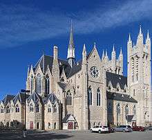
More images |
| Pagani House |
13 Evergreen Drive, Guelph, ON |
43°31′35″N 80°13′15″W / 43.5264°N 80.2209°W / 43.5264; -80.2209 (Pagani House) |
|
|
13853 |
|
|
| Parkview |
88 London Road West, Guelph, ON |
43°32′53″N 80°15′35″W / 43.5481°N 80.2597°W / 43.5481; -80.2597 (Parkview) |
|
|
10930 |
|
|
| Perry-Scroggie House |
15 Oxford Street, Guelph, ON |
43°32′46″N 80°15′14″W / 43.546°N 80.2538°W / 43.546; -80.2538 (Perry-Scroggie House) |
|
|
11882 |
|
|
| The Petrie Building |
15 Wyndham Street, Guelph, ON |
43°32′42″N 80°14′53″W / 43.5451°N 80.248°W / 43.5451; -80.248 (The Petrie Building) |
|
|
9897 |
|
 |
| Phoenix Mill |
358 Waterloo Street, Guelph, ON |
43°31′55″N 80°15′36″W / 43.532°N 80.2599°W / 43.532; -80.2599 (Phoenix Mill) |
|
|
12077 |
|
|
| President's House |
100 College Avenue East, University of Guelph, Guelph, ON |
43°31′41″N 80°13′24″W / 43.528°N 80.2232°W / 43.528; -80.2232 (President's House) |
|
|
11890 |
|
|
| Provincial Winter Fair Building |
1 Carden Street, Guelph, ON |
43°32′37″N 80°14′57″W / 43.5436°N 80.2491°W / 43.5436; -80.2491 (Provincial Winter Fair Building) |
|
|
11892 |
|
|
| St. James the Apostle Anglican Church |
86 Glasgow, Guelph, ON |
43°32′36″N 80°15′23″W / 43.5432°N 80.2565°W / 43.5432; -80.2565 (St. James the Apostle Anglican Church) |
|
|
12847 |
|
|
| The Schoolhouse |
611 Silvercreek Parkway North, Guelph, ON |
43°33′15″N 80°18′00″W / 43.5541°N 80.2999°W / 43.5541; -80.2999 (The Schoolhouse) |
|
|
13855 |
|
|
| Speed River Bicycle Shop |
135 Wyndham Street, Guelph, ON |
43°32′49″N 80°15′00″W / 43.5469°N 80.25°W / 43.5469; -80.25 (Speed River Bicycle Shop) |
|
|
13241 |
|
|
| Stone Road Bridge |
Stone Road, Guelph, ON |
43°32′50″N 80°11′50″W / 43.5471°N 80.1973°W / 43.5471; -80.1973 (Stone Road Bridge) |
|
|
13192 |
|
 |
| Stone Store |
32 Gordon Street, Guelph, ON |
43°32′11″N 80°14′19″W / 43.5364°N 80.2386°W / 43.5364; -80.2386 (Stone Store) |
|
|
13221 |
|
|
| Sunnyside |
16 Arthur Street North, Guelph, ON |
43°32′54″N 80°14′37″W / 43.5483°N 80.2435°W / 43.5483; -80.2435 (Sunnyside) |
|
|
9663 |
|
|
| Sunset |
74 Paisley Road, Guelph, ON |
43°32′38″N 80°15′20″W / 43.544°N 80.2556°W / 43.544; -80.2556 (Sunset) |
|
|
11869 |
|
|
| Torrance Public School |
151 Waterloo Avenue, Guelph, ON |
43°32′14″N 80°15′16″W / 43.5372°N 80.2545°W / 43.5372; -80.2545 (Torrance Public School) |
|
|
13856 |
|
|
| Wellington Hotel |
147 Wyndham Street North, Guelph, ON |
43°32′51″N 80°15′03″W / 43.5476°N 80.2508°W / 43.5476; -80.2508 (Wellington Hotel) |
|
8205 |
|
|
|
| Wood Cottage |
280 Palmer Street, Guelph, ON |
43°33′22″N 80°14′23″W / 43.556°N 80.2398°W / 43.556; -80.2398 (Wood Cottage) |
|
|
10656 |
|
|
| Rockwood Academy |
477 Main Street South, Guelph/Eramosa (Rockwood), ON |
43°36′40″N 80°08′02″W / 43.611°N 80.134°W / 43.611; -80.134 (Rockwood Academy) |
|
10546 |
|
|
|