List of cultural heritage sites in Khyber Pakhtunkhwa
Following is the list of monuments and archaeological sites in Khyber Pakhtunkhwa, Pakistan. A total 85 sites in the province were under the protection of the Federal Government. The list includes the only completely inscribed UNESCO World Heritage Site in Khyber Pakhtunkhwa, the Buddhist Ruins of Takht-i-Bahi and Neighbouring City Remains at Sahr-i-Bahlol[1] as well as sites which are part of the World Heritage Sites at Taxila.
Protected/Unprotected sites
Until the passing of the Eighteenth Amendment to the Constitution of Pakistan, the protected sites were under the Federal Government.
Inscribed UNESCO sites and Tentative UNESCO sites
| ID | Name | Type | Location | District | Coordinates | Image |
|---|---|---|---|---|---|---|
| KPK-1 | Zuro Dheri | Village Shinkiari | Mansehra |  | ||
| KPK-2 | Akra (A) mound | near Village Bhart | Bannu |  | ||
| KPK-3 | Akra (B) mound | near Village Vhart | Bannu | .JPG) | ||
| KPK-4 | House of Dilip Kumar, Peshawar | Peshawar | Peshawar District |  | ||
| KPK-5 | Sheri Khan Tarakai | Village Jani Khel Wazir | Bannu |  | ||
| KPK-6 | Ghundai | Village Bakka - Khel Wazir | Bannu | | ||
| KPK-7 | Ranigat | Totalai | Buner |  | ||
| KPK-8 | Rehman Dheri | Hisam | D.I.Khan |  | ||
| KPK-9 | Northern Kafir Kot - ancient fort and temple | Umer Khel | D.I.Khan |  | ||
| KPK-10 | Graveryard including four tombs at Lal Mohra Sharif | Lunda Pahar | D.I.Khan | 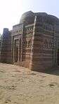 | ||
| KPK-11 | Southern Kafir Kot - ancient fort and temple | Bilot | D.I.Khan |  | ||
| KPK-12 | Badalpur Buddhist stupa and monastery (Taxila) | Badalpur | Haripur | 33°46′56″N 72°52′08″E / 33.782142°N 72.868814°E | _by_Usman_Ghani.jpg) | |
| KPK-13 | Lal Chak stupa and monastery (Taxila) | Garhian | Haripur | 33°47′15″N 72°51′49″E / 33.787430°N 72.863493°E | | |
| KPK-14 | Jaulian (Taxila) | Jaulian | Haripur | 33°45′53″N 72°52′29″E / 33.764842°N 72.874804°E |  | |
| KPK-15 | Sirsukh (Taxila) | Marchabad | Haripur | 33°46′21″N 72°50′52″E / 33.772628°N 72.847853°E |  | |
| KPK-16 | Piplan site (Taxila) | Jaulian | Haripur | 33°45′57″N 72°51′57″E / 33.765752°N 72.865954°E |  | |
| KPK-17 | Bhamala Stupa site | Next to Haro River in Bhamala | Haripur |  | ||
| KPK-18 | Pind Ghakhran mound | Pind Ghakhran | Haripur | .JPG) | ||
| KPK-19 | Mirpur mound | Mirpur village | Haripur | | ||
| KPK-20 | Bhera (mound) | Bhera | Haripur |  | ||
| KPK-21 | Chitti site | Chitti | Haripur | | ||
| KPK-22 | Tarnawa-Chitti site A & B | Tarnawa (see above also) | Haripur | | ||
| KPK-23 | Burj or Tuma site | Garamthun | Haripur | | ||
| KPK-24 | Bhari Dheri | Kutehra | Haripur | | ||
| KPK-25 | Dana Wali | Kutehra | Haripur | | ||
| KPK-26 | Tope site | Kamalpur | Haripur | | ||
| KPK-27 | Handyside Fort | Kohat |  | |||
| KPK-28 | Tomb of Hazrat Shaheed Ahmad Maujadid Baralvi | Bala Kot | Mansehra |  | ||
| KPK-29 | Tomb of Shah Ismail Shaheed | Bala Kot | Mansehra | 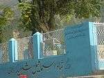 | ||
| KPK-30 | Buddhist inscribed rock at Shahdaur | Shahdaur Agror | Mansehra |  | ||
| KPK-31 | Mansehra Rock Edicts (Fourteen rock edicts of Asoka inscribed on three rock boulders) | Mansehra | 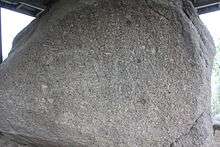 | |||
| KPK-32 | Sahri Bahlol city remains | Sahri Bahlol | Mardan | 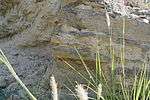 | ||
| KPK-33 | Fourteen rock edicts of Ashoka inscribed on two rocks in Shahbazgarhi | Shahbazgarhi village | Mardan | 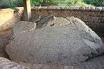 | ||
| KPK-34 | Takht-i-Bahi Buddhist ruins | Takht-i-Bahi | Mardan | _at_Takht-i-Bahi.JPG) | ||
| KPK-35 | Buddhist ruins | Jamal Garhi | Mardan |  | ||
| KPK-36 | Stone circle | Asota - Swabi Tehsil | Swabi |  | ||
| KPK-37 | Chanaka Dheri | Shahbaz Garhi | Mardan | | ||
| KPK-38 | Tereli Buddhist remains | Sawal Dhera | Marden | | ||
| KPK-39 | Kasmir Samast | Rustam | Mardan |  | ||
| KPK-40 | Ruined fort wall | Hund | Mardan |  | ||
| KPK-41 | Maida Ghundai or Maida Dheri | Shahbaz Garhi | Mardan | | ||
| KPK-42 | Hussai Dheri | Shahbaz Garhi | Mardan |  | ||
| KPK-43 | Adina Dheri | near Gariala | Mardan | | ||
| KPK-44 | Chargul Dheri | Chargul - 5 miles southwest of Rustam | Mardan |  | ||
| KPK-45 | Chichar Dheri | Jamal Garhi | Mardan | | ||
| KPK-46 | Turlandi Ghundai (mound) | Chak No. 2 | Mardan | 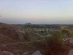 | ||
| KPK-47 | Takhtaband | Tehsile Sawabi | Sawabi | | ||
| KPK-48 | Black Rock | on right bank of Indus River - Modery | Nowshera | | ||
| KPK-49 | Mirchi-ki-ddheri | Head Bust - Chak Razar | Peshawar | | ||
| KPK-50 | Gorkhatree | Peshawar | 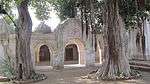 | |||
| KPK-51 | Bala Hisar mound | Charsadda | Peshawar | 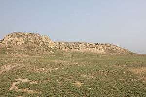 | ||
| KPK-52 | Tomb built by one Shah Qutb during the reign of Mughal Emperor Akbar | Dilzak | Peshawar | 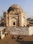 | ||
| KPK-53 | Sheikhan Dheri | Chak Razar - Head Bust | Peshawar | | ||
| KPK-54 | Rattappan mound | 2 miles from Jalbi Village | Peshawar | | ||
| KPK-55 | Ghaz Dheri | Razzar | Peshawar | | ||
| KPK-56 | Hamza Garhi mounds | Hamza Garhi | Peshawar | | ||
| KPK-57 | Dharam Sal-ki-dheri | Mera Prang | Peshawar | | ||
| KPK-58 | Kaniza-ki-dheri | Charsadda | Peshawar | | ||
| KPK-59 | Tomb and mosque of Sheikh Immamuddin | Pilosi Piran | Peshawar | 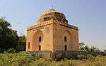 | ||
| KPK-60 | Gateway of Kotla Mohsin Khan | Kotala Moshin Khan | Peshawar | | ||
| KPK-61 | Sethi House Complex | Mohallah - Setian | Peshawar |  | ||
| KPK-62 | Abasin Arts Council | Peshawar | Peshawar | | ||
| KPK-63 | Barama site | Mingora | Swat | 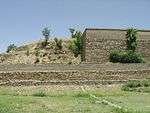 | ||
| KPK-64 | Odigram Castle | Odigram | Swat | 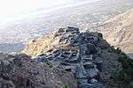 | ||
| KPK-65 | Butkara-I | Mingora | Swat |  | ||
| KPK-66 | Panr site | Panr | Swat |  | ||
| KPK-67 | Loebnr stupa | Loebanr | Swat |  | ||
| KPK-68 | Saidu stupa | Saidu Sharif | Swat | 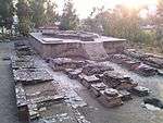 | ||
| KPK-69 | Dangram stupa | Dangram | Swat | 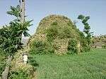 | ||
| KPK-70 | Gogdara Rock Carvings | Gogdara | Swat | 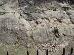 | ||
| KPK-71 | Manglawar stupa | Manglawar | Swat | 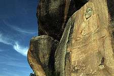 | ||
| KPK-72 | Shinashah stupa | Batura | Swat |  | ||
| KPK-73 | Gullaki Dheri | Kukarai | Swat | | ||
| KPK-74 | Aligrama site | Aligrama | Swat |  | ||
| KPK-75 | Najigram site | Nijigram | Swat |  | ||
| KPK-76 | Nawagai (Gumbatuna) | Nawagai | Swat | 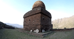 | ||
| KPK-77 | Amlukdara stupa | Amlukdara Serai | Swat |  | ||
| KPK-78 | Shingardara stupa | Amlukdara Serai | Swat | 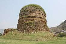 | ||
| KPK-79 | Nimogram site | Village Gumkot | Swat |  | ||
| KPK-80 | Barikot Ghundai | ancient Bazira - Barikot | Swat |  | ||
| KPK-81 | Ghalegay Cave | Barikot | Swat | 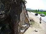 | ||
| KPK-82 | Butkara-III | Gulkada Babozai | Swat | 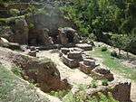 | ||
| KPK-83 | Islamia College Peshawar | Peshawar | 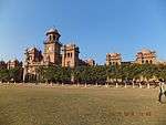 | |||
| KPK-84 | the Fort of Nawab shah Jahan | Dir District | | |||
| KPK-85 | Kapoor Family House | Peshawar | Peshawar District | 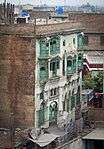 | ||
| KPK-86 | House of Hazrat Barri Imam | Banks of Hazro River | Abbottabad District | 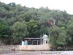 | ||
| KPK-87 | Jinnan Wali Dheri | Haripur Khanpur Road | Haripur District | 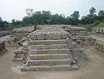 | ||
| KPK-88 | Badshahi Masjid Chitral | Noghor Road | Chitral District |  | ||
| KPK-89 | Syed ka Bagh | Dubgari Road | Peshawar | 34°00′09″N 71°33′27″E / 34.002453°N 71.557442°E | 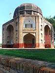 | |
| KPK-90 | Grant Hostelm | Peshawar |  |
Sites in what was previously FATA
National monuments
| ID | Name | Type | Location | District | Coordinates | Image |
|---|---|---|---|---|---|---|
| FATA-1 | Ali Masjid and Ali Masjid Fort | Fort | It is located at the narrowest point of Khyber Pass[2] | Khyber Agency | 34°01′27″N 71°15′52″E / 34.024280°N 71.264470°E | 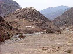 |
| FATA-2 | Bab-e-Khyber | Historical site | located in Jamrud on N-5 Highway | Khyber Agency | 34°00′09″N 71°22′48″E / 34.002516°N 71.380040°E |  |
| FATA-3 | Jamrud Fort | Fort | located next to Bab-e-Khyber in Jamrud[3] | Khyber Agency | 34°00′14″N 71°22′43″E / 34.003808°N 71.378524°E |  |
| FATA-4 | Sphola Stupa | Archaeological site | Near the village of Zarai[3][4] | Khyber Agency | 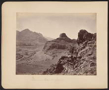 | |
| FATA-5 | Shagai Fort | Fort | Located 13 kilometres (8.1 mi) from Jamrud[3][5] | Khyber Agency | 34°01′02″N 71°16′48″E / 34.017350°N 71.279887°E |  |
| FATA-6 | Khyber Stupa | Archaeological site | Located 5 miles (8.0 km) before Landikotal beside the N-5 Highway[6] | Khyber Agency | 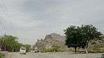 | |
| FATA-7 | Michni Post | Historical site | Between Landikotal and Torkham[7] | Khyber Agency |  | |
| FATA-8 | Alexander Fort | Fort | Razmak | North Waziristan Agency | .jpg) | |
| FATA-9 | Malik Ammir Jani Mosque | Fort | North Waziristan Agency |  |
References ;
| Wikimedia Commons has media related to Cultural heritage monuments in Khyber Pakhtunkhwa. |
- ↑ Pakistan Environmental Protection Agency. "Guidelines for Critical & Sensitive Areas" (PDF). Government of Pakistan. pp. 12, 47, 48. Archived from the original (PDF) on 14 October 2013. Retrieved 6 June 2013.
- ↑ "Ali Masjid". The Lonely Planet. Retrieved 1 August 2014.
- 1 2 3 "The Khyber Pass". The Lonely Planet. Retrieved 1 August 2014.
- ↑ "History fades as second century Sphola Stupa continues to crumble". The Express Tribune. 17 May 2014. Retrieved 1 August 2014.
- ↑ "Shagai Fort". Khyber Agency Official Website, Government of Pakistan. Retrieved 1 August 2014.
- ↑ "Khyber Stupa". Khyber Agency Official Website, Government of Pakistan. Retrieved 1 August 2014.
- ↑ "Michni Post". Khyber Agency Official Website, Government of Pakistan. Retrieved 1 August 2014.
| History | |
|---|---|
| Government | |
| Culture and places |
|
| Geography | |
| Education & Health | |
| Sport | |
| |
This article is issued from
Wikipedia.
The text is licensed under Creative Commons - Attribution - Sharealike.
Additional terms may apply for the media files.