List of state highways in Wyoming
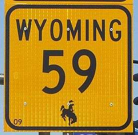
  Signage used for Wyoming State Highways, which includes the Bucking Horse and Rider. | |
| Highway names | |
|---|---|
| Interstates | Interstate X (I-X) |
| US Highways | U.S. Highway X (US X) |
| State | Wyoming Highway X (State Route X; WYO X) |
| System links | |
The state highway system in the U.S. state of Wyoming consists of a series of numbered routes; usually known as WYO X,[1] where X is the route number.
State highways
10-96
| Number | Length (mi) | Length (km) | Southern or western terminus | Northern or eastern terminus | Formed | Removed | Notes |
|---|---|---|---|---|---|---|---|
| 9.12 | 14.68 | Larimer CR 103 at CO border | WYO 230 in Woods Landing | — | — | Jelm Mountain Road | |
| 10.94 | 17.61 | NFS Route 500 in Albany | Wyo 130 near Centennial | — | — | Albany Road | |
| 12.18 | 19.60 | Albany CR 57 near Woodedge | WYO 130 near Laramie | — | — | Herrick Lane | |
| 17.76 | 28.58 | I-80 at Arlington | US 30 and US 287 in Rock River | — | — | Arlington Road | |
| 449.21 | 722.93 | US 14 in Cody | US 14 in Burgess Junction | 1940 | 1965[2] | Replaced by US 14A | |
| 0.36 | 0.58 | Laramie Regional Airport | WYO 130 near Laramie Regional Airport | — | — | Airport Road | |
| 17.53 | 28.21 | ID 33 near Wilson | US 26/US 89/US 189/US 191 in Jackson | 1942 | current | Teton Pass Highway | |
| 46.72 | 75.19 | US 14 at Devils Tower Junction | SD 34 near Aladdin | 1961 | current | Bear Lodge Highway | |
| 52.38 | 84.30 | US 30/US 287 near Bosler | US 87 in Wheatland | 1926 | 1950 | Replaced by WYO 34 | |
| 96.5 | 155.3 | WYO 372 near Farson | US 287/WYO 789 near Lander | — | — | South Pass Highway | |
| 26.02 | 41.88 | US 14/US 16/US 20 near Burlington | US 16/US 20/WYO 789 in Basin | — | — | Otto Road | |
| 22.09 | 35.55 | US 16/US 20/WYO 789 in Manderson | Big Horn CR R49 at Hyattville | — | — | Cold Springs Road | |
| 31.48 | 50.66 | US 14/US 16/US 20 near Emblem | US 310/US 14A/WYO 789 near Lovell | — | — | Emblem Highway | |
| 1.39 | 2.24 | BLM route near Forester Gulch | WYO 32 near Lovell | — | — | Mileage marker starts at 2.89, coinciding with WYO 32 mileage at junction | |
| 52.38 | 84.30 | US 30/US 287 south of Bosler | I-25/US 87 south of Wheatland | 1950 | current | Laramie–Wheatland Road | |
| 1.08 | 1.74 | Big Horn CR R7 near Cowley | US 310/WYO 789 in Cowley | — | — | ||
| 2.76 | 4.44 | WYO 30 in Basin | US 16/US 20/WYO 789 north of Basin | — | — | ||
| 9.00 | 14.48 | US 14A near Lovell | Bighorn Canyon NRA | — | — | ||
| 52.67 | 84.76 | WYO 387 at Pine Tree Junction | US 14/US 16/WYO 59/I-90 Bus. in Gillette | — | — | Skyline Drive; 4 J Road | |
| 24.79 | 39.90 | I-90/US 14/US 16/I-90 Bus. in Gillette | US 14/US 16/I-90 Bus. in Moorcroft | — | — | Rozet Road | |
| 171.97 | 276.76 | I-25/US 20/US 26/US 87/I-25 Bus./US 20 Bus./US 26 Bus./US 87 Bus./WYO 94 in Douglas | MT 59 near Gillette | 1945 | current | ||
| 0.45 | 0.72 | WYO 59 in Douglas | WYO 59 in Douglas | — | — | ||
| 55.84 | 89.87 | US 530 in Evanston UT 30 near Kemmerer | UT 16 near Bear River ID 16 near Geneva, Idaho |
1924 | 1938 | Replaced by WYO 89 over northern portion in 1926 (reduced route to 17.44 mi), then over southern portion in 1938 | |
| 57.66 | 92.79 | WYO 789 in Baggs | WYO 230 in Riverside | — | — | Battle Highway | |
| 10.83 | 17.43 | Carbon CR 401 near Rawlins | WYO 78 in Rawlins | — | — | Sage Creek Road | |
| 15.45 | 24.86 | Carbon CR 402 in Elk Mountain | Adams Street in Hanna | — | — | Hanna Road | |
| 4.64 | 7.47 | Sweetwater | US 287/WY 789 in Lamont | — | — | Bairoil Road | |
| 0.13 | 0.21 | WYO 130 in Saratoga | Carbon CR 504 in Saratoga | — | — | Unsigned; Bridge Street | |
| 22.10 | 35.57 | WYO 487 near Medicine Bow | WYO 487 near Alcove | — | 1975 | Replaced by WYO 487 | |
| 6.54 | 10.53 | I-80/US 30/US 287/I-80 Bus./US 30 Bus. in Rawlins | I-80/US 30/US 287 near Sinclair | — | — | Old US 30/US 287 | |
| 22.18 | 35.70 | WYO 487 north of Medicine Bow | WYO 487 near Alcove | 1975 | current | Old Shirley Basin Road | |
| 1.23 | 1.98 | Wyoming State Penitentiary in Rawlins | WYO 71 in Rawlins | — | — | Higley Boulevard | |
| 53.20 | 85.62 | CO 13 near Baggs, Wyoming | US 30 near Creston | 1930 | 1940 | Replaced by WYO 330, now WYO 789; Baggs Road | |
| 55.84 | 89.87 | I-80/US 189/WYO 150 in Evanston UT 30 near Kemmerer | UT 16 near Bear River ID 16 near Geneva, Idaho |
1926 | current | route only covered northern portion 1926-, decommissioned (became WYO 91) 1936, recommissioned over WYO 65 and WYO 91 1938 | |
| 3.00 | 4.83 | Converse CR 17 southeast of Glenrock | US 20/US 26/US 87/I-25 Bus. east of Glenrock | — | — | Boxelder Road | |
| 38.40 | 61.80 | UT 30 near Kemmerer | ID 16 near Geneva, Idaho | 1936 | 1938 | Replaced by WYO 89 | |
| 23.10 | 37.18 | Converse CR 11/CR 24 southwest of Douglas | WYO 94 in Douglas | — | — | Cold Springs Road | |
| 16.50 | 26.55 | US 26/US 85 in Torrington | N-92 near Huntley | — | — | ||
| 26.02 | 41.88 | WYO 59 in Douglas | Converse CR 32/CR 33 northwest of Douglas | — | — | ||
| 16.61 | 26.73 | Converse CR 5 north of Esterbrook | I-25 Bus./US 20 Bus./US 26 Bus./US 87 Bus./WYO 59 in Douglas | — | — | Esterbrook Road | |
| 19.23 | 30.95 | I-25/I-25 Bus. south of Glenrock US 20, US 26/US 87 in Glenrock | US 20/US 26/US 87/I-25 Bus. in Glenrock WYO 93 northeast of Glenrock |
— | — | Monkey Mountain Road; Glenrock-Ross Road | |
| 3.11 | 5.01 | I-25/US 20/US 26/US 87 near Douglas | WYO 91 west of Douglas | — | — |
110-196
| Number | Length (mi) | Length (km) | Southern or western terminus | Northern or eastern terminus | Formed | Removed | Notes |
|---|---|---|---|---|---|---|---|
| — | — | WYO 24 near Devils Tower | Devils Tower NM | — | — | Devils Tower Road | |
| — | — | I-90 and US 14 northeast of Sundance | WYO 24 at Aladdin | — | — | ||
| — | — | WYO 24 in Hulett | Montana state line south of Alzada, Montana | — | — | ||
| — | — | US 14 north of Moorcroft | Pine Haven Road in Pine Haven | — | — | Old Sundance Road | |
| — | — | US 14 Alt. at Garland | US 310 and WYO 789 in Deaver | — | — | Old Sundance Road | |
| — | — | — | — | — | — | Replaced by US 116 (later US 14) | |
| — | — | WYO 450 west of Newcastle | US 14 and I-90 Bus. in Sundance | — | — | ||
| — | — | US 20 and WYO 789 in Thermopolis | Montana state line north of Clark | — | — | ||
| — | — | I-80, US 30, and US 287 south of Walcott | I-80 Bus., US 30, and US 287 in Laramie | — | — | Snowy Range Road | |
| — | — | Sinks Canyon Road southwest of Lander | US 287 in Lander | — | — | Sinks Canyon Road | |
| — | — | US 287 north of Lander | US 26 and WYO 133 at Kinnear | — | — | Ethete Road | |
| — | — | US 26 and WYO 132 at Kinnear | Pavillion Road in Pavillion | — | — | Pavillion Road | |
| — | — | WYO 133 south of Pavillion | US 26 and WYO 789 southwest of Shoshoni | — | — | Missouri Valley Road | |
| — | — | US 287 and WYO 789 at Sweetwater Station | WYO 789 south of Riverton | — | — | Sand Draw Road | |
| — | — | WYO 135 south of Riverton | CR 5 in the Gas Hills Uranium Mining District | — | — | Gas Hills Road | |
| — | — | CR 334 southwest of Riverton | WYO 789 south of Riverton | — | — | Seventeen Mile Road | |
| — | — | WYO 789 east of Hudson | WYO 137 at Saint Stephens | — | — | RendezvoUS Road | |
| — | — | WYO 135 west of Sand Draw | Sand Draw | — | — | Sand Draw Road | |
| — | — | — | — | — | — | Mirror Lake Scenic Byway | |
| — | — | — | — | — | — | La Grange Road | |
| — | — | — | — | — | — | ||
| — | — | — | — | — | — | Goodland Road | |
| — | — | — | — | — | — | Goodland Road | |
| — | — | — | — | — | — | ||
| — | — | — | — | — | — | ||
| — | — | — | — | — | — | ||
| — | — | — | — | — | — | ||
| — | — | — | — | — | — | ||
| — | — | — | — | — | — | ||
| — | — | CR 15 at Hamilton Dome | WYO 120 northwest of Thermopolis | — | — | Owl Creek Road (east–west); Hamilton Dome Road (north–south) | |
| — | — | CR 17 and CR 36 at Glass Creek | WYO 120 east of Glass Creek | — | — | Grass Creek Road | |
| — | — | US 20 and WYO 789 at Lucerne | CR 6 east of Lucerne | — | — | Kirby Creek Road; Black Mountain Road | |
| — | — | US 20 and WYO 789 south of Thermopolis | CR 31 south of Thermopolis | — | — | ||
| — | — | CR 1 south of Hamilton Dome | WYO 170 south of Hamilton Dome | — | — | Red Creek Ranch Road | |
| — | — | US 20 and WYO 789 west of Kirby | West Main Street in Kirby | — | — | Kirby Road | |
| — | — | US 20/US 26/US 87 in Douglas | MT 59 near Gillette | 1934 | 1936 | Replaced by WYO 387, now WYO 59 | |
| — | — | CR 78 at Barnum | WYO 191 west of Kaycee | — | — | Barnum Road | |
| — | — | CR 115 and CR 266 at Mayoworth | WYO 192 and WYO 196 in Kaycee | — | — | Mayoworth Road | |
| — | — | WYO 191 and WYO 196 in Kaycee | WYO 387 northeast of Edgerton | — | — | ||
| — | — | I-90 and US 87 near Kearny | US 87 at Banner | — | — | ||
| — | — | Story Fish Hatchery west of Story | WYO 193 east of Story | — | — | ||
| — | — | I-25 and US 87 south of Kaycee | I-25 Bus. and US 87 Bus. in Buffalo | — | — | Old US 87 |
210-296
| Number | Length (mi) | Length (km) | Southern or western terminus | Northern or eastern terminus | Formed | Removed | Notes |
|---|---|---|---|---|---|---|---|
| — | — | — | — | — | — | Happy Jack Road | |
| — | — | — | — | — | — | Horse Creek Road; Iron Mountain Road | |
| — | — | — | — | — | — | College Drive; Four Mile Road | |
| — | — | — | — | — | — | Burns Road | |
| — | — | — | — | — | — | Carpenter Road | |
| — | — | — | — | — | — | ||
| — | — | — | — | — | — | Albin Road | |
| — | — | — | — | — | — | Replaced by US 216 | |
| — | — | — | — | — | — | ||
| — | — | — | — | — | — | Harriman Road | |
| — | — | — | — | — | — | Yellowstone Road | |
| — | — | US 287 and WYO 789 north of Muddy Gap | I-25, US 20, US 26, and US 87 in Casper | — | — | Alcova Highway | |
| — | — | — | — | — | — | Fox Farm Road | |
| — | — | — | — | — | — | Fort Access Road | |
| — | — | — | — | — | — | Terry Ranch Road | |
| WYO 224 | — | — | — | — | — | — | Wyoming Dept. of Transportation Headquarters Entrance |
| — | — | — | — | — | — | Otto Road | |
| — | — | — | — | — | — | Replaced by WYO 210 | |
| — | — | — | — | — | — | Rivers Road | |
| — | — | CR 207 in Cokeville | US 30, WYO 89, and WYO 232 in Cokeville | — | — | Cokeville–Utah Road | |
| — | — | US 30, WYO 89, and WYO 231 in Cokeville | Smiths Fork Road north of Cokeville | — | — | Smiths Fork Road | |
| — | — | US 189 in Kemmerer | CR 305 north of Kemmerer | — | — | Hams Fork Road | |
| — | — | US 189 in La Barge | CR 134 at Calpet | — | — | ||
| — | — | CR 140 and CR 142 at Fairveiw | US 89 south of Afton | — | — | ||
| — | — | 1st Street at Auburn | US 89 at Grover | — | — | ||
| — | — | US 89 in Afton | US 89 north of Auburn | — | — | ||
| — | — | Idaho state line at Freedom | US 89 east of Freedom | — | — | ||
| — | — | US 30 in Opal | US 189 northeast of Kemmerer | — | — | Opal Road | |
| — | — | US 89 north of Smoot | WYO 236 south of Afton | — | — | ||
| — | — | CR 505 at Casper Mountain | I-25 Bus., US 20 Bus., US 26 Bus., and US 87 Bus. in Casper | — | — | Casper Mountain Road; Walcott Road | |
| — | — | WYO 251 south of Casper | WYO 258 in Casper | — | — | Gothmore Park Spur; Garden Creek Road | |
| — | — | CR 606 southeast of Casper | US 20, US 26, and US 87 in Evansville | — | — | ||
| — | — | US 20 Bus. and US 26 Bus. in Mills | I-25 and US 87 at Hartrandt | — | — | ||
| — | — | I-25 Bus., US 20 Bus., US 26 Bus., and US 87 Bus. in Casper | I-25, US 20, US 26, US 87, I-25 Bus., and US 87 Bus. in Casper | — | — | Center Street Casper | |
| — | — | US 20, US 26, US 87, and WYO 253 in Evansville | CR 701 northeast of Evansville | — | — | Cole Creek Road | |
| — | — | WYO 220 south of Red Butte | US 20, US 26, US 20 Bus., and US 26 Bus. in Casper | — | — | Casper West Belt Loop | |
| — | — | US 20 Bus. and US 26 Bus. in Casper, Wyoming | US 20, US 26, and US 87 in Evansville | — | — | Casper Beltline | |
| — | — | I-25 and US 87 north of Antelope Hills | WYO 387 in Midwest | — | — | ||
| — | — | US 26 east of Guernsey | US 18 and US 85 north of Lusk | — | — | ||
| — | — | CR 23 at West Lance Creek | WYO 270 at Lance Creek | — | — | Manning Road | |
| — | — | WYO 270 east of Lance Creek | CR 14 north of Lance Creek | — | — | North Lance Creek Road | |
| — | — | US 18 and US 20 east of Lusk | Niobrara Country Club | — | — | Country Club Road | |
| — | — | — | — | — | — | Replaced by US 189 | |
| — | — | CR 4IX and CR 5XS near Dumbell | WYO 120 in Meeteetse | — | — | ||
| — | — | CR 6WX southwest of Cody | US 14, US 16, and US 20 in Cody | — | — | Clarks Fork Canyon Road | |
| — | — | US 14 Alt. near Ralston | WYO 120 near Clark | — | — | ||
| — | — | WYO 32 southeast of Powell | CR 1NG near Elk Basin | — | — | ||
| — | — | US 212 near Yellowstone NP | WYO 120 north of Cody | — | — | Chief Joseph Highway |
310-391
| Number | Length (mi) | Length (km) | Southern or western terminus | Northern or eastern terminus | Formed | Removed | Notes |
|---|---|---|---|---|---|---|---|
| — | — | — | — | — | — | ||
| — | — | — | — | — | — | Oak Street Wheatland | |
| — | — | — | — | — | — | ||
| — | — | — | — | — | — | Preuit Road | |
| — | — | — | — | — | — | ||
| — | — | — | — | — | — | Slater Road | |
| — | — | — | — | — | — | Pioneer Road | |
| — | — | — | — | — | — | ||
| — | — | — | — | — | — | ||
| — | — | WYO 270 in Hartville | Sunrise | — | — | ||
| — | — | I-25, US 26, and US 87 in Glendo | WYO 319 in Glendo | — | — | Old Yellowstone Highway | |
| — | — | I-25, US 26, and US 87 south of Glendo | US 18 and US 20 east of Orin | — | — | Spur of WYO 319 | |
| — | — | — | — | — | — | Old Yellowstone Highway | |
| — | — | — | — | — | — | Old Yellowstone Highway | |
| — | — | — | — | — | — | Replaced by WWY 211 | |
| 53.20 | 85.62 | CO 13 near Baggs | US 30 near Creston | 1940 | 1954 | Replaced by WYO 789 | |
| — | — | CR 74 west of Sheridan | I-90 Bus., US 14 Bus., US 87 Bus., and WYO 336 in Sheridan | — | — | Fifth Street Sheridan | |
| — | — | CR 53 at Beckton | I-90 Bus., US 14 Bus., and US 87 Bus. in Sheridan | — | — | Big Goose Canyon Road | |
| — | — | US 87 and WYO 335 south of Sheridan | I-90 Bus., US 14 Bus., and US 87 Bus. in Sheridan | — | — | Big Horn Avenue | |
| — | — | Sheridan County Airport | WYO 332 in Sheridan | — | — | Airport Road | |
| — | — | WYO 332 in Sheridan | I-90 Bus., US 14 Bus., and US 87 Bus. in Sheridan | — | — | ||
| — | — | CR 26 southwest of Big Horn | US 87 and WYO 332 south of Sheridan | — | — | Brinton Road; Red Grade Road | |
| — | — | I-90 Bus., US 14 Bus., US 87 Bus., and WYO 330 in Sheridan | CR 42 at Wyarno | — | — | Ulm Road | |
| — | — | Fort MacKenzie Road in Sheridan | I-90 Bus., US 14 Bus., and US 87 Bus. in Sheridan | — | — | Fort Road | |
| — | — | I-90, I-90 Bus., US 14 Bus., and US 87 Bus. in Sheridan | Montana state line north of Sheridan | — | — | Decker Road; Higby Road | |
| — | — | I-90, US 14, and US 87 north of Sheridan | WYO 338 north of Sheridan | — | — | Jensick Connector | |
| — | — | CR 2 west of Story | WYO 194 at Story | — | — | ||
| — | — | CR 38 and CR 273 at Arvada | US 14 and US 16 north of Arvada | — | — | Arvada Spur | |
| — | — | US 87 south of Sheridan | I-90 south of Sheridan | — | — | Meade Road | |
| — | — | US 14 in Dayton | WYO 345 in Parkman | — | — | ||
| WYO 344 | — | — | — | — | — | — | Unsigned; Old US 87/US 87 |
| — | — | Montana state line north of Parkman | I-90, US 14, and US 87 at Monarch | — | — | ||
| WYO 346 | — | — | — | — | —[3] | — | Unsigned; Old US 87 |
| — | — | CR 111 and CR 142 west of Big Piney | US 189 in Big Piney | — | — | Middle Piney Road | |
| — | — | US 189 north of Marbleton | US 191 east of Marbleton | — | — | ||
| — | — | US 191 west of Pinedale | Bridger-Teton NF | — | — | ||
| — | — | US 191 at Boulder | CR 118 and CR 133 near Big Sandy | — | — | ||
| — | — | CR 112 northwest of Daniel | US 189 and US 191 north of Daniel | — | — | Daniel–Merna Road | |
| — | — | I-80 and US 30 east of Rock Springs | Rock Springs-Sweetwater County Airport | — | — | Baxter Road | |
| — | — | I-80 and US 30 south of Superior | Upper Superior Road in Superior | — | — | Superior Road | |
| — | — | WYO 374 west of James Town | US 189 west of Fontenelle | — | — | La Barge Road | |
| — | — | — | — | — | — | ||
| — | — | I-80 south of Granger I-80 and US 30 at Little America | US 30 south of Granger I-80 Bus. and US 30 in Green River |
— | — | Jamestown Road | |
| — | — | 3rd Street in Granger | US 30 in Granger | — | — | Granger Road | |
| — | — | I-80 Bus. and US 30 Bus. in Rock Springs | I-80 Bus. and US 30 Bus. in Rock Springs | — | — | Rock Springs Beltway; Circumferential Highway | |
| — | — | I-80 and US 30 at Point of Rocks | CR 15 east of Point of Rocks | — | — | Point of Rocks Road | |
| — | — | I-25 and US 87 west of Midwest | WYO 59 in Wright | — | — | ||
| — | — | US 20/US 26/US 87 in Douglas | MT 59 near Gillette | 1936 | 1945 | Replaced by WYO 59 | |
| — | — | WYO 22 east of Wilson | Grand Teton NP | — | — | Moose–Wilson Road | |
| — | — | — | — | — | — | Jackson Area Wyoming Department of Transportation Maintenance Shop |
410-789
| Number | Length (mi) | Length (km) | Southern or western terminus | Northern or eastern terminus | Formed | Removed | Notes | |
|---|---|---|---|---|---|---|---|---|
| — | — | — | — | — | — | |||
| — | — | — | — | — | — | Milburne Road | ||
| — | — | I-80 and WYO 414 northwest of Lyman | US 189 south of Kemmerer | — | — | Carter–Lyman Road | ||
| — | — | — | — | — | — | |||
| — | — | — | — | — | — | |||
| — | — | — | — | — | — | Replaced by US 14 | ||
| — | — | — | — | — | — | Replaced by WYO 120 | ||
| — | — | Colorado state line near Hiawatha, Colorado | WYO 376 in Rock Springs | — | — | |||
| — | — | WYO 120 south of Meeteetse | US 20, WYO 432, and WYO 789 southwest of Worland | — | — | |||
| — | — | US 20, WYO 431, and WYO 789 southwest of Worland | US 20 and WYO 789 in Worland | — | — | |||
| — | — | US 20 and WYO 789 in Worland | US 16, US 20, and WYO 789 west of Manderson | — | — | |||
| — | — | CR R82 at Big Trails | US 16 in Ten Sleep | — | — | Nowood Road | ||
| — | — | US 16 east of Ten Sleep | Old US 16 east of Ten Sleep | — | — | Fish Hatchery Road | ||
| — | — | US 16 east of Ten Sleep | CR R56 southeast of Ten Sleep | — | — | Rome Hill Road | ||
| — | — | WYO 59 south of Wright | US 16 west of Newcastle | — | — | Little Thunder Road | ||
| — | — | CR 36B west of Osage | US 16 in Osage | — | — | Oil City Road | ||
| — | — | US 30 and US 287 in Medicine Bow | WYO 220 southwest of Casper | — | — | Shirley Basin Road | ||
| — | — | — | — | 1938 | 1964[4] | Replaced by WYO 24 | ||
| 100.53 | 161.79 | US 14 in Cody | US 14 in Burgess Junction | 1936 | 1940 | Replaced by US 14, former alignment became former WYO 14 | ||
| — | — | — | — | — | — | West Flaming Gorge Road | ||
| — | — | US 85 at Four Corners | US 14 and I-90 Bus. in Sundance | — | — | |||
| — | — | Colorado state line near Baggs | Montana state line near Frannie | — | — | Canada to Mexico Highway | ||
| ||||||||
 Route marker sign in the field
See also

References
- ↑ Northwest Wyoming Road Report Update
- ↑ Wyoming State Route Log: 1-99
- ↑ Wyoming Department of Transportation (November 2004). Wyoming Department of Transportation Reference Marker Book (PDF) (Map). Cheyenne: Wyoming Department of Transportation. Archived from the original (PDF) on July 17, 2011. Retrieved February 24, 2010.
- ↑ Wyoming State Route Log: 500-789
External links
This article is issued from
Wikipedia.
The text is licensed under Creative Commons - Attribution - Sharealike.
Additional terms may apply for the media files.