Kinnear, Wyoming
| Kinnear, Wyoming | |
|---|---|
| Unincorporated community | |
 Kinnear Location within the state of Wyoming  Kinnear Kinnear (the US) | |
| Coordinates: 43°9′7″N 108°40′39″W / 43.15194°N 108.67750°WCoordinates: 43°9′7″N 108°40′39″W / 43.15194°N 108.67750°W | |
| Country | United States |
| State | Wyoming |
| County | Fremont |
| Elevation | 5,400 ft (1,600 m) |
| Time zone | UTC-7 (Mountain (MST)) |
| • Summer (DST) | UTC-6 (MDT) |
| ZIP codes | 82516 |
| GNIS feature ID | 1590366[1] |
Kinnear is an unincorporated community in central Fremont County, Wyoming, United States. It lies along the concurrent U.S. Highways 26 and 287 at their intersection with Wyoming Highway 133, northwest of the city of Riverton and north of the city of Lander, the county seat of Fremont County.[2] Its elevation is 5,400 feet (1,646 m).[1] Although Kinnear is unincorporated, it has a post office, with the ZIP code of 82516.[3]
Public education in the community of Kinnear is provided by Fremont County School District #6.
References
- 1 2 "Kinnear, Wyoming". Geographic Names Information System. United States Geological Survey. Retrieved 2008-04-14.
- ↑ Rand McNally. The Road Atlas '08. Chicago: Rand McNally, 2008, p. 116.
- ↑ Zip Code Lookup
Municipalities and communities of Fremont County, Wyoming, United States | ||
|---|---|---|
| Cities | 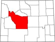 | |
| Towns | ||
| CDPs | ||
| Unincorporated communities | ||
| Ghost town | ||
| Indian reservation | ||
This article is issued from
Wikipedia.
The text is licensed under Creative Commons - Attribution - Sharealike.
Additional terms may apply for the media files.