| [3] |
Name on the Register[4] |
Image |
Date listed[5] |
Location |
City or town |
Description |
|---|
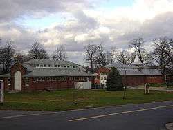
| 1 |
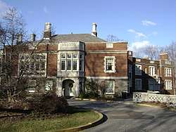
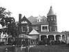
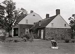
Ailsa Farms |
|
April 30, 1976
(#76001181) |
300 Pompton Rd.
40°56′37″N 74°11′50″W / 40.943611°N 74.197222°W / 40.943611; -74.197222 (Ailsa Farms) |
Wayne |
The Ailsa Farms estate is now William Paterson University. The estate's house (Haledon Hall) has been restored as Hobart Manor. |
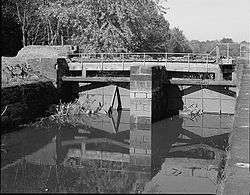
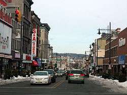
| 2 |
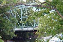
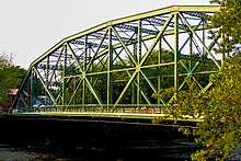
Arch Street Bridge over the Passaic River |
|
March 22, 2018
(#100002230) |
Arch St. over Passaic R.
40°55′24″N 74°10′12″W / 40.923226°N 74.169963°W / 40.923226; -74.169963 (Arch Street Bridge over the Passaic River) |
Paterson |
|
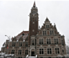
| 3 |
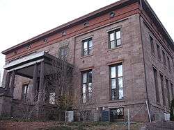
Aycrigg Mansion |
|
April 29, 1982
(#82003299) |
Main Ave. and Temple Pl.
40°51′02″N 74°07′30″W / 40.850556°N 74.125°W / 40.850556; -74.125 (Aycrigg Mansion) |
Passaic |
|
| 4 |
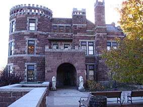
Belle Vista |
|
June 3, 1976
(#76001180) |
Valley Rd. in Garret Mountain Reservation
40°54′00″N 74°10′24″W / 40.9°N 74.173333°W / 40.9; -74.173333 (Belle Vista) |
Paterson |
|
| 5 |
Botany Worsted Mills Historic District |
|
July 26, 1991
(#91000928) |
80-82 and 90 Dayton Ave. and 6-32 Mattimore St.
40°52′25″N 74°07′10″W / 40.873611°N 74.119444°W / 40.873611; -74.119444 (Botany Worsted Mills Historic District) |
Passaic |
|
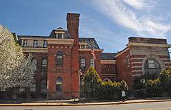
| 6 |
Pietro Botto House |
|
July 30, 1974
(#74001188) |
83 Norwood St.
40°56′05″N 74°11′19″W / 40.934722°N 74.188611°W / 40.934722; -74.188611 (Pietro Botto House) |
Haledon |
Also known as Pietro and Maria Botto House |
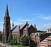
| 7 |
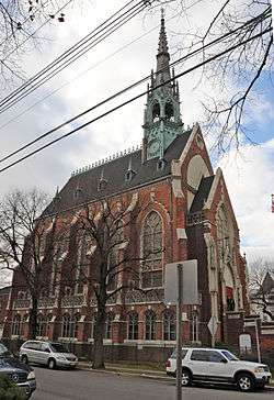
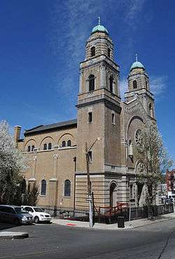
Cathedral of St. John the Baptist |
|
December 16, 1977
(#77000903) |
Main and Grand Sts.
40°54′46″N 74°10′21″W / 40.912778°N 74.1725°W / 40.912778; -74.1725 (Cathedral of St. John the Baptist) |
Paterson |
|
| 8 |
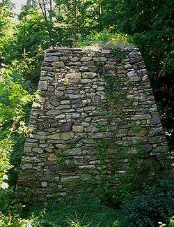
Clinton Furnace |
|
June 18, 1976
(#76001179) |
Off NJ 23 at Clinton Reservoir
41°04′20″N 74°27′00″W / 41.072222°N 74.45°W / 41.072222; -74.45 (Clinton Furnace) |
Newfoundland |
|
| 9 |
Frederick William Cooke Residence |
|
July 8, 1982
(#82003302) |
384 Broadway
40°55′06″N 74°09′31″W / 40.918333°N 74.158611°W / 40.918333; -74.158611 (Frederick William Cooke Residence) |
Paterson |
Destroyed by fire in 1991.[6] |
| 10 |
Danforth Memorial Library |
|
March 1, 1984
(#84002782) |
250 Broadway
40°55′05″N 74°09′52″W / 40.918056°N 74.164444°W / 40.918056; -74.164444 (Danforth Memorial Library) |
Paterson |
|
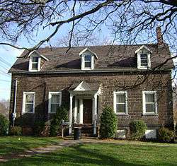
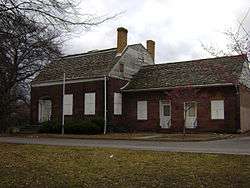
| 11 |
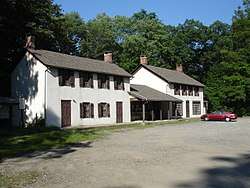
Dey Mansion |
|
December 18, 1970
(#70000392) |
199 Totowa Rd.
40°54′56″N 74°14′00″W / 40.915556°N 74.233333°W / 40.915556; -74.233333 (Dey Mansion) |
Wayne |
|
| 12 |
Dundee Canal Industrial Historic District |
|
January 21, 1999
(#98001640) |
George St., N along Dundee Canal, approx. 1.2 mi. to headgates opposite E. Clifton Ave.
40°52′25″N 74°07′12″W / 40.873611°N 74.12°W / 40.873611; -74.12 (Dundee Canal Industrial Historic District) |
Passaic |
|
| 13 |
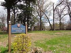
Eastside Park Historic District |
|
July 7, 2004
(#04000673) |
Roughly bounded by 20th, Vreeland, and 11th Aves., E. 33rd St. and Mclean Bvd.
40°54′53″N 74°08′13″W / 40.914713°N 74.136815°W / 40.914713; -74.136815 (Eastside Park Historic District) |
Paterson |
|
| 14 |
John W. Ferguson House |
|
May 23, 1980
(#80002516) |
421 12th Ave.
40°55′11″N 74°08′46″W / 40.919722°N 74.146111°W / 40.919722; -74.146111 (John W. Ferguson House) |
Paterson |
Demolished in 1988.[7] |
| 15 |
Goffle Brook Park |
|
November 1, 2002
(#02001276) |
Goffle Rd., bet. Lafayette and MacFarlan Ave.
40°57′22″N 74°09′42″W / 40.956111°N 74.161667°W / 40.956111; -74.161667 (Goffle Brook Park) |
Hawthorne |
|
| 16 |
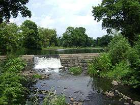
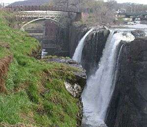
Great Falls of Paterson/S.U.M. Historic District |
|
April 17, 1970
(#86001507) |
At Passaic River
40°55′01″N 74°10′52″W / 40.917064°N 74.181061°W / 40.917064; -74.181061 (Great Falls of Paterson/S.U.M. Historic District) |
Paterson |
|
| 17 |
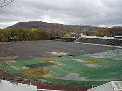
Hinchliffe Stadium |
|
March 22, 2004
(#04000223) |
Maple and Liberty Sts., overlooking the Great Falls of the Passaic
40°55′13″N 74°10′53″W / 40.920278°N 74.181389°W / 40.920278; -74.181389 (Hinchliffe Stadium) |
Paterson |
Listed as "National Register of Historic Places - Local Significance."
This error was never corrected. |
| 18 |
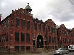
Kossuth Street School |
|
April 10, 1980
(#80002515) |
47 Kossuth St.
40°56′17″N 74°11′01″W / 40.938058°N 74.183531°W / 40.938058; -74.183531 (Kossuth Street School) |
Haledon |
|
| 19 |
Long Pond Ironworks |
|
January 11, 1974
(#74001189) |
NE of West Milford on NJ 511
41°08′47″N 74°18′39″W / 41.146389°N 74.310833°W / 41.146389; -74.310833 (Long Pond Ironworks) |
West Milford |
|
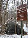
| 20 |
Morris Canal |
|
October 1, 1974
(#74002228) |
Irregular line beginning at Phillipsburg and ending at Jersey City
40°41′08″N 75°09′49″W / 40.685556°N 75.163611°W / 40.685556; -75.163611 (Morris Canal) |
Not applicable |
|
| 21 |
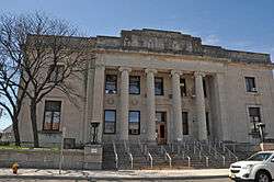
Passaic County Court House and United States Custom House and Post Office Historic District |
|
July 21, 2015
(#15000443) |
73-87, 63-65 Hamilton St.
40°54′49″N 74°10′17″W / 40.9137°N 74.1715°W / 40.9137; -74.1715 (Passaic County Court House and United States Custom House and Post Office Historic District) |
Paterson |
|
| 22 |
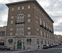
Passaic Elks Club |
|
December 28, 2005
(#05001485) |
29-31 Howe Ave.
40°51′46″N 74°07′40″W / 40.862778°N 74.127778°W / 40.862778; -74.127778 (Passaic Elks Club) |
Passaic |
|
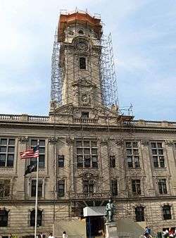
| 23 |
Paterson City Hall |
|
March 10, 1995
(#95000232) |
155 Market St.
40°55′00″N 74°10′19″W / 40.916667°N 74.171944°W / 40.916667; -74.171944 (Paterson City Hall) |
Paterson |
|
| 24 |
Paterson Downtown Commercial Historic District |
|
February 12, 1999
(#99000192) |
Roughly bounded by Patterson, Ward and Gross Sts., and Hamilton Ave.
40°55′02″N 74°10′21″W / 40.917222°N 74.1725°W / 40.917222; -74.1725 (Paterson Downtown Commercial Historic District) |
Paterson |
|
| 25 |
Public School Number Two |
|
March 8, 1978
(#78001790) |
Mill and Passaic Sts.
40°54′55″N 74°10′38″W / 40.915278°N 74.177222°W / 40.915278; -74.177222 (Public School Number Two) |
Paterson |
|
| 26 |
John W. Rea House |
|
September 17, 1999
(#99001168) |
675 Goffle Rd.
40°57′26″N 74°09′43″W / 40.957222°N 74.161944°W / 40.957222; -74.161944 (John W. Rea House) |
Hawthorne |
|
| 27 |
Reinhardt Mills |
|
May 9, 2003
(#03000393) |
283-297 21st Ave., 122-136 20th Ave., 46-72 Gray St., 45-67 State St.
40°54′28″N 74°09′43″W / 40.907778°N 74.161944°W / 40.907778; -74.161944 (Reinhardt Mills) |
Paterson |
|
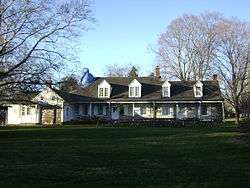
| 28 |
Ringwood Manor |
|
November 13, 1966
(#66000471) |
3 mi. E of Hewitt, Ringwood Manor State Park
41°08′40″N 74°15′10″W / 41.144444°N 74.252778°W / 41.144444; -74.252778 (Ringwood Manor) |
Ringwood |
|
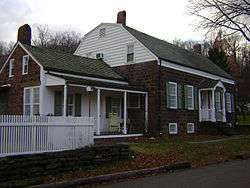
| 29 |
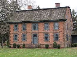
Schuyler-Colfax House |
|
April 3, 1973
(#73001133) |
2343 Paterson Hamburg Tpke.
40°59′15″N 74°16′47″W / 40.9875°N 74.279722°W / 40.9875; -74.279722 (Schuyler-Colfax House) |
Wayne |
|
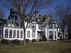
| 30 |
Skylands |
|
September 28, 1990
(#90001438) |
Ringwood State Park
41°07′30″N 74°14′14″W / 41.125°N 74.237222°W / 41.125; -74.237222 (Skylands) |
Ringwood |
|
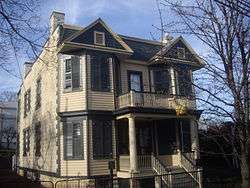
| 31 |
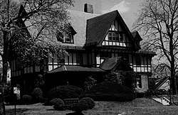
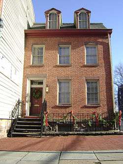
Reynier Speer House |
|
July 18, 1985
(#85001566) |
612 Upper Mountain Ave.
40°51′37″N 74°12′11″W / 40.8604°N 74.202947°W / 40.8604; -74.202947 (Reynier Speer House) |
Little Falls |
|
| 32 |
St. John's Evangelical Lutheran Church |
|
May 7, 1982
(#82003301) |
140 Lexington Ave.
40°52′04″N 74°07′38″W / 40.867778°N 74.127222°W / 40.867778; -74.127222 (St. John's Evangelical Lutheran Church) |
Passaic |
|
| 33 |
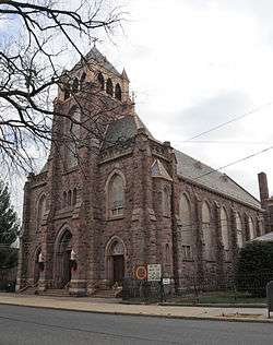
St. Michael's Roman Catholic Church |
|
December 15, 1978
(#78001791) |
74 Cianci St.
40°54′53″N 74°10′30″W / 40.914722°N 74.175°W / 40.914722; -74.175 (St. Michael's Roman Catholic Church) |
Paterson |
|
| 34 |
St. Nicholas Roman Catholic Church |
|
May 14, 1979
(#79001517) |
Washington, State and Ann Sts.
40°51′43″N 74°07′24″W / 40.861944°N 74.123333°W / 40.861944; -74.123333 (St. Nicholas Roman Catholic Church) |
Passaic |
|
| 35 |
Straight Street Bridge over the Passaic River |
|
March 22, 2018
(#100002231) |
Straight St. over Passaic R.
40°55′35″N 74°09′58″W / 40.926273°N 74.166015°W / 40.926273; -74.166015 (Straight Street Bridge over the Passaic River) |
Paterson |
|
| 36 |
Daniel Thompson and John Ryle Houses |
|
July 30, 1981
(#81000398) |
8 and 9 Mill St.
40°54′59″N 74°10′42″W / 40.916389°N 74.178333°W / 40.916389; -74.178333 (Daniel Thompson and John Ryle Houses) |
Paterson |
|
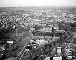
| 37 |
U.S. Animal Quarantine Station |
|
October 9, 1981
(#81000397) |
Clifton Ave.
40°52′05″N 74°09′43″W / 40.868056°N 74.161944°W / 40.868056; -74.161944 (U.S. Animal Quarantine Station) |
Clifton |
|
| 38 |
Van Riper-Hopper House |
|
August 21, 1972
(#72000806) |
533 Berdan Ave.
40°58′40″N 74°14′34″W / 40.977664°N 74.242903°W / 40.977664; -74.242903 (Van Riper-Hopper House) |
Wayne |
|
| 39 |
John and Anna Vreeland House |
|
May 13, 1982
(#82003300) |
971 Valley Rd.
40°52′05″N 74°11′28″W / 40.868056°N 74.191111°W / 40.868056; -74.191111 (John and Anna Vreeland House) |
Clifton |
|
| 40 |
Westside Park |
|
March 7, 1973
(#73001132) |
114 Totowa Ave.
40°54′47″N 74°11′28″W / 40.913056°N 74.191111°W / 40.913056; -74.191111 (Westside Park) |
Paterson |
|