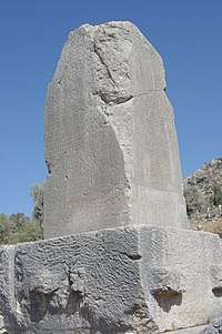
List of Lycian place names


.jpg)

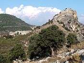
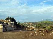

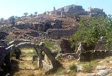
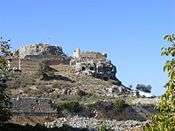
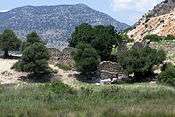

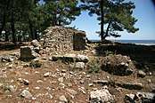
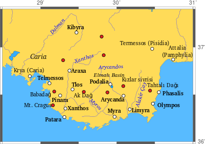
This article contains a list of Lycian place names that have survived from ancient Lycia in Anatolia. Names of settlements and geomorphic features are known from ancient literary sources. Ptolemy's Geography lists places in Asia Minor[1] and specifically Lycia.[2] Strabo's Geography has a section on Lycia as well,[3] as does Pliny's Natural History.[4] Stephanus of Byzantium includes a large number of Lycian places in Ethnica.[5] Hierocles in Synecdemus lists the cities in the eparchy of Lycia.[6] William Martin Leake's Journal of his own trips through Anatolia, as well as of those of many other travellers, with analyses of sources, mainly Ptolemy, is still a valuable source of information on the locations and appearances of the Lycian sites.[7] In addition, numerous inscriptions in the Lycian language state some place names in their Lycian forms.[8] The topographical information comes from the Aydin thesis, and was developed from Turkish military maps.[9]
This article does not address the task of defining Lycia. Over a thousand or more years, the borders of the historical territory, called Lycia in English, are not likely to have remained invariant. This list includes places named by some source at some time as "Lycian", and also any settlement with a Lycian language name, even though located in some other city-state. "Lycia" therefore represents a maximum territory, to which any historical Lycia was never exactly identical.
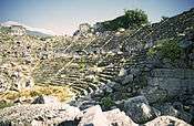
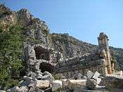
Aydin studied 44 out of 78 known ancient settlements. Many more archaeological sites are not identifiable with ancient settlements. Aydin also collected information on 870 Turkish settlements over the same region.[10] The moderns, certainly, populate the region much more densely than the ancients.
Some of the modern place names are given in Turkish. For the most part, the equivalent English, French or German pronunciations are good approximations, but Turkish has some letters not present in those languages. Ğ or ğ is not pronounced, but lengthens the preceding vowel. For example, dağ, "mountain", is pronounced daa. Substitution of an English G or g is false. Ç or ç is a ch as in child, Ş or ş is an sh as in shore. What appear to be an English C or c is a J as in John, while the J or j is pronounced as the z in azure. The vowels have a short rather than a long pronunciation. As Turkish is an agglutinative language, the endings do not have the same meanings; e.g., daği is not the plural of dağ, which is daĝlar (daalar).
Contents: Top · 0–9 A B C D E F G H I J K L M N O P Q R S T U V W X Y Z
A
| English classical name | Inscriptional name | Description | Sources |
|---|---|---|---|
| Acalessus | Greek Akalessos | Stephanus, Hierocles, who has Akalisos. | |
| Acarassus | Greek Akarassos | Stephanus | |
| Aedesa River | Turkish Ak Çay.[11] | Pliny the Elder | |
| Agathe Island | Greek Agathe. | Stephanus | |
| Alimala | Greek Alimala | Stephanus | |
| Alina Island | Greek Alina. | Stephanus, an island belonging to Crya. | |
| Amelas | Pliny the Elder | ||
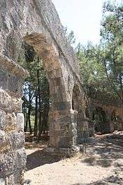
| Andriaca | 36°13′46.6″N 29°57′30.6″E / 36.229611°N 29.958500°E, Greek Andriake, 2.543 km (1.580 mi) from Tugluc, elevation 0. | Ptolemy, Pliny. | |
| Anticragus Mountain | Greek Antikragos, Turkish Buba Dağ.[11] | Strabo. | |
| Antiphellus | Greek Antiphellos, Turkish Kaş[11] | Ptolemy, Strabo, Pliny, who says it was formerly Habessus, Stephanus, Hierocles. | |
| Aperlae | Apr and prl | 36°9′43.5″N 29°47′19.9″E / 36.162083°N 29.788861°E, elevation 56 m (184 ft). Greek Aperlai, a former port of Lycia, Turkish Siçak Iskelesi,[11] the docks on Aperlai Bay, 4.11 km (2.55 mi) from Kiliçli. | Lycian name from coins. Listed in Ptolemy as Aperroe, in Pliny as Aperræ. Hierocles has Aperlai. |
| Apollonia Island | Greek Apollonia, Turkish Sıçak.[11] | Stephanus | |
| Aptera | Greek Aptera | Stephanus | |
| Araxa | Araththi | Greek Araksa, located at Turkish Ören on the Xanthus River. | Ptolemy, Stephanus, Hierocles. The Lycian name is from coins. |
| Argais Island | Greek Argais | Stephanus | |
| Arna | See Xanthus | ||
| Arneae | Greek Arneiai. | Stephanus, who calls it a "small city" and says that Homer called it Orneiai. | |
| Arsinoe | Greek Arsinoe | Stephanus | |
| Artymnesus | Greek Artumnesos | Stephanus | |
| Arycanda | Arykawanda | Greek Arukanda, located at Aykiriçay in Antalya Province. | Stephanus, Hierocles. |
| Arycandus River | Greek Arukandos, Turkish Karasu Çay.[12] | Pliny, who says it is a tributary of the Xanthus. | |
| Ascandalis | Pliny the Elder | ||
| Aspalathis Island | Greek Aspalathis | Stephanus | |
| Aspis Island | Greek Aspis | Stephanus | |
| Aulae | Greek Aulai | Stephanus |
B
| English classical name | Inscriptional name | Description | Sources |
|---|---|---|---|
| Balbura | Greek Balboura, Turkish Çölkayaği[12] or Çölkayiği[13] | Ptolemy, Pliny, Stephanus | |
| Balura | Greek Baloura. | Hierocles | |
| Bubon | Greek Boubon, Turkish Ibecik.[12] | Ptolemy, Pliny, Stephanus, who says it is Homer's Boudeion, Hierocles. |
C
| English classical name | Inscriptional name | Description | Sources |
|---|---|---|---|
| Cabalia | A region | Ptolemy, Strabo, who calls it Cabalis, and says it contains Oenianda, Balbura, Bubon. The Solymi lived there and the Lydians of Cibyra settled there. Part was in Milyas, part in Pisidia, and part in Rhodian territory, as well as in Lycia. | |
| Cabessus | Greek Kabessos | Stephanus | |
| Cadianda | Khadawãti | Greek Kaduanda, near Üzümlü. | |
| Cadrema | Stephanus | ||
| Calbius Spring | Greek Kalbios Krene. | Stephanus says that some say it is Kalainon. | |
| Callatebus | Greek Kallatebos | Stephanus | |
| Calinda | Greek Kalunda, Turkish Kozpınar.[14] | Listed in Ptolemy in coastal Lycia | |
| Canas | Pliny the Elder | ||
| Candyba | Khãkba | Greek Kanduba, close to Gendive. | Ptolemy, Pliny. Possibly the same as Hittite Hinduwa. Named for the son of Deucalion, according to Stephanus. Hierocles. |
| Cannus | Listed by Ptolemy as a coastal town | ||
| Carbana | Greek Karbana | Stephanus | |
| Carmylessus | adjacent to Kaya[15] | Strabo says it is a settlement on a ravine of Anticragus Mountain. | |
| Carya | Listed by Ptolemy as a coastal town | ||
| Carysis Island | Greek Karusis. | Stephanus, island belonging to Crya. | |
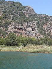
| Caunus | Khbide | Greek Kaunos, a major city and seaport near Dalyan | Ptolemy lists the city as part of Doris, meaning Dorian Anatolia, near the Lycian border. Hierocles. |
| Chelidoniae Islands | Greek Chelidoniai, Turkish Beş Adalar.[12] | Strabo says there are three off the promontory, one with a landing for vessels. | |
| Chelidonia Promontory | Greek Hiera Akra, "Sacred promontory," Turkish Gelidonya Burnu.[12] | Ptolemy, who calls it cliffs, and Strabo, who says the continuous chain of the Taurus Mountains start here. | |
| Cherrhonesus Promontory | Greek Cherrhonesos Akra | Stephanus | |
| Chimaera Ravine | Avlan valley.[12] | Strabo says it is a ravine "extending up from the shore." | |
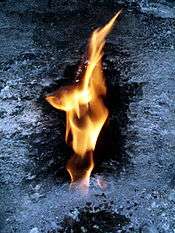
| Chimaera Mountain | Turkish Yanartaş.[12] | Pliny speaks of an eternal flame, which turns out to be a steady stream of inflammable gas. | |
| Chlyda | Listed by Ptolemy as a coastal town | ||
| Choma | Near Sarılar.[12] | Ptolemy, Pliny, who says it is on the Aedesa, Hierocles. | |
| Chrysaor | Greek Chrysaoris. | Stephanus says this is a Carian city with substantial Lycian residents. | |
| Cibyra | Greek Kibura, abandoned site north of Gölhisar. | Strabo. An independent city, ruler of the Tetrapolis, never politically part of Lycia, but housing a population element speaking the language of the Solymi. The state was called the Cibyratis. | |
| Cisthene island and town | Strabo | ||
| Climax Mountain | Greek Klimaks | Strabo | |
| Cochliousa Island | Greek Kochliousa | Stephanus | |
| Comba | Greek Kombe | Ptolemy, Hierocles has Kombe. | |
| Comistaraus | Greek Komistaraos. | Hierocles | |
| Corycus | Greek Korukos | Described by Strabo as a stretch of coast. | |
| Corydalla | 36°22′5.9″N 30°18′4.6″E / 36.368306°N 30.301278°E, Greek Korudalla, 424 m (1,391 ft) from Kumluca. Elevation 30 m (98 ft), not a mountain village. | Ptolemy, a mountain village of Pliny. | |
| Cragus (KP) | Greek Kragos, a monetary district of Lycia | It had its own coinage. Implied by Ptolemy's "near the Cragus mountains." | |
| Cragus Mountain | Greek Kragos, Turkish Avdancık or Sandak Dağ.[16] | Pliny, Ptolemy, Strabo, who says it has eight promontories. | |
| Cragus | Greek Kragos. | Strabo mentions a city of the same name as the mountain. | |
| Crambusa | Strabo | ||
| Crya | Greek Krua | Stephanus | |
| Cyaneae | 36°15′10.5″N 29°49′45.7″E / 36.252917°N 29.829361°E, elevation 653 m (2,142 ft), Greek Kuaneai, 350 m (1,150 ft) from Turkish Yavı.[16] | Pliny the Elder | |
| Cydna | Ptolemy |
D
| English classical name | Inscriptional name | Description | Sources |
|---|---|---|---|
| Daedala | Greek Daidala. A known archaeological site at Inlice Asari on an uninhabited hill in the countryside about 2.5 mi. to the northeast of Göcek.[17] | A coastal town in Ptolemy, under Rhodes in Strabo and Stephanus, who says it was named after Dedalus. | |
| Daedala Mountain | Kizildağ[18] | A mountain within Lycia on the western border, in Strabo, Stephanus. | |
| Daphne | Stephanus | ||
| Dias | Stephanus | ||
| Dolchiste island | Greek Dolchiste, Turkish Kekova.[18] | Ptolemy, Stephanus. | |
| Doliche Island | Greek Doliche. | Stephanus, who relates that Alexandros says it is the same as Dolchiste Island, but Callimachus does not. | |
| Drepana | Stephanus |
E
| English classical name | Inscriptional name | Description | Sources |
|---|---|---|---|
| Edebessus | Greek Edebessos | Stephanus | |
| Elaiou Teichos | Stephanus | ||
| Elebesus | Greek Elebesos. | Hierocles | |
| Eleutherai | Stephanus | ||
| Ereuates | Stephanus | ||
| Eudocia | Greek Eudokia | Hierocles |
G
| English classical name | Inscriptional name | Description | Sources |
|---|---|---|---|
| Gagae | 36°17′56.4″N 30°21′17.3″E / 36.299000°N 30.354806°E, elevation 34 m (112 ft). Greek Gagai, located at Yali, within Mavikent, within Kumluca. This is not, however, a mountain community. Opinions vary. | A mountain village in Pliny, an old fort in Stephanus. Hierocles has Gaga. | |
| Glaukou demos | Stephanus says it was named after the hero, Glaucus. |
H
| English classical name | Inscriptional name | Description | Sources- |
|---|---|---|---|
| Henoanda | Greek Henoanda. | Hierocles | |
| Hiera | See Chelidonia Promontory | ||
| Hephæstium | City located by Pliny below Chimaera Mountain | ||
| Hippou Kome | Turkish İtasar.[18] | Stephanus | |
| Hoauapus | Greek Hoauapos. | Hierocles | |
| Hylami | Greek Hulamoi. | Stephanus | |
| Hytenna | Greek Hutenna | Stephanus |
I
| English classical name | Inscriptional name | Description | Sources |
|---|---|---|---|
| Ilaris | Stephanus | ||
| Isinda | Isñta | Located at Belenli, or, at another period, Alaettin Mahalle, Korkuteli.[14] | Strabo |
L
| English classical name | Inscriptional name | Description | Sources |
|---|---|---|---|
| Lamyra | Greek Lamura | Stephanus | |
| Lamyrus River | Greek Lamuros | Stephanus | |
| Limyra | Zẽmuri | Greek Limura, a coastal city | Ptolemy, Strabo, Pliny, Stephanus, Hierocles. |
| Limyrus river | The Alakır Çay.[16] | Ptolemy, Strabo, Pliny. | |
| Lycia | Trm̃mis | Greek Lukia, the ancient region now in Turkey. | Listed in Ptolemy and numerous classical texts and inscriptions, as well as being the Lukka lands of Late Bronze Age Hittite and Egyptian inscriptions. |
| Lycian Promontory | Pliny. See Chelidonia Promontory. |
M
| English classical name | Inscriptional name | Description | Sources |
|---|---|---|---|
| Macra Island | Greek Makra, Turkish Meğri Ada.[19] | Stephanus | |
| Masicytus | A political unit of Lycia | It had its own coinage. Implied by Ptolemy's "near the Masicytus mountains." | |
| Masicytus mountains | Greek Masikytos, Turkish Alaca Dağ.[19] | Ptolemy lists without coordinates, Pliny has Masycites. | |
| Megale Island | Greek Megale. | Stephanus | |
| Megiste | Ancient Greek Megiste, modern Greek Kastellorizon.[19] | Strabo, Stephanus, who place it on the island, same name. | |
| Megiste Island | Ancient Greek Megiste, Modern Greek Megiste, belongs to Greece. | Ptolemy, Strabo, Stephanus. | |
| Melaenae | Greek Melainai | Stephanus | |
| Melanippion | Greek Melanippion, on Turkish Karaöz Limanı.[19] | Stephanus | |
| Menedemion | Stephanus | ||
| Meroe | Stephanus | ||
| Milias | Greek Miluas, Anglicised to Milyas. A district located on an alpine plain near Bay Dağ, identified by the Greek name on an inscription. | Ptolemy, Strabo. | |
| Misai | Misae | Hierocles | |
| Molydeia | Moludeia | Stephanus | |
| Myra | 36°15′47.1″N 29°58′37.0″E / 36.263083°N 29.976944°E, elevation 239 m (784 ft), Greek Mura, 295 m (968 ft) from Sumeli in Demre.[19] | Strabo, Pliny, Stephanus. Hierocles has Myra Metropolis. |
N
| English classical name | Inscriptional name | Description | Sources |
|---|---|---|---|
| Nisa | Ptolemy | ||
| Noscopium | Pliny the Elder |
O
| English classical name | Inscriptional name | Description | Sources |
|---|---|---|---|
| Octapolis | Listed in Ptolemy | ||
| Oenoanda | Hieroglyphic Luwian Wiyanawanda | Turkish İncealiler.[19] | Ptolemy, Stephanus, Pliny as Oenianda |
| Olympus | Turkish Deliktaş.[19] Also called Hadrianopolis. | Listed by Ptolemy, Strabo, Pliny. | |
| Olympus, Mountain | Tahtalı Dağ.[19] | Strabo, who says it is also called Phoenicus. |
P
| English classical name | Inscriptional name | Description | Sources |
|---|---|---|---|
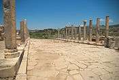
| Patara | Lycian Pttara, Hieroglyphic Luwian Patara, Hittite Patar. | 36°15′58.0″N 29°18′54.3″E / 36.266111°N 29.315083°E, elevation 2 metres (6.6 ft), Greek Patara, a port city, capital of the Lycian League, at Turkish Gelemiş.[20] Also named Arsinoe. | Ptolemy, Strabo, Stephanus, Hierocles. |
| Perdicia | Greek Perdikia | Village and harbor in Stephanus | |
| Phaselis | 36°31′35.2″N 30°32′53.3″E / 36.526444°N 30.548139°E, elevation 9 m (30 ft). 3,190 m (1.98 mi) from Egelkoyu in Tekirova.[20] | Ptolemy, Strabo, who says it is a city with three harbors and a lake. | |
| Phasydis | Greek Phasudis. | Hierocles | |
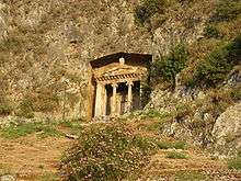
| Phellus | Wehñta | Greek Phellos, at Turkish Çukurbağ.[20] | Ptolemy, Strabo, Pliny, Stephanus, Hierocles. |
| Phoinkous Island | Stephanus, "an island against Lycia." | ||
| Phrixus | Greek Phriksos | Stephanus | |
| Physcia | Greek Phuskia | Stephanus, a mountain city | |
| Pinara | Lycian Pilleñni, Hieroglyphic Luwian Pinali | Near the village of Minara in the Xanthus Valley. | Ptolemy, Strabo, Pliny, Stephanus, who says it is a large city under Cragus. Hierocles. |
| Plateis Island | Greek Plateis. | Stephanus | |
| Podalia | Greek Podalia, Turkish Söğle.[20] | Ptolemy, Pliny, Stephanus, Hierocles. | |
| Pyrra | Pliny the Elder |
R
| English classical name | Inscriptional name | Description | Sources |
|---|---|---|---|
| Rhengcylias | Greek Rhegkulias | Hierocles | |
| Rhax Island | Greek Rhaks | Stephanus | |
| Rhoge Island | Greek Rhoge, Turkish Kara Ada.[21] | Stephanus | |
| Rhodia | 36°22′38.0″N 30°16′31.7″E / 36.377222°N 30.275472°E, elevation 44 m (144 ft), not a mountain village. Greek Rhodia, near Kumluca.[21] | Stephanus, Ptolemy, Pliny, who calls it Rhodiopolis, and a mountaian village. |
S
| English classical name | Inscriptional name | Description | Sources |
|---|---|---|---|
| Sacred Promontory | See Chelidonia Promontory | ||
| Sagalassus | Greek Sagalassos | Ptolemy, Strabo. | |
| Sebeda | Greek Sebeda, Turkish Bayındır Liman.[21] | Stephanus, town and harbor. | |
| Sidake | Greek Sidake. | Stephanus | |
| Sidarous | Greek Sidarous, Turkish Ceneviz Limanı.[21] | Stephanus, town and harbor | |
| Sidene | Greek Sidene | Stephanus | |
| Sidyma | 36°24′36.9″N 29°11′30.1″E / 36.410250°N 29.191694°E, elevation 545 m (1,788 ft). Greek Siduma, Turkish Dodurga.[21] | Ptolemy, Strabo, who says it was on a mountain. Stephanus, Hierocles. | |
| Simena | 36°11′41.2″N 29°51′49.7″E / 36.194778°N 29.863806°E, elevation 13 m (43 ft), 1.513 km (0.940 mi) from Kaleüçağız. | Stephanus, Pliny. | |
| Sindia | Greek Sindia | Stephanus, possibly the same as Strabo's Sinda near or in Cabalis. | |
| Scari | Greek Skaroi | Stephanus | |
| Sirbis River | See Xanthus River. | ||
| Solyma Mountain | Turkish Güllük Dağ.[21] | Strabo. Elsewhere he calls it Solymus and says it is above Termessus. | |
| Sura Oracle | Surezi | Greek Soura, Turkish Sura.[21] | Stephanus |
| Syessa Sanctuary to Leto | Greek Suessa | Stephanus | |
| Symbra | Ptolemy |
T
| English classical name | Inscriptional name | Description | Sources |
|---|---|---|---|
| Taurus Mountains | Greek Tauros, Turkish Toros Dağları | Strabo, who says they start at Cape Chelidonia. | |
| Telandrus | Turkish Tersane.[22] | Pliny the Elder | |
| Telephian Community | Greek Telephios Demos | Stephanus, a community at the spring. | |
| Telephus Spring | Greek Telephou Krene. | Stephanus | |
| Telmessis Promontory | Greek Telmessis akra, Turkish Çamlı Burun.[22] | Strabo says it is a promontory with a harbor. Stephanus. | |
| Telmessus | Telebehi | 36°37′21.3″N 29°6′41.4″E / 36.622583°N 29.111500°E, Greek Telmessos, at Turkish Fethiye, elevation 6 m (20 ft). | Ptolemy, Strabo, Pliny. Stephanus says it is a city of Caria, although expressing also the Lycian view. Hierocles has Telmisos. |
| Tenedos | Stephanus | ||
| Termera | Stephanus | ||
| Termessus | Trm̃mis | Greek Termēs(s)os | Described by Strabo as a city of Pisidia in the pass to Milyas. Same name as Lycia. Strabo says the Termessians are called the Solymi. Cibyra is just below and near Termessus. |
| Thryanda | Greek Thruanda | Stephanus | |
| Tlos | Lycian Tlãñna, Hieroglyphic Luwian Talawa | 36°33′51.9″N 29°25′14.8″E / 36.564417°N 29.420778°E, elevation 370 m (1,210 ft). Greek Tlos, near Turkish Düğer.[22] | Ptolemy, Strabo, Pliny, Stephanus. Hierocles has Tlo. |
| Trauala | Greek Trauala. | Stephanus | |
| Tymena | Greek Tumena | Stephanus says it is a village of Lycia. | |
| Tymnessus | Tuminehi < *Tumine, * Tumini, or *Tumina | Greek Tumnessos. | Stephanus says it is a city of Caria but the citizens were Lycian at first. |
X
| English classical name | Inscriptional name | Description | Sources |
|---|---|---|---|
| Xanthus | Lycian Arñna, Hieroglyphic Luwian Awarna, and possibly Arinna | Greek Ksanthos, the largest city of Lycia, the site of present-day Kınık, Antalya Province, Turkey. | Listed in Ptolemy, Hierocles, Strabo, who says it was later called Arsinoe, and Pliny. Stephanus says it was called Arna before Xanthus. |
| Xanthus river | Hittite Siyanti | Turkish Esen Çay.[22] | Listed by Ptolemy, Strabo, who says it was formerly the Sirbis, and Pliny. |
Notes
- ↑ Book 5, Chapter 2.
- ↑ Book 5, Chapter 3.
- ↑ Strabo. "Book XIV, Chapter 3". Geography. Also Strabo. "Book XIII, Chapter 4, Sections 15-17". Geography.
- ↑ Pliny the Elder. "Book V, Chapter 28". Natural History.
- ↑ Stephanus of Byzantium. "Index". Ethnica.
- ↑ Hierocles (1893). "Eparchia Lukias". In Augustus Burckhardt. Synecdemus. Lipsiae: Teubner. pp. 26–28.
- ↑ Leake 1824, Chapter 5.
- ↑ This article relies heavily for its Lycian names on Bryce 1986, pp. xvi, 70, 76–93, 211. Bryce in turn was influenced by Ten Cote, PH. H.J. Houwink (1961). "Chapter Four, The Transliteration of Proper Names, 3. The Greek transliteration of Lycian place names". The Luwian Population Groups of Lycia and Cilicia Aspera During the Hellenistic Period. Leiden, Netherlands: Brill. pp. 106–108. Ten Cate lists all the inscriptions bearing on the names. Most present variants. Only one appears in column 2 above, typically that favored by Bryce. There are slight differences in the transliteration to English as well.
- ↑ Aydin 2006, pp. 39, 102
- ↑ Aydin 2006, p. 84.
- 1 2 3 4 5 Foss & Mitchell 2000, p. 997.
- 1 2 3 4 5 6 7 8 Foss & Mitchell 2000, p. 998.
- ↑ Stillwell, Richard. MacDonald, William L. McAlister, Marian Holland (1976). "The Princeton encyclopedia of classical sites". Princeton University Press. Retrieved December 9, 2014.
- 1 2 Foss & Mitchell 2000, p. 1000.
- ↑ Richard Talbert. Barrington Atlas of the Greek and Roman World. p. 1000. ISBN 0-691-03169-X. Retrieved December 18, 2014.
- 1 2 3 Foss & Mitchell 2000, p. 1001
- ↑ Freely 2004, p. 270.
- 1 2 3 Foss & Mitchell 2000, p. 999.
- 1 2 3 4 5 6 7 8 Foss & Mitchell 2000, p. 1002.
- 1 2 3 4 Foss & Mitchell 2000, p. 1003.
- 1 2 3 4 5 6 7 Foss & Mitchell 2000, p. 1004
- 1 2 3 4 Foss & Mitchell 2000, p. 1005.
References
- Bryce, Trevor (1986). The Lycians. Volume 1, The Lycians in literary and epigraphic sources. Copenhagen: Museum Tusculanum Press. ISBN 87-7289-023-1.
- Leake, William Martin (1824). Journal of a tour in Asia Minor, with comparative remarks on the ancient and modern geography of that country. London: Murray.
- Freely, John (2004). The western shores of Turkey: discovering the Aegean and Mediterranean Coasts. Tauris Parke paperbacks. London: Tauris Parke.
- Foss, C.; Mitchell, S. (2000), "Map 65 Lycia - Pisidia", in Talbert, J.A., Map-by-Map Directory (PDF), Princeton: Princeton University Press, pp. 998–1012
- Aydın, Ervin Kenan (2006). Examining the Lycian sites by using GIS (PDF). Dissertation, Middle East Technical University. Ankara: [s.n.]
External links
- Foss, Pedar W. "Lycia". Encyclopedia of the Roman Provinces (ERP). Archived from the original on 2012-02-26.
|  | |
† Italy was never constituted as a province, instead retaining a special juridical status until Diocletian's reforms. | ||