List of Historic Sites of Japan (Okinawa)

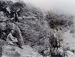
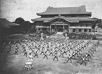
This list is of the Historic Sites of Japan located within the Prefecture of Okinawa.[1] Much of the heritage of the Ryūkyū Kingdom and Islands was destroyed during the Battle of Okinawa. The mausoleum complex of Tamaudun, Shuri Castle, Katsuren Castle, Nakagusuku Castle, Nakijin Castle, Zakimi Castle, Sefa-utaki, and Sonohyan-utaki all form part of the UNESCO World Heritage Site Gusuku Sites and Related Properties of the Kingdom of Ryukyu.[2]

National Historic Sites

As of 1 September 2017, forty Sites have been designated as being of national significance.[3][4][5]

Site Island Municipality Comments Image Coordinates Type Ref.
Furusutobaru Castle
フルスト原遺跡
Furusutobaru iseki
Ishigaki IslandIshigakiC13-C15 gusuku-style fortifications, domestic buildings, utaki, and tombs extending for 12.3 ha on the Ryūkyū limestone (琉球石灰岩) hills overlooking Miyara Bay; said to have been used by Oyake Akahachi and suppressed by the forces of Shō Shin in 1500; finds include local pottery, white porcelain and celadon from China, and the bones of horses and cows[6][7]24°21′04″N 124°11′42″E / 24.3511203°N 124.19500445°E / 24.3511203; 124.19500445 (Furusutobaru Site)2
Agena Castle Site
安慶名城跡
Agena-jō ato
Okinawa IslandUrumagusuku fortified in the fifteenth century[8]26°22′51″N 127°51′01″E / 26.38088963°N 127.85036561°E / 26.38088963; 127.85036561 (Agena Castle Site)2
Iha Shell Mound
伊波貝塚
Iha kaizuka
Okinawa IslandUrumaJōmon site discovered in 1920; finds include shells, fish bones, animal borns, earthenware, stoneware, and goods made of horn[8][9]26°25′14″N 127°49′15″E / 26.42047542°N 127.82081653°E / 26.42047542; 127.82081653 (Iha Shell Mound)1
Ireibaru Site
伊礼原遺跡
Ireibaru iseki
Okinawa IslandChatanearly Jōmon site; goods of jade and obsidian are evidence of early maritime trade26°19′28″N 127°45′31″E / 26.32434512°N 127.7586994°E / 26.32434512; 127.7586994 (Ireibaru Site)1
Uegusuku Castle Site
宇江城城跡
Uegusuku-jō ato
Kumejima IslandKumejimaof uncertain date, but probably razed at the time of assimilation into the Ryūkyū Kingdom c.1500; finds include Chinese ceramics and fish bones; the view extends over the entire island[10]26°22′37″N 126°46′12″E / 26.37696201°N 126.77013595°E / 26.37696201; 126.77013595 (Uegusuku Castle Site)2
Uzahama Site
宇佐浜遺跡
Uzahama iseki
Okinawa IslandKunigamiYayoi site on the northern tip of the island[11]26°51′58″N 128°15′37″E / 26.86602391°N 128.26020475°E / 26.86602391; 128.26020475 (Uzahama Site)1
Urasoe Castle Site
浦添城跡
Urazoe-jō ato
Okinawa IslandUrasoefortifications date back to C13/C14; incurred heavy damage during the Battle of Okinawa[12]26°14′47″N 127°43′56″E / 26.24648788°N 127.73227642°E / 26.24648788; 127.73227642 (Urazoe Castle Site)2
Enkaku-ji Site
円覚寺跡
Enkaku-ji ato
Okinawa IslandNahafounded in 1492 by Shō Shin; the wooden temple buildings were destroyed during the war, an ornately carved stone bridge (ICP) survives[13]26°13′06″N 127°43′11″E / 26.21832884°N 127.71963726°E / 26.21832884; 127.71963726 (Enkakuji Site)3
Ogidō Shell Mound
荻堂貝塚
Ogidō kaizuka
Okinawa IslandKitanakagusukuJōmon period, with a 1.2 m thick deposit of shells[14]26°17′36″N 127°47′55″E / 26.29323453°N 127.79865309°E / 26.29323453; 127.79865309 (Ogidō Shell Mound)1
Shimotabaru Castle Site
下田原城
Shimotabaru-jō ato
Hateruma IslandTaketomi24°04′10″N 123°46′45″E / 24.06934384°N 123.77915508°E / 24.06934384; 123.77915508 (Shimotabaru Castle Site)2
Tamagusuku Castle Site
玉城城跡
Tamagusuku-jō ato
Okinawa IslandNanjō26°08′39″N 127°46′50″E / 26.1441253°N 127.78067218°E / 26.1441253; 127.78067218 (Tamagusuku Castle Site)2
Tamaudun
玉陵
Tamaudun
Okinawa IslandNaharoyal mausoleum complex constructed in 1501; World Heritage Site26°13′06″N 127°42′53″E / 26.21831078°N 127.71465507°E / 26.21831078; 127.71465507 (Tamaudūn)7
Kushibaru Shell Mound
具志原貝塚
Kushibaru kaizuka
Ie IslandIevariety of shells and Jōmon and Yayoi earthenware[15]26°42′30″N 127°48′03″E / 26.7083557°N 127.80085456°E / 26.7083557; 127.80085456 (Kushibaru Shell Mound)1
Gushikawa Castle Site
具志川城跡
Gushikawa-jō ato
Okinawa IslandItomanC13-C15 Chinese ceramics found during excavations; thirteen-year restoration project between 2000 and 2012[16]26°04′49″N 127°39′52″E / 26.08027649°N 127.66431713°E / 26.08027649; 127.66431713 (Gushikawa Castle Site (Itoman))2
Gushikawa Castle Site
具志川城
Gushikawa-jō ato
Kumejima IslandKumejimasame name but distinct from the castle in Itoman26°23′05″N 126°45′07″E / 26.38470951°N 126.75190674°E / 26.38470951; 126.75190674 (Gushikawa Castle (Kumejima))2
Kunigami Hōsei Kaidō
国頭方西海道
Kunigami hōsei kaidō
Okinawa IslandOnnahistoric route on the west coast of the island[17]26°26′05″N 127°47′23″E / 26.43476258°N 127.78981966°E / 26.43476258; 127.78981966 (Kunigamihōseikaidō)6
Nakijin Castle Site
今帰仁城跡 附シイナ城跡
Nakijin-jō ato tsuketari Shiina-jō ato
Okinawa IslandNakijinsacked in 1432; World Heritage Site; designation includes the site of Shiina Castle (シイナ城)[18]26°41′28″N 127°55′47″E / 26.69108846°N 127.92975556°E / 26.69108846; 127.92975556 (Nakijin Castle Site)2
Zakimi Castle Site
座喜味城跡
Zakimi-jō ato
Okinawa IslandYomitanconstructed c. 1420 by Gosamaru; World Heritage Site[19]26°24′30″N 127°44′30″E / 26.40840356°N 127.74176086°E / 26.40840356; 127.74176086 (Zakimi Castle Site)2
Sefa-utaki
斎場御嶽
Seifa-utaki
Okinawa IslandNanjōshrine; excavated artefacts including magatama are an ICP; World Heritage Site[20]26°10′24″N 127°49′38″E / 26.17325543°N 127.82717685°E / 26.17325543; 127.82717685 (Seifā Utaki)3
Yamada Castle Site
山田城跡
Yamada-jō ato
Okinawa IslandOnnaHome of Gosamaru. Partially deconstructed to build Zakimi Castle.26°25′11″N 127°47′12″E / 26.419737°N 127.786575°E / 26.419737; 127.786575 (Yamada Castle Site)2
Itokazu Castle Site
糸数城跡
Itokazu-jō ato
Okinawa IslandNanjōdamaged during the war[21]26°09′06″N 127°45′46″E / 26.15163312°N 127.76271914°E / 26.15163312; 127.76271914 (Itokazu Castle Site)2
Shuri Castle Site
首里城跡
Shuri-jō ato
Okinawa IslandNahapalace of the Ryūkyū Kings; the main hall was repurposed as the haiden of Okinawa Shrine; reconstructed after near-total destruction during the war; World Heritage Site26°13′01″N 127°43′09″E / 26.21699426°N 127.71903149°E / 26.21699426; 127.71903149 (Shuri Castle Site)2
Katsuren Castle Site
勝連城跡
Katsuren-jō ato
Okinawa IslandUrumaC15 fortified residence of Amawari; World Heritage Site[8]26°19′50″N 127°52′43″E / 26.33064943°N 127.8787427°E / 26.33064943; 127.8787427 (Katsuren Castle Site)2
Sakishima Beacons
先島諸島火番盛
Sakishima-shotō hibanmui
Sakishima IslandsMiyakojima, Ishigaki, Tarama, Taketomi, Yonagunibeacon network established in 1644 by the Ryūkyū Kings, under the influence of the Satsuma Domain, to monitor shipping in relation to the policy of sakoku[22]24°40′21″N 124°42′17″E / 24.672602°N 124.704697°E / 24.672602; 124.704697 (Sakishima Beacons)2
Kabira Shell Mound
川平貝塚
Kabira kaizuka
Ishigaki IslandIshigakiinland to the northwest of Kabira Bay24°28′01″N 124°07′58″E / 24.46695318°N 124.1327838°E / 24.46695318; 124.1327838 (Kabira Shell Mound)1
Ōyama Shell Mound
大山貝塚
Ōyama kaizuka
Okinawa IslandGinowan26°16′25″N 127°44′42″E / 26.27372255°N 127.74506971°E / 26.27372255; 127.74506971 (Ōyama Shell Mound)1
Yamato Spring
大和井
Yamato gā
Miyakojima IslandMiyakojimaconstructed c.1720 and mentioned in Yōsei-kyūki (雍正旧記) (1727); reserved for official use[23] (see also Water supply in Miyakojima)24°48′40″N 125°17′09″E / 24.81119218°N 125.28581142°E / 24.81119218; 125.28581142 (Yamato Spring)8
Chinen Castle Site
知念城跡
Chinen-jō ato
Okinawa IslandNanjōrepaired in C18 by Shō Kei[24]26°09′38″N 127°48′41″E / 26.16043586°N 127.8113489°E / 26.16043586; 127.8113489 (Chinen Castle Site)2
Nakagusuku Castle Site
中城城跡
Nakagusuku-jō ato
Okinawa IslandKitanakagusukubuilt by Gosamaru of Zakimi Castle to defend against Amawari of Katsuren Castle; World Heritage Site[25][26]26°17′02″N 127°48′05″E / 26.28401819°N 127.8014842°E / 26.28401819; 127.8014842 (Nakagusuku Castle Site)2
Nakagami Hōsei Kaidō
中頭方西海道及び普天間参詣道
Nakagami hōsei aidō oyobi Futenma sankeimichi
Okinawa IslandUrasoe26°14′45″N 127°43′19″E / 26.24594166°N 127.72194722°E / 26.24594166; 127.72194722 (Nakagami Hōsei Kaidō)6
Nakabaru Site
仲原遺跡
Nakabaru iseki
Ikeijima IslandUrumaC5 BC settlement with eleven sunken stone hearths[8]26°23′30″N 127°59′39″E / 26.39172832°N 127.99421926°E / 26.39172832; 127.99421926 (Nakabaru Site)1
Nakadomari Site
仲泊遺跡
Nakadomari iseki
Okinawa IslandOnnacave dwellings and shell mound[27]26°26′07″N 127°47′28″E / 26.43534998°N 127.79112758°E / 26.43534998; 127.79112758 (Nakadomari Site)1
Shimashīi-Ōzato Castle Site
島添大里城跡
Shimashīōzato-jō ato
Okinawa IslandNanjōcaptured by Shō Hashi in the early C15; excavations have uncovered Chinese ceramics and items of iron and bronze[28]26°08′26″N 127°46′07″E / 26.140664°N 127.768604°E / 26.140664; 127.768604 (Shimashīōzato Castle Site)2
Uchimaudūn
内間御殿
Uchimaudūn
Okinawa IslandNishiharacentre for veneration of the Ryūkyū Kings, founded on the site of the residence of Shō En before he became king; damaged during the war26°13′42″N 127°46′05″E / 26.2283337°N 127.7680754°E / 26.2283337; 127.7680754 (Uchimaudūn)3
Sueyoshi-gū Site
末吉宮跡
Sueyoshigū ato
Okinawa IslandNahashrine to Kumano Gongen dating to the time of Shō Taikyū, destroyed during the war[29]26°13′47″N 127°42′50″E / 26.22984537°N 127.71385161°E / 26.22984537; 127.71385161 (Sueyoshigū Site)3
Mekaru Tomb Cluster
銘苅墓跡群
Mekaru haka ato gun
Okinawa IslandNahagroup of 330 C14/15 tombs with a large C18 turtle-back tomb; includes the Izenadunchi Tomb (伊是名殿内の墓)[30]26°13′50″N 127°41′51″E / 26.23057554°N 127.69758267°E / 26.23057554; 127.69758267 (Mekaru Tomb Cluster)7
Momenbaru Site
木綿原遺跡
Momenbaru iseki
Okinawa IslandYomitanincludes a burial with a stone sarcophagus and Yayoi ceramics[31]26°22′12″N 127°44′06″E / 26.37007559°N 127.73498297°E / 26.37007559; 127.73498297 (Momenbaru Site)1
Sashiki Castle Site
佐敷城跡
Sashiki-jō ato
Okinawa IslandNanjō26°09′58″N 127°47′14″E / 26.16615068°N 127.78716622°E / 26.16615068; 127.78716622 (Sashiki Castle Site)2
Nakagusuku Hanta Road
中城ハンタ道
Nakagusuku Hanta michi
Okinawa IslandNakagusuku26°16′46″N 127°47′46″E / 26.279342°N 127.796043°E / 26.279342; 127.796043 (Nakagusuku Hanta Road)
Kitadaitōjima Phosphorus Mining Site
北大東燐鉱山
Kitadaitō-jima rinkōzan iseki
Kitadaitōjima IslandKitadaitō25°57′14″N 131°17′06″E / 25.954002°N 131.28511°E / 25.954002; 131.28511 (Kitadaitōjima Phosphorus Mining Site)

Prefectural Historic Sites

As of 1 May 2017, fifty-four Sites have been designated as being of prefectural importance.[5][32]

Site Island Municipality Comments Image Coordinates Type Ref.
Ryūtan and its Surroundings
龍潭及びその周辺
Ryūtan oyobi sono shūhen
Okinawa IslandNaha26°13′12″N 127°43′02″E / 26.220039°N 127.717277°E / 26.220039; 127.717277 (Ryūtan and its Surroundings)for all refs see
Sonohyan-utaki
園比屋武御嶽
Sonohyan utaki
Okinawa IslandNahaWorld Heritage Site26°13′05″N 127°43′02″E / 26.218114°N 127.717309°E / 26.218114; 127.717309 (Sonohyan-utaki)
Noguni Sōkan Grave
野国総官の墓
Noguni Sōkan no haka
Okinawa IslandKadena26°20′56″N 127°44′43″E / 26.348806°N 127.745311°E / 26.348806; 127.745311 (Noguni Sōkan Grave)
German Emperor's Tributary Monument
ドイツ皇帝博愛記念碑
Doitsu kōtei hakuai kinen hi
Miyakojima IslandMiyakojima24°48′24″N 125°16′45″E / 24.806628°N 125.279058°E / 24.806628; 125.279058 (German Emperor's Tributary Monument)
Nakasone Toyomiya Grave
仲宗根豊見親の墓
Nakasone Toyomiya no haka
Miyakojima IslandMiyakojima24°48′32″N 125°16′45″E / 24.808980°N 125.279138°E / 24.808980; 125.279138 (Nakasone Toyomiya Grave)
Uehiyayama Site
上比屋山遺跡
Uehiyayama iseki
Miyakojima IslandMiyakojima24°43′43″N 125°21′04″E / 24.728746°N 125.351086°E / 24.728746; 125.351086 (Uehiyayama Site)
Noborudake Spirit Stones
野原岳の霊石
Noborudake no tamaishi
Miyakojima IslandMiyakojima24°45′54″N 125°19′27″E / 24.765109°N 125.324178°E / 24.765109; 125.324178 (Noborudake Spirit Stones)
Nakazato Warehouse Overseer Site
仲里間切蔵元跡
Nakazato magiri kuramoto ato
Kumejima IslandKumejima26°21′17″N 126°48′29″E / 26.354805°N 126.808019°E / 26.354805; 126.808019 (Nakazato Warehouse Overseer Site)
Misakion
美崎御嶽
Misakion
Ishigaki IslandIshigaki24°20′07″N 124°09′30″E / 24.335298°N 124.158350°E / 24.335298; 124.158350 (Misakion)
Yagaji Untenbaru Sabaya Shell Mound
屋我地運天原サバヤ貝塚
Yagaji Untenbaru Sabaya kaizuka
Yagaji IslandNago26°40′17″N 128°00′10″E / 26.671468°N 128.002825°E / 26.671468; 128.002825 (Yagaji Untenbaru Sabaya Shell Mound)
Noguni Shell Mound Cluster
野国貝塚群
Noguni kaizuka-gun
Okinawa IslandKadena26°22′00″N 127°45′13″E / 26.366562°N 127.753530°E / 26.366562; 127.753530 (Noguni Shell Mound Cluster)
Sachihijā Shell Mound
崎樋川貝塚
Sachihijā kaizuka
Okinawa IslandNaha26°14′15″N 127°41′00″E / 26.237516°N 127.683363°E / 26.237516; 127.683363 (Sachihijā Shell Mound)
Henna Shell Mound
平安名貝塚
Henna kaizuka
Okinawa IslandUruma26°19′05″N 127°53′17″E / 26.318167°N 127.888000°E / 26.318167; 127.888000 (Henna Shell Mound)
Komesu Shell Mound
米須貝塚
Komesu kaizuka
Okinawa IslandItoman26°05′19″N 127°42′04″E / 26.088585°N 127.701023°E / 26.088585; 127.701023 (Komesu Shell Mound)
Kumejima Ōhara Shell Mound
久米島大原貝塚
Kumejima Ōhara kaizuka
Kumejima IslandKumejima26°21′01″N 126°43′38″E / 26.350344°N 126.727252°E / 26.350344; 126.727252 (Kumejima Ōhara Shell Mound)
Shimotabaru Shell Mound
下田原貝塚
Shimotabaru kaizuka
Hateruma IslandTaketomi24°04′13″N 123°46′39″E / 24.070172°N 123.777509°E / 24.070172; 123.777509 (Shimotabaru Shell Mound)
Nakama No.1 Shell Mound
仲間第一貝塚
Nakama daiichi kaizuka
Iriomote IslandTaketomi24°16′31″N 123°52′58″E / 24.275291°N 123.882694°E / 24.275291; 123.882694 (Nakama No.1 Shell Mound)
Nakama No.2 Shell Mound
仲間第二貝塚
Nakama daini kaizuka
Iriomote IslandTaketomi24°16′50″N 123°53′23″E / 24.280533°N 123.889818°E / 24.280533; 123.889818 (Nakama No.2 Shell Mound)
Binishi Shell Mound
平西貝塚
Binishi kaizuka
Iriomote IslandTaketomi24°19′33″N 123°55′02″E / 24.325708°N 123.917177°E / 24.325708; 123.917177 (Binishi Shell Mound)
Iejima Deer Fossils
伊江島鹿の化石
Iejima shika no kaseki
Iejima IslandIe26°44′08″N 127°48′49″E / 26.735531°N 127.813525°E / 26.735531; 127.813525 (Iejima Deer Fossils)
Bengadake
弁ケ嶽
Bengadake
Okinawa IslandNaha26°13′04″N 127°43′54″E / 26.217902°N 127.731552°E / 26.217902; 127.731552 (Bengadake)
Izena Tamaudun
伊是名玉御殿
Izena Tamaudun
Izena IslandIzena26°54′57″N 127°57′06″E / 26.915713°N 127.951552°E / 26.915713; 127.951552 (Izena Tamaudun)
Izena Castle Site
伊是名城跡
Izena-jō ato
Izena IslandIzena26°54′53″N 127°57′09″E / 26.914685°N 127.952410°E / 26.914685; 127.952410 (Izena Castle Site)
Birthplace of King Shō En
尚円王生誕地屋敷内「みほそ所」
Shō En ō seitanchi yashiki nai (Mihoso-dokoro)
Izena IslandIzena26°56′00″N 127°57′00″E / 26.933252°N 127.949964°E / 26.933252; 127.949964 (Birthplace of King Shō En)
Sashiki Yodore
佐敷ようどれ
Sashiki yōdore
Okinawa IslandNanjōfamily mausoleum of Shō Shishō, father of Shō Hashi; relocated from Sashiki Nishiuehara in 1764[33]26°09′44″N 127°47′20″E / 26.162237°N 127.788752°E / 26.162237; 127.788752 (Sashiki Yodore)
Large Stones of Nakashima
仲島の大石
Nakashima no ōishi
Okinawa IslandNaha26°12′41″N 127°40′37″E / 26.211289°N 127.677044°E / 26.211289; 127.677044 (Large Stones of Nakashima)
Nakijin Village Nakahara Baba
今帰仁村仲原馬場
Nakijin-son Nakahara baba
Okinawa IslandNakijin26°41′17″N 127°57′56″E / 26.688038°N 127.965564°E / 26.688038; 127.965564 (Nakijin Village Nakahara Baba)
Nishitō-utaki
西塘御嶽
Nishitō-utaki
Taketomi IslandTaketomi24°19′46″N 124°05′06″E / 24.329462°N 124.085051°E / 24.329462; 124.085051 (Nishitō-utaki)
Kuramoto Site
蔵元跡
Kuramoto ato
Taketomi IslandTaketomi24°19′09″N 124°04′38″E / 24.319177°N 124.077315°E / 24.319177; 124.077315 (Kuramoto Site)
Kakinohana Castle Site
垣花城跡
Kakinohana-jō ato
Okinawa IslandNanjō26°08′52″N 127°47′32″E / 26.147859°N 127.792314°E / 26.147859; 127.792314 (Kakinohana Castle Site)
Iso Castle Site
伊祖城跡
Iso-jō ato
Okinawa IslandUrasoe26°15′26″N 127°43′22″E / 26.257247°N 127.722850°E / 26.257247; 127.722850 (Iso Castle Site)
Iha Castle Site
伊波城跡
Iha-jō ato
Okinawa IslandUruma26°25′18″N 127°49′05″E / 26.421755°N 127.817999°E / 26.421755; 127.817999 (Iha Castle Site)
Ishikinawa Castle Site
伊敷索城跡
Ishikinawa-jō ato
Kumejima IslandKumejimaalso pronounced Chinaha Castle26°20′33″N 126°45′46″E / 26.342364°N 126.762915°E / 26.342364; 126.762915 (Ishikinawa Castle Site)
Shurikinjō-chō Ishidatami-michi
首里金城町石畳道
Shurikinjō-chō ishidatami-michi
Okinawa IslandNahaalso a Prefectural Place of Scenic Beauty26°12′58″N 127°42′55″E / 26.216035°N 127.715335°E / 26.216035; 127.715335 (Shurikinjō-chō Ishidatami-michi)
Kaiketsu Haneji River Monument
改決羽地川碑記
Kaiketsu Haneji-gawa hiki
Okinawa IslandNago26°37′08″N 128°01′02″E / 26.618841°N 128.017116°E / 26.618841; 128.017116 (Kaiketsu Haneji River Monument)
Yamashita No.1 Cave
山下町第一洞穴
Yamashita-chō daiichi dōketsu
Okinawa IslandNaha26°12′12″N 127°40′04″E / 26.203233°N 127.667913°E / 26.203233; 127.667913 (Yamashita No.1 Cave)
Urasoe Shell Mound
浦添貝塚
Urasoe kaizuka
Okinawa IslandUrasoe26°15′18″N 127°43′31″E / 26.255054°N 127.725189°E / 26.255054; 127.725189 (Urasoe Shell Mound)
Kogachi Ware Kiln Site
古我知焼窯跡
Kogachi-yaki kama ato
Okinawa IslandNago26°37′37″N 127°59′28″E / 26.626907°N 127.991205°E / 26.626907; 127.991205 (Kogachi Ware Kiln Site)
Hamasaki Shell Mound
浜崎貝塚
Hamasaki kaizuka
Iejima IslandIe26°42′47″N 127°49′44″E / 26.713011°N 127.828825°E / 26.713011; 127.828825 (Hamasaki Shell Mound)
Utida Stones
ウティダ石
Utida ishi
Kumejima IslandKumejima26°22′50″N 126°46′52″E / 26.380529°N 126.780982°E / 26.380529; 126.780982 (Utida Stones)
Taramajima Ntabaru Tōyumya Myāka
多良間島土原豊見親のミャーカ
Taramajima no Ntabaru Tōyumya no myāka
Taramajima IslandMiyako24°40′17″N 124°42′04″E / 24.671374°N 124.701111°E / 24.671374; 124.701111 (Taramajima Ntabaru Tōyumya Myāka)
Terayama Site
寺山の遺跡
Terayama no iseki
Taramajima IslandMiyako24°40′13″N 124°42′17″E / 24.670145°N 124.704652°E / 24.670145; 124.704652 (Terayama Site)
Hamamoto Sachipin Shell Mound
浜元サチビン貝塚
Hamamoto Sachipin kaizuka
Okinawa IslandMotobu26°40′16″N 127°53′24″E / 26.671046°N 127.890022°E / 26.671046; 127.890022 (Hamamoto Sachipin Shell Mound)
Yamakawa Minatobaru Site
山川港原遺跡
Yamakawa Minatobaru iseki
Okinawa IslandMotobu26°41′00″N 127°52′58″E / 26.683240°N 127.882769°E / 26.683240; 127.882769 (Yamakawa Minatobaru Site)
Yamakawa Kakiuchi Gongen Cave Site
山川垣内権現洞穴遺跡
Yamakawa Kakiuchi Gongen dōketsu iseki
Okinawa IslandMotobu26°41′00″N 127°52′58″E / 26.683240°N 127.882769°E / 26.683240; 127.882769 (Yamakawa Kakiuchi Gongen Cave Site)
Sumaryā Myāka
スムリャーミャーカ
Sumaryā Myāka
Kurima IslandMiyako24°43′26″N 125°15′19″E / 24.723990°N 125.255299°E / 24.723990; 125.255299 (Sumaryā Myāka)
Minton Gusuku
ミントングスク
Minton gusuku
Okinawa IslandNanjō26°08′43″N 127°47′30″E / 26.145263°N 127.791574°E / 26.145263; 127.791574 (Minton Gusuku)
Iejima Gohezu Cave Site
伊江島のゴヘズ洞穴遺跡
Iejima no Gohezu dōketsu iseki
Iejima IslandIe26°43′25″N 127°46′55″E / 26.723744°N 127.781940°E / 26.723744; 127.781940 (Iejima Gohezu Cave Site)
Shimoji-chō Ikeda Bridge
下地町の池田矼
Shimoji-chō no Ikeda-bashi
Miyakojima IslandMiyakojima24°45′12″N 125°17′08″E / 24.753333°N 125.285556°E / 24.753333; 125.285556 (Shimoji-chō Ikeda Bridge)
Hirae Arasuku Village Site
平得アラスク村遺跡
Hirae Arasuku-mura iseki
Ishigaki IslandIshigaki24°21′23″N 124°10′37″E / 24.356265°N 124.177051°E / 24.356265; 124.177051 (Hirae Arasuku Village Site)
Kusatobaru Shell Mound
久里原貝塚
Kusatobaru kaizuka
Iheyajima IslandIheya27°02′31″N 127°58′31″E / 27.042022°N 127.975402°E / 27.042022; 127.975402 (Kusatobaru Shell Mound)
Tōzato Onda Site
桃里恩田遺跡
Tōzato Onda iseki
Ishigaki IslandIshigaki24°25′38″N 124°14′46″E / 24.427184°N 124.245973°E / 24.427184; 124.245973 (Tōzato Onda Site)
Takausu Castle Site
高腰城跡
Takausu-jō ato
Miyakojima IslandMiyako24°47′17″N 125°22′28″E / 24.788176°N 125.374475°E / 24.788176; 125.374475 (Takausu Castle Site)
Kokugaku - Shuri Seibyō Stone Wall
国学・首里聖廟石垣
Kokugaku・Shuri Seibyō ishigaki
Okinawa IslandNaha26°13′08″N 127°43′06″E / 26.218783°N 127.718285°E / 26.218783; 127.718285 (Kokugaku - Shuri Seibyō Stone Wall)

Municipal Historic Sites

As of 1 May 2017, a further three hundred Sites have been designated as being of municipal importance.[5][34]

Site Island Municipality Comments Image Coordinates Type Ref.
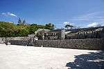
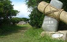
Nanzan Castle Site
南山城跡
Nanzan-gusuku ato
Okinawa IslandItoman26°07′41″N 127°41′22″E / 26.128145°N 127.689417°E / 26.128145; 127.689417 (Nanzan Castle Site)for all refs see

See also

References

  1. "Cultural Properties for Future Generations". Agency for Cultural Affairs. Retrieved 24 September 2017.
  2. "Gusuku Sites and Related Properties of the Kingdom of Ryukyu". UNESCO. Retrieved 24 September 2017.
  3. 史跡名勝天然記念物 [Number of Monuments of Japan by Prefecture] (in Japanese). Agency for Cultural Affairs. 1 December 2014. Archived from the original on 30 June 2011. Retrieved 24 December 2014.
  4. "Database of National Cultural Properties: 国宝・重要文化財(建造物) (沖縄県)" (in Japanese). Agency for Cultural Affairs. Retrieved 24 September 2017.
  5. 1 2 3 国・県・市町村指定文化財 [National, Prefectural, and Municipal Cultural Properties] (PDF) (in Japanese). Okinawa Prefecture. 1 May 2016. Retrieved 24 September 2017.
  6. フルスト原遺跡 [Furusutobaru Site] (in Japanese). Okinawa Prefecture. Retrieved 30 May 2012.
  7. フルスト原遺跡の概要 [Overview of the Furusutobaru Site] (in Japanese). Ishigaki City. Archived from the original on 2 May 2007. Retrieved 30 May 2012.
  8. 1 2 3 4 見どころ:国指定の文化財 [Sightseeing Places - Nationally designated Cultural Properties] (in Japanese). Uruma City. Archived from the original on 2 May 2012. Retrieved 30 May 2012.
  9. 伊波貝塚 [Iha Shell Mound] (in Japanese). Agency for Cultural Affairs. Retrieved 30 May 2012.
  10. 宇江城城跡 [Uegusuku Castle Site] (in Japanese). Agency for Cultural Affairs. Retrieved 30 May 2012.
  11. 宇佐浜遺跡 [Uzahama Site] (in Japanese). Agency for Cultural Affairs. Archived from the original on 8 July 2012. Retrieved 31 May 2012.
  12. 浦添城跡 [Urazoe Castle Site] (in Japanese). Agency for Cultural Affairs. Retrieved 31 May 2012.
  13. 旧円覚寺放生橋 [Engaku-ji Hōjō Bridge] (in Japanese). Agency for Cultural Affairs. Retrieved 31 May 2012.
  14. 荻堂貝塚 [Ogidō Shell Mound] (in Japanese). Agency for Cultural Affairs. Retrieved 31 May 2012.
  15. 具志原貝塚 [Kushibaru Shell Mound] (in Japanese). Ie Village. Retrieved 31 May 2012.
  16. 具志川城跡保存修理事業 [Restoration of Gushikawa Castle] (in Japanese). Itoman City. Archived from the original on 29 July 2012. Retrieved 31 May 2012.
  17. 国頭方西海道 [Kunigami Hōsei Kaidō] (in Japanese). Agency for Cultural Affairs. Retrieved 31 May 2012.
  18. 今帰仁城跡 附シイナ城跡 [Nakijin Castle Site] (in Japanese). Agency for Cultural Affairs. Retrieved 31 May 2012.
  19. 座喜味城跡 [Zakimi Castle Site] (in Japanese). Agency for Cultural Affairs. Retrieved 8 June 2012.
  20. 沖縄県斎場御嶽出土品 [Items excavated from Seifā Utaki (Okinawa Prefecture)] (in Japanese). Agency for Cultural Affairs. Retrieved 8 June 2012.
  21. 糸数城跡 [Itokazu Castle Site] (in Japanese). Agency for Cultural Affairs. Retrieved 8 June 2012.
  22. 先島諸島火番盛 [Sakishima Beacon Sites] (in Japanese). Agency for Cultural Affairs. Retrieved 8 June 2012.
  23. 宮古島市野文化財 国関係 [Cultural Properties of Miyakojima City (National)] (in Japanese). Miyakojima City. Archived from the original on 19 January 2012. Retrieved 8 June 2012.
  24. 知念城跡 [Chinen Castle Site] (in Japanese). Agency for Cultural Affairs. Retrieved 8 June 2012.
  25. 中城城跡 [Nakagusuku Castle Site] (in Japanese). Okinawa Prefecture. Archived from the original on 6 August 2010. Retrieved 8 June 2012.
  26. Okinawa Prefectural reserve cultural assets center (2016). "中城御殿跡". Comprehensive Database of Archaeological Site Reports in Japan. Retrieved 2016-09-02.
  27. 仲泊遺跡 [Nakadomari Site] (in Japanese). Agency for Cultural Affairs. Archived from the original on 19 December 2012. Retrieved 8 June 2012.
  28. 島添大里城跡 [Shimashīōzato Castle Site] (in Japanese). Agency for Cultural Affairs. Retrieved 8 June 2012.
  29. 末吉宮跡 [Sueyoshigū Site] (in Japanese). Agency for Cultural Affairs. Retrieved 8 June 2012.
  30. 銘苅墓跡群 [Mekaru Tomb Cluster] (in Japanese). Agency for Cultural Affairs. Retrieved 8 June 2012.
  31. 木綿原遺跡 [Momenbaru Site] (in Japanese). Agency for Cultural Affairs. Retrieved 8 June 2012.
  32. 都道府県別指定等文化財件数(都道府県分) [Number of Prefectural Cultural Properties by Prefecture] (in Japanese). Agency for Cultural Affairs. 1 May 2017. Retrieved 24 September 2017.
  33. 佐敷ようどれ [Sashiki Yodore] (in Japanese). Nanjō City. Retrieved 14 October 2013.
  34. 都道府県別指定等文化財件数(市町村分) [Number of Municipal Cultural Properties by Prefecture] (in Japanese). Agency for Cultural Affairs. 1 May 2017. Retrieved 24 September 2017.
This article is issued from Wikipedia. The text is licensed under Creative Commons - Attribution - Sharealike. Additional terms may apply for the media files.