Liberty Township, Marion County, Kansas
| Liberty Township Marion County, Kansas | |
|---|---|
| Township | |
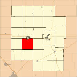 Location within Marion County | |
 Liberty Township Marion County, Kansas Location within the state of Kansas | |
| Coordinates: 38°18′13″N 097°12′37″W / 38.30361°N 97.21028°WCoordinates: 38°18′13″N 097°12′37″W / 38.30361°N 97.21028°W | |
| Country | United States |
| State | Kansas |
| County | Marion |
| Area | |
| • Total | 36 sq mi (90 km2) |
| Dimensions | |
| • Length | 6.0 mi (9.7 km) |
| • Width | 6.0 mi (9.7 km) |
| Elevation | 1,362 ft (415 m) |
| Population (2010)[1] | |
| • Total | 320 |
| • Density | 8.9/sq mi (3.4/km2) |
| Time zone | UTC−06:00 (CST) |
| • Summer (DST) | UTC−05:00 (CDT) |
| Area code | 620 |
| FIPS code | 20-40225 [2] |
| GNIS feature ID | 477341 [3] |
| Website | County Website |
Liberty Township is a township in Marion County, Kansas, United States. As of the 2010 census, the township population was 320, not including the city of Hillsboro.[1]
Geography
Liberty Township covers an area of 36 square miles (93.2 km2).
Cities and towns
The township contains the following settlements:
- City of Hillsboro (south of D Street). The north part is located in Risley Township.
- Ghost town of Gnadenau.
Cemeteries
The township contains the following cemeteries:
- Alexanderfeld Cemetery (a.k.a. Church of God in Christ Cemetery), located in Section 4 T20S R2E.[4]
- Ebenfeld Mennonite Brethren Church Cemetery, located in Section 25 T20S R2E.[4]
- Gard Cemetery, located in Section 24 T20S R2E.[4]
- Gnadenau Church Cemetery #1 (There are no stones, records are in Library at Tabor College), located in Section 11 T20S R2E.[4]
- Gnadenau Church Cemetery #2 (a.k.a. Parkview Cemetery) (a.k.a. Grace Meadow Cemetery), located in Section 9 T20S R2E.[4]
- Haven of Rest Cemetery (includes Ebenezer of Bruderthal and First Mennonite sections), located in Section 2 T20S R2E.[4]
- Hope Valley Cemetery, located in Section 17 T20S R2E.[4]
- Jost Cemetery, located in Section 5 T20S R2E.[4]
- Mennonite Brethren Church Cemetery of Hillsboro, located in Section 3 T20S R2E.[4]
- Salem Orphan's Home Cemetery, located in Section 2 T20S R2E.[4]
Transportation
No major highways or railroads pass through the township.[5]
Further reading
References
- 1 2 "2010 Total Population - Township of Liberty". U.S. Census Bureau. Retrieved November 16, 2013.
- ↑ "American FactFinder". United States Census Bureau. Archived from the original on September 11, 2013. Retrieved 2011-05-14.
- ↑ U.S. Geological Survey Geographic Names Information System: Township of Liberty
- 1 2 3 4 5 6 7 8 9 10 Marion County Cemetery List. Archived May 9, 2013, at the Wayback Machine.
- ↑ Marion County Highway Map; KSDOT.
External links
- Marion County Website
- City-Data.com
- Marion County Maps: Current, Historic, KDOT
Places adjacent to Liberty Township, Marion County, Kansas | |
|---|---|
Municipalities and communities of Marion County, Kansas, United States | ||
|---|---|---|
| Cities | 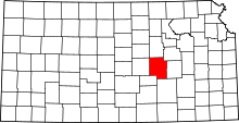 | |
| Unincorporated communities | ||
| Ghost towns | ||
| Townships | ||
| Footnotes | ‡This populated place also has portions in an adjacent county or counties | |
This article is issued from
Wikipedia.
The text is licensed under Creative Commons - Attribution - Sharealike.
Additional terms may apply for the media files.