Les Moulins Regional County Municipality
| Les Moulins | |
|---|---|
| Regional county municipality | |
 | |
| Coordinates: 45°45′N 73°36′W / 45.750°N 73.600°WCoordinates: 45°45′N 73°36′W / 45.750°N 73.600°W[1] | |
| Country |
|
| Province |
|
| Region | Lanaudière |
| Effective | January 1, 1982 |
| County seat | Terrebonne |
| Government[2] | |
| • Type | Prefecture |
| • Prefect | Jean-Marc Robitaille |
| Area[2][3] | |
| • Total | 266.30 km2 (102.82 sq mi) |
| • Land | 261.38 km2 (100.92 sq mi) |
| Population (2011)[3] | |
| • Total | 148,813 |
| • Density | 569.3/km2 (1,474/sq mi) |
| • Pop 2006–2011 |
|
| Time zone | UTC−5 (EST) |
| • Summer (DST) | UTC−4 (EDT) |
| Area code(s) | 450 and 579 |
| Website |
www |
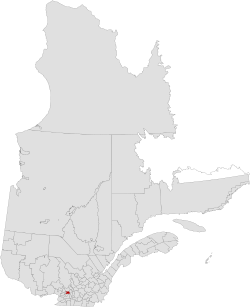
Les Moulins is a regional county municipality in the Lanaudière region of Quebec, Canada.
It is located immediately north of Laval on the north shore of the Rivière des Mille-Îles, and comprises the municipalities of Terrebonne and Mascouche. Historic communities in the region, which are now arrondissements of the two existing cities, include Lachenaie and La Plaine.
The population according to the Canada 2011 Census is 148,813[3]
Subdivisions
There are 2 subdivisions within the RCM:[2]
- Cities & Towns
Transportation
Access Routes
Highways and numbered routes that run through the municipality, including external routes that start or finish at the county border:[4]
See also
References
External links
Adjacent Counties & Equivalent Territories | |
|---|---|
| Regional county municipalities and equivalent territories | |
|---|---|
| Municipalities | |
This article is issued from
Wikipedia.
The text is licensed under Creative Commons - Attribution - Sharealike.
Additional terms may apply for the media files.