La Rivière-du-Nord Regional County Municipality
| La Rivière-du-Nord | |
|---|---|
| Regional county municipality | |
 | |
| Coordinates: 45°49′N 74°01′W / 45.817°N 74.017°WCoordinates: 45°49′N 74°01′W / 45.817°N 74.017°W[1] | |
| Country |
|
| Province |
|
| Region | Laurentides |
| Effective | January 1, 1983 |
| County seat | Saint-Jérôme |
| Government[2] | |
| • Type | Prefecture |
| • Prefect | Yvon Brière |
| Area[2][3] | |
| • Total | 466.10 km2 (179.96 sq mi) |
| • Land | 451.06 km2 (174.16 sq mi) |
| Population (2011)[3] | |
| • Total | 115,165 |
| • Density | 255.3/km2 (661/sq mi) |
| • Pop 2006-2011 |
|
| • Dwellings | 52,997 |
| Time zone | UTC−5 (EST) |
| • Summer (DST) | UTC−4 (EDT) |
| Area code(s) | 450 and 579 |
| Website |
www |
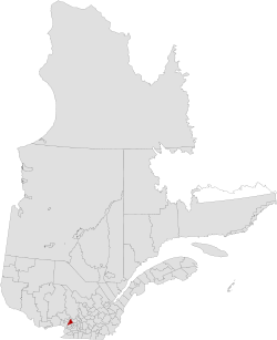
La Rivière-du-Nord (The Rivière-du-Nord or The River of the North) is a regional county municipality in the Laurentides region of Quebec, Canada. The seat is in Saint-Jérôme. It is named for the river that runs through it, the Rivière du Nord.
The population according to the Canada 2011 Census is 115,165.[3]
Subdivisions
|
|
| Canada Census Mother Tongue - La Rivière-du-Nord, Quebec[4] | ||||||||||||||||||
|---|---|---|---|---|---|---|---|---|---|---|---|---|---|---|---|---|---|---|
| Census | Total | French |
English |
French & English |
Other | |||||||||||||
| Year | Responses | Count | Trend | Pop % | Count | Trend | Pop % | Count | Trend | Pop % | Count | Trend | Pop % | |||||
2016 |
126,525 |
119,570 | 94.5% | 2,400 | 1.89% | 935 | 0.74% | 3,215 | 2.54% | |||||||||
2011 |
114,230 |
108,350 | 94.85% | 2,385 | 2.09% | 785 | 0.69% | 2,415 | 2.11% | |||||||||
2006 |
100.205 |
95,340 | 95,14% | 2,055 | 2.05% | 540 | 0.53% | 2,270 | 2.26% | |||||||||
2001 |
88,750 |
85,235 | 96% | 1,785 | 2.01% | 545 | 0.61% | 1,180 | 1,33% | |||||||||
1996 |
82,540 |
78,965 | n/a | 95,67% | 1,830 | n/a | 2.21% | 775 | n/a | 0.93% | 900 | n/a | 1.09% | |||||
Transportation
Access Routes
Highways and numbered routes that run through the municipality, including external routes that start or finish at the county border:[5]
|
|
|
|
See also
References
- ↑ Reference number 141088 of the Commission de toponymie du Québec (in French)
- 1 2 Geographic code 750 in the official Répertoire des municipalités (in French)
- 1 2 3 "(Code 2475) Census Profile". 2011 census. Statistics Canada. 2012.
- ↑ Statistics Canada: 1996, 2001, 2006, 2011, 2016 census
- ↑ Official Transport Quebec Road Map
Adjacent Counties & Equivalent Territories | ||||||||||
|---|---|---|---|---|---|---|---|---|---|---|
| ||||||||||
This article is issued from
Wikipedia.
The text is licensed under Creative Commons - Attribution - Sharealike.
Additional terms may apply for the media files.