Saint-Félix-de-Valois, Quebec
| Saint-Félix-de-Valois | |
|---|---|
| Municipality | |
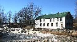 The Emery Mill on the Bayonne River | |
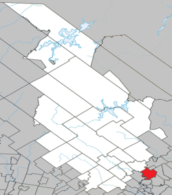 Location within Matawinie RCM | |
 Saint-Félix-de-Valois Location in central Quebec | |
| Coordinates: 46°10′N 73°26′W / 46.17°N 73.43°WCoordinates: 46°10′N 73°26′W / 46.17°N 73.43°W[1] | |
| Country |
|
| Province |
|
| Region | Lanaudière |
| RCM | Matawinie |
| Settled | c. 1830 |
| Constituted | December 24, 1997 |
| Government[2] | |
| • Mayor | Audrey Boisjoly |
| • Federal riding | Joliette |
| • Prov. riding | Berthier |
| Area[2][3] | |
| • Total | 89.80 km2 (34.67 sq mi) |
| • Land | 87.87 km2 (33.93 sq mi) |
| Population (2011)[3] | |
| • Total | 6,029 |
| • Density | 68.6/km2 (178/sq mi) |
| • Pop 2006-2011 |
|
| • Dwellings | 2,749 |
| Time zone | UTC−5 (EST) |
| • Summer (DST) | UTC−4 (EDT) |
| Postal code(s) | J0K 2M0 |
| Area code(s) | 450 and 579 |
| Highways |
|
| Website |
www |
Saint-Félix-de-Valois is a municipality in the Lanaudière region of Quebec, Canada, part of the Matawinie Regional County Municipality.
Quebec author Réjean Ducharme, recipient of several Governor General's Awards, was born in Saint-Félix-de-Valois in 1942.
History
Historically it was part of the Berthier Seignory. Circa 1830, a small group of pioneers from England, Scotland, and Ireland started to colonize the place. In 1840, the Mission of Saint-Félix-de-Valois was formed and soon after in 1844 it became a parish when it separated from the Sainte-Élisabeth Parish. It was named after Felix of Valois.[1]
In 1845, the Parish Municipality of Saint-Félix-de-Valois was first established, but abolished two years later. In 1851, its post office opened. In 1855, the parish municipality was reestablished.[1]
In 1926, the main village, also known as Saint-Félix-de-Valois, was incorporated as a separate Village Municipality. On December 24, 1997, the parish municipality and the village municipality were reunited into the new Municipality of Saint-Félix-de-Valois.[1]
Demographics
Population
| Historical Census Data - Saint-Félix-de-Valois, Quebec[4] | ||
|---|---|---|
| Year | Pop. | ±% |
| 1991 | 5,132 | — |
| 1996 | 5,442 | +6.0% |
| 2001 | 5,465 | +0.4% |
| 2006 | 5,755 | +5.3% |
| 2011 | 6,029 | +4.8% |
Private dwellings occupied by usual residents: 2548 (total dwellings: 2749)
Language
Mother tongue:
- English as first language: 0.5%
- French as first language: 98.2%
- English and French as first language: 0.3%
- Other as first language: 1%
Education
Commission scolaire des Samares is the French school board.
- École secondaire de l'Érablière
- École des Moulins (Saint-Félix-de-Valois)
Sir Wilfrid Laurier School Board serves as the English school board.[7]
- Joliette Elementary School in Saint-Charles-Borromée[8]
- Joliette High School in Joliette[9]
Notable residents
- Peter B. Champagne, American businessman and politician
- Michel Vaillancourt, silver medalist at the 1976 Olympics in equestrian
See also
References
- 1 2 3 4 "Saint-Félix-de-Valois (Municipalité)" (in French). Commission de toponymie du Québec. Retrieved 2009-11-17.
- 1 2 Geographic code 62007 in the official Répertoire des municipalités (in French)
- 1 2 Statistics Canada 2011 Census - Saint-Félix-de-Valois census profile
- ↑ Statistics Canada: 1996, 2001, 2006, 2011 census
- ↑ "des Moulins (pavillon Notre-Dame)." Commission scolaire des Samares. Retrieved on September 22, 2017.
- ↑ "des Moulins (pavillon Sainte-Marguerite)." Commission scolaire des Samares. Retrieved on September 22, 2017.
- ↑ "Ward #10." Sir Wilfrid Laurier School Board. Retrieved on July 31, 2015.
- ↑ "JOLIETTE ELEMENTARY ZONE." Sir Wilfrid Laurier School Board. Retrieved on September 17, 2017.
- ↑ "Joliette High School Zone Sec 1-5." Sir Wilfrid Laurier School Board. Retrieved on September 5, 2017.
External links

Adjacent Municipal Subdivisions | |
|---|---|
| Municipalities | |
|---|---|
| Parishes | |
| Unorganized Territories | |
| |