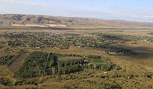
Lepsy
| Lepsy Лепсі | |
|---|---|
| Village | |
 | |
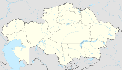 Lepsy Location in Kazakhstan | |
| Coordinates: 45°31′43″N 80°37′00″E / 45.52861°N 80.61667°ECoordinates: 45°31′43″N 80°37′00″E / 45.52861°N 80.61667°E | |
| Country | Kazakhstan |
| Region | Almaty Region |
| District | Alakol District |
| Population (2009) | |
| • Total | 1,151 |
| Time zone | UTC+6 (Omsk Time) |
Lepsy (Kazakh: Лепсі, before 2010, Lepsinsk) is a village in Alakol District, Almaty Region, in south-eastern Kazakhstan.[1] It is the administrative seat of Lepsy Village District, which also includes the villages of Baizerek (Байзерек, pop. 106), Zhunzhurek (Жунжурек, pop. 79) and Chumbulak (Чимбулак, pop. 106). It is located on the northern end of the Dzungarian Alatau, near the headwaters of the Lepsy River.
The settlement was founded in 1846. By 1918, there were a separate village and town, both called Lepsinsk. In 1913, 6249 people lived in the village and 8764 people lived in the city. In 1936 the city lost its status and the two settlements were merged into the village Lepsinsk. Since 2010, it was renamed Lepsy.[2]
References
- ↑ National Geospatial-Intelligence Agency. GeoNames database entry. (search) Accessed 13 May 2011.
- ↑ "В Алматинской области переименованы некоторые сельские округа и села » Automan.kz | Автомобильный портал: автоновости, автомобили и новости". Automan.kz. Retrieved 2016-01-19.
This article is issued from
Wikipedia.
The text is licensed under Creative Commons - Attribution - Sharealike.
Additional terms may apply for the media files.