Lelystad
| Lelystad | |||
|---|---|---|---|
| City and Municipality | |||
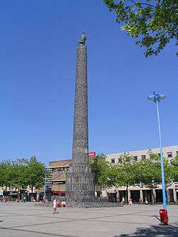 Lelystad city centre | |||
| |||
.svg.png) Location in Flevoland | |||
| Coordinates: 52°30′N 5°29′E / 52.500°N 5.483°ECoordinates: 52°30′N 5°29′E / 52.500°N 5.483°E | |||
| Country | Netherlands | ||
| Province | Flevoland | ||
| Established | 1 January 1967 | ||
| Government[1] | |||
| • Body | Municipal council | ||
| • Mayor | Ina Adema (VVD) | ||
| Area[2] | |||
| • Total | 765.45 km2 (295.54 sq mi) | ||
| • Land | 231.54 km2 (89.40 sq mi) | ||
| • Water | 533.91 km2 (206.14 sq mi) | ||
| Elevation[3] | −3 m (−10 ft) | ||
| Population (August 2017)[4] | |||
| • Total | 77,260 | ||
| • Density | 334/km2 (870/sq mi) | ||
| Time zone | UTC+1 (CET) | ||
| • Summer (DST) | UTC+2 (CEST) | ||
| Postcode | 8200–8249 | ||
| Area code | 0320 | ||
| Website |
www | ||

Lelystad (Dutch pronunciation: [ˈleːlistɑt] (![]()
History
Lelystad is built on the seabed of the former Zuiderzee. About 6500 years ago this wetland was above high tide level and inhabited; the Netherlands have steadily subsided since. Near Lelystad at Swifterbant, the oldest human skeletons in Western Europe were discovered. Due to rising water levels and storms, the peatlands were washed away, and the Lacus Flevo (in Roman times) grew to be the Almere (Middle Ages) and became the Zuiderzee. The Zuiderzee (Southern Sea) was the main transport route from Amsterdam to the North Sea and the Hanseatic League cities. Due to the many shipwrecks in Flevoland, Lelystad now houses the National Centre for Maritime History, with a museum and the shipyard that has built the Batavia replica.

After the Second World War the Zuiderzee Works continued, constructing the polder of Eastern Flevoland. In 1950 work commenced on several construction islands in the middle of the IJsselmeer. Lelystad-Haven was the largest island, and its wooden barracks housed a community of dyke-builders. In 1955 they reached the mainland, which made it possible to drive to Lelystad by car. One of the three pumping stations, which drained the polder in June 1957, was the diesel-powered Wortman in Lelystad-Haven. Until 1967 the only inhabitants of Lelystad were technical engineers and laborers and superintendents, living on the former construction island.
Climate
| Climate data for Lelystad | |||||||||||||
|---|---|---|---|---|---|---|---|---|---|---|---|---|---|
| Month | Jan | Feb | Mar | Apr | May | Jun | Jul | Aug | Sep | Oct | Nov | Dec | Year |
| Record high °C (°F) | 14.3 (57.7) |
15.8 (60.4) |
22.3 (72.1) |
29.6 (85.3) |
32.2 (90) |
32.7 (90.9) |
34.7 (94.5) |
34.7 (94.5) |
32.0 (89.6) |
25.2 (77.4) |
18.2 (64.8) |
14.6 (58.3) |
34.7 (94.5) |
| Average high °C (°F) | 5.2 (41.4) |
5.8 (42.4) |
9.4 (48.9) |
13.5 (56.3) |
17.4 (63.3) |
19.6 (67.3) |
22.0 (71.6) |
22.0 (71.6) |
18.6 (65.5) |
14.2 (57.6) |
9.2 (48.6) |
5.6 (42.1) |
13.5 (56.3) |
| Daily mean °C (°F) | 2.7 (36.9) |
2.9 (37.2) |
5.7 (42.3) |
8.9 (48) |
12.9 (55.2) |
15.3 (59.5) |
17.5 (63.5) |
17.3 (63.1) |
14.4 (57.9) |
10.6 (51.1) |
6.5 (43.7) |
3.4 (38.1) |
9.8 (49.6) |
| Average low °C (°F) | 0.1 (32.2) |
−0.1 (31.8) |
2.0 (35.6) |
4.2 (39.6) |
7.9 (46.2) |
10.4 (50.7) |
12.6 (54.7) |
12.4 (54.3) |
10.2 (50.4) |
6.9 (44.4) |
3.7 (38.7) |
0.8 (33.4) |
5.9 (42.6) |
| Record low °C (°F) | −16.6 (2.1) |
−22.9 (−9.2) |
−17.8 (0) |
−6.4 (20.5) |
−1.6 (29.1) |
1.8 (35.2) |
5.0 (41) |
4.2 (39.6) |
2.4 (36.3) |
−4.8 (23.4) |
−8.3 (17.1) |
−16.9 (1.6) |
−22.9 (−9.2) |
| Average relative humidity (%) | 90 | 87 | 84 | 78 | 77 | 79 | 81 | 82 | 86 | 88 | 91 | 92 | 85 |
| Mean monthly sunshine hours | 62.8 | 88.3 | 129.7 | 181.0 | 211.4 | 204.3 | 216.0 | 193.3 | 143.4 | 118.6 | 63.3 | 53.7 | 1,665.8 |
| Source: Royal Netherlands Meteorological Institute (1981–2010 normals, snowy days normals for 1971–2000)[5] | |||||||||||||
Landscape

Lelystad is the largest municipality in the Netherlands in area, but a large part of that area is water: Markermeer and IJsselmeer. Another major area is the internationally famous nature park of Oostvaardersplassen, which arose naturally when the polder of South Flevoland was drained. Lelystad is also surrounded by a square of woodlands and parks and flat farmland. The importance of the landscape and sky is emphasized by several pieces of land art: engineers' work and works such as the Observatorium by Robert Morris (see below).
Tourism
Lelystad has several tourist attractions, including:
- The replica of the 17th-century ship Batavia at the Batavia Shipyard.
- Batavia Stad Fashion Outlet
- Hanzestad Compagnie, a fleet of historical sailing ships
- Lelystad Nature Park
- National Aviation Theme Park Aviodrome
- Modern architecture, for example the Zilverparkkade and Agora Theatre
Lelystad hosts many one-day events like the Lelystad Airshow, the Water Festival, the National Old Timer Day, Lelystad Speedway, Architecture day and several sports events. On the Midland Circuit many motor, kart and stock car racing events and several autoclub meetings are held. On the coast there are several marinas.
Transport
Lelystad can be reached by air, water, and land.
- Air: Lelystad Airport is the biggest general aviation airport in the Netherlands. It is owned wholly by Schiphol Group. Lelystad Airport is currently undergoing major expansion, including the construction of a passenger terminal for commercial flights, as well as an extension of the runway. Commercial flights are expected to take off from and arrive at Lelystad Airport in 2020, with Ryanair and Transavia showing interest in operating from the airport.
- Water: Lelystad has a small inland port, several marinas, and a canal system which also functions to aid in managing the water levels in the rest of the polder. The canal system connects to the Markermeer with a lock to the southwest of Lelystad, and connects the city and its industrial areas to all other towns and their respective industrial areas in the polder.
- Rail: the Weesp–Lelystad railway (Flevolijn) extends south from Lelystad Centrum railway station and connects the city with Almere, and to the Randstad region beyond. The Lelystad–Zwolle railway (Hanzelijn) extends north from Lelystad and connects it with Dronten, Kampen and Zwolle.
- Motorway: The A6 motorway runs along Lelystad on the eastern side of the city. There are two on-ramps connecting this motorway to Lelystad, each allowing traffic to travel northbound to Emmeloord and the province of Friesland, or southbound to Almere and the Randstad region.
- Provincial roads: The N302 provincial road runs through Lelystad, this road connects Lelystad to the south-east with Harderwijk and the province of Gelderland beyond, and across the Houtribdijk to Enkhuizen and the province of North Holland beyond. The N307 and N309 extend to the east from Lelystad, both connecting to Dronten and beyond that to Kampen in the province of Overijssel and Elburg in the province of Gelderland respectively.
Shield and flag

The honeycomb grid in the arms of Lelystad represents the dykes, built with six-edged concrete or basalt blocks. The colour gold indicates the high costs of the project of making the polder. The centre shield is the arms of engineer Cornelis Lely. The sealions reflect the history of the land.
In the flag, the fleur-de-lis (lily) again takes a central point, referring to the name Lely. The yellow background reflects the precious land, and the blue lines the dykes and waterways. The flag of the province is similarly adorned with the fleur-de-lis to commemorate Lely.
Notable residents
- Abraham Bueno de Mesquita (d. 2005), comedian and actor
- Rianne ten Haken, model
- Karin Ruckstuhl, former athlete
- Niels de Ruiter, professional darts player
- Ivan Sokolov, Bosnian chess master
- Co Stompé, professional darts player
- Jolijn van Valkengoed, swimmer
- Thijs van Valkengoed (born 1983), breaststroke swimmer
- Chiel Warners, former decathlete
- Boy Waterman, football goalkeeper
- Nathaniël Will, footballer
- Aron Winter, retired footballer, football manager
- Ruben Schaken, football player
- Edsilia Rombley, singer
References
- ↑ "Portefeuilleverdeling" [Tasks] (in Dutch). Gemeente Lelystad. Retrieved 1 September 2013.
- ↑ "Kerncijfers wijken en buurten" [Key figures for neighbourhoods]. CBS Statline (in Dutch). CBS. 2 July 2013. Retrieved 12 March 2014.
- ↑ "Postcodetool for 8232ZX". Actueel Hoogtebestand Nederland (in Dutch). Het Waterschapshuis. Archived from the original on 21 September 2013. Retrieved 1 September 2013.
- ↑ "Bevolkingsontwikkeling; regio per maand" [Population growth; regions per month]. CBS Statline (in Dutch). CBS. 27 October 2017. Retrieved 27 October 2017.
- ↑ "Klimaattabel Lelystad, langjarige gemiddelden, tijdvak 1981–2010" (PDF) (in Dutch). Royal Netherlands Meteorological Institute.
External links
| Wikimedia Commons has media related to Lelystad. |

- Official website
Places adjacent to Lelystad | ||||||||||
|---|---|---|---|---|---|---|---|---|---|---|
| ||||||||||
Municipalities of Flevoland | ||
|---|---|---|
 | ||
| ||