Lazy Acres, Colorado
| Lazy Acres, Colorado | |
|---|---|
| Census-designated place | |
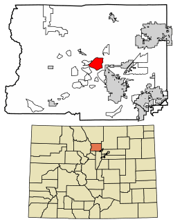 Location of Lazy Acres in Boulder County, Colorado. | |
 Lazy Acres Location of Lazy Acres in Boulder County, Colorado. | |
| Coordinates: 40°5′35″N 105°19′58″W / 40.09306°N 105.33278°WCoordinates: 40°5′35″N 105°19′58″W / 40.09306°N 105.33278°W | |
| Country |
|
| State |
|
| County | Boulder[1] |
| Area | |
| • Total | 5.3 sq mi (13.7 km2) |
| • Land | 5.3 sq mi (13.7 km2) |
| • Water | 0 sq mi (0 km2) |
| Elevation[1] | 7,000 ft (2,000 m) |
| Population (2010) | |
| • Total | 920 |
| • Density | 174/sq mi (67.2/km2) |
| Time zone | UTC-7 (MST) |
| • Summer (DST) | UTC-6 (MDT) |
| GNIS feature ID | 08-44270 |
Lazy Acres is a census-designated place (CDP) in Boulder County, Colorado, United States. The population as of the 2010 Census was 920.[2]
Geography
Lazy Acres is located in central Boulder County in the Front Range of the Colorado Rocky Mountains. It is situated on a ridge northwest of the city of Boulder.
According to the U.S. Census Bureau, the Lazy Acres CDP has an area of 5.3 square miles (13.7 km2), all of it land.[3]
Demographics
| Historical population | |||
|---|---|---|---|
| Census | Pop. | %± | |
| U.S. Decennial Census[4] | |||
See also
References
- 1 2 "US Board on Geographic Names". United States Geological Survey. 2007-10-25. Retrieved 2008-01-31.
- ↑ Colorado Trend Report 2: State and Complete Places (Sub-state 2010 Census Data). Missouri Census Data Center. Accessed 2011-02-25.
- ↑ "Geographic Identifiers: 2010 Demographic Profile Data (G001): Lazy Acres CDP, Colorado". U.S. Census Bureau, American Factfinder. Retrieved September 27, 2013.
- ↑ "Census of Population and Housing". Census.gov. Retrieved June 4, 2016.
| Wikimedia Commons has media related to Lazy Acres, Colorado. |
Municipalities and communities of Boulder County, Colorado, United States | ||
|---|---|---|
| Cities | 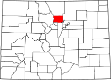 | |
| Towns | ||
| CDPs | ||
| Unincorporated communities | ||
| Ghost town | ||
| Footnotes | ‡This populated place also has portions in an adjacent county or counties | |
This article is issued from
Wikipedia.
The text is licensed under Creative Commons - Attribution - Sharealike.
Additional terms may apply for the media files.