Lane Plantation
|
Lane Plantation House | |
  | |
| Location | 7684 Lane Road, about 3.2 miles (5.1 km) northeast of Ethel |
|---|---|
| Nearest city | Ethel, Louisiana |
| Coordinates | 30°48′32″N 91°04′54″W / 30.80895°N 91.08176°WCoordinates: 30°48′32″N 91°04′54″W / 30.80895°N 91.08176°W |
| Area | 3.2 acres (1.3 ha) |
| Built | c.1825 |
| Architectural style | Federal, Carolina I |
| NRHP reference # | 93000322[1] |
| Added to NRHP | April 22, 1993 |
The Lane Plantation is a historic plantation located about 3.2 miles (5.1 km) northeast of Ethel, Louisiana East Feliciana Parish, Louisiana, USA.[2]
The plantation was bought around 1830 by William Allen Lane from the Weston family, which had owned it for a short time before selling it. The property had remained then in the Lane family since then.[3][4]
A 3.2 acres (1.3 ha) area comprising the Lane Plantation House, also known as Weston Place, was listed on the National Register of Historic Places on April 22, 1993.[1]
See also
References
- 1 2 National Park Service (2013-11-02). "National Register Information System". National Register of Historic Places. National Park Service.
- ↑ Duncan, Patricia L. (Summer 1994). "Lane Plantation House". Louisiana History: The Journal of the Louisiana Historical Association. 35 (3): 320. JSTOR 4233125. (Registration required (help)).
- ↑ "Lane Plantation House" (PDF). State of Louisiana's Division of Historic Preservation. Retrieved May 22, 2018. with four photos and two maps
- ↑ National Register Staff (January 1993). "National Register of Historic Places Registration Form: Lane Plantation House". National Park Service. Retrieved May 22, 2018. With six photos from 1992.


Municipalities and communities of East Feliciana Parish, Louisiana, United States | ||
|---|---|---|
| Towns | 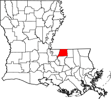 | |
| Villages | ||
| Unincorporated communities | ||
This article is issued from
Wikipedia.
The text is licensed under Creative Commons - Attribution - Sharealike.
Additional terms may apply for the media files.